

Blackstone Edge
Wikimedia Commons
Blackstone Edge is a gritstone escarpment rising to 1549 feet (472 m) above sea level in the South Pennine hills, surrounded by moorlandDominant landscape of Britain's uplands, including many of its national parks. on the boundary between Greater Manchester and West Yorkshire in northern England.
Once thought to be the location of a Roman road, the paved causeway is now considered to be a packhorse road or early turnpike road. The Pennine Way passes along the escarpment.
Geology and geography
Wikimedia Commons
The area’s underlying geology comprises sandstones and shales of the Millstone Grit and Coal Measures, Carboniferous rocks formed 354–290 million years ago. They were deposited as sediments in large river deltas that extended into the shallow, tropical seas that covered much of Britain at this time. Continuing deposition and further building out of the deltas formed an extensive low-lying, swamp area in which the succeeding Coal Measures were deposited.[1] The sandstones and shales of the Millstone Grit group outcrop in the uplands of the South Pennines to the east of Manchester and north of Rochdale. Erosion in the layers of sandstone and shales has created the rolling moorland punctuated by cliff-like gritstone escarpments such as Blackstone Edge surrounded by heathland and blanket peat.[1]
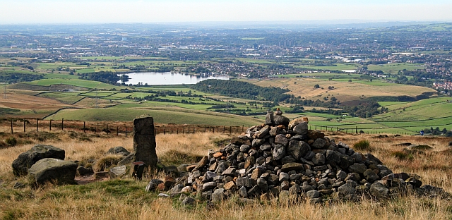
Blackstone Edge is on the Greater Manchester / West Yorkshire boundary, south of the A58 Rochdale to Halifax road and north of the M62 motorway about mid way between the Blackstone Edge and Green Withens Reservoirs. The long-distance footpath, the Pennine Way passes along the escarpment. A triangulation pillarPillars erected by the Ordnance Survey to allow more accurate maps of Great Britain to be produced. at its summit records its height as 472.238 metres, 1,549 feet above sea level.[2]
History

Wikimedia Commons
Much of the surrounding area was within the ancient parishAncient or ancient ecclesiastical parishes encompassed groups of villages and hamlets and their adjacent lands, over which a clergyman had jurisdiction. of Rochdale.[3] In the English Civil War the Parliamentarians sent 800 men to fortify Blackstone Edge. John Rosworm came from Manchester to direct the construction of defences and it was successfully held against an attack by Royalist cavalry.[4] In 1660 the churchwardens of St Chad’s Church in Rochdale paid 24 shillings for eight loads of “great stones from Blackstoneedge” for the church steps. Celia Fiennes travelled over Blackstone Edge in about 1700 and described her journey.[3] A meeting of Chartists attracted up to 30,000 people from the surrounding industrial towns in Lancashire and Yorkshire in 1846.[5]
Passing the escarpment is Blackstone Edge Long Causeway, also known as Blackstone Edge Roman Road, a paved road once thought to be of Roman origin. After investigations by James Maxim it is now considered to be a 1735 turnpike or packhorse route.[6] The Aiggin Stone, a seven foot long gritstone pillar, possibly a way-marker, stands alongside the packhorse route and marks the county boundary. The stone has a cross and the letters I and T cut into it. Its name is said to derive from the French aiguille for a needle or aigle for an eagle.[7]