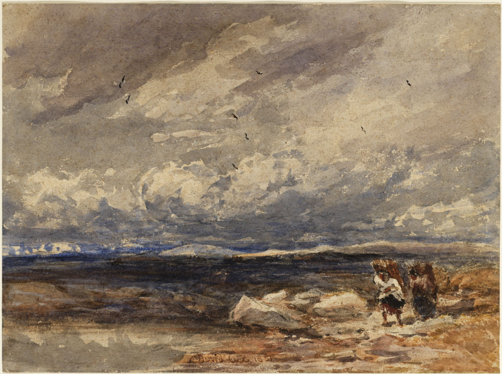

On Carrington Moss, 1851, David Cox
Wikimedia Commons
Carrington Moss is a large area of peat bog near Carrington in Greater Manchester, England. It lies south of the River Mersey, approximately ten miles (16 km) south-west of Manchester, and occupies an area of about 1,100 acres (445 ha). The depth of peat varies between 17 and 20 feet (5.2 and 6.1 m).
Originally an unused area of grouse moorland, the moss was reclaimed in the latter half of the 19th century for farming and the disposal of Manchester’s waste. A system of tramways was built to connect it with the Manchester Ship Canal and a nearby railway line. During the Second World War the land was used as a Starfish site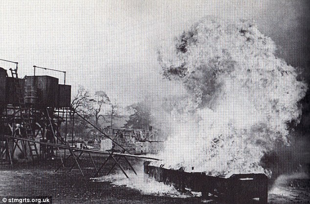 Large-scale night-time decoy created during the blitz of the Second World War to simulate burning British cities, diverting German night bombers from their intended targets.Large-scale night-time decoy created during the blitz of the Second World War to simulate burning British cities, diverting German night bombers from their intended targets. and in the latter half of the 20th century, a large industrial complex was built along its northern edge. More recently, several sporting facilities have been built on Carrington Moss.
The land is still used for farming, and several nature reserves have been established within its bounds. Parts of Carrington Moss are accessible to the public over several rights of way.
History
A History of Flixton, Urmston, and Davyhulme (1898) claims that the name Carrington might be derived from the Goidelic Celtic root cathair, meaning a fortress,[1] but a more recent theory is that it derives from the Anglicised form of a Scandinavian personal name.[2] The Carrington family, descended from William de Caryngton, had their seat at Carrington Hall, to the north of Carrington Moss, at the junction formed by the modern-day A6144 and B5158 roads.[1] The word moss, first used during the 15th century,[3] is the local name for a lowland peat bog.[4] Today the term mosslands is used to describe the bogs and the former bogs that have been converted to farmland.[5]
19th century
Manchester’s population increased by more than 150 per cent between 1831 and 1851. This placed considerable pressure on the city’s ability to dispose of refuse, exacerbated during the 1870s by a gradual switch from the older cesspit methods of sewage disposal to pail closets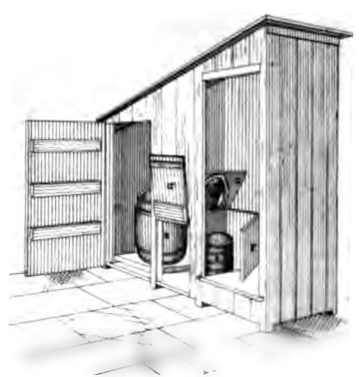 Small outhouse containing a seat underneath which was a bucket into which the user would defecate. The buckets were regularly removed and emptied by the local authority.. These needed to be emptied regularly, and by the 1880s night soil accounted for about 7 per cent of Manchester’s 200,000 tons of refuse.[6]
Manchester’s expansion following the incorporation of the suburbs of Bradford, Harpurhey and Rusholme in 1885[7] placed additional demands on the city’s refuse disposal systems. Manchester Corporation began to look for disposal sites, and Carrington Moss was chosen partly because of its accessibility. Therefore in 1886 the corporation bought the Carrington Moss Estate – an area of grouse moorland – from Harry Grey, 8th Earl of Stamford.[8]
Wikimedia Commons
The purchase was part of the corporation’s ultimately unsuccessful plan to retain the pail closet system (now superseded by the water closet), and followed a public scandal created by the daily dumping of 30–60 tons of human faeces into the Medlock and Irwell rivers, at Holt Town sewage works.[9][a]Holt Town was an area to the east of Manchester, along the River Medlock. The “sanitary works” are visible on late 19th-century Ordnance Survey maps, along Upper Helena Street. It paid about £38,000,[b]Varying figures are to be found for the purchase price; the Cleansing Committee 1971 visit booklet states £39,165 but no figure is given for the total cost, therefore only approximate figures from The Times newspaper are included in this article. equivalent to about £4.2 million as of 2018,[10] for the site, but the bog’s depth of 17–20 feet (5.2–6.1 m)[11] pushed the total development cost to almost £94,000. The 1,101-acre (446 ha) estate included 600 acres (243 ha) of wild mossland, 209 acres (85 ha) of partly cultivated mossland, 282 acres (114 ha) of mossland under cultivation and {{convert|10 (Undefined conversion) |acre}} of incomplete roads. A number of brick buildings were included, along with Asphodel Farm and Ash Farm, both with wooden farmhouses.[12] The corporation rented 700 acres (283 ha) of land in small holdings to local farmers and kept 400 acres (162 ha) for itself.[13]

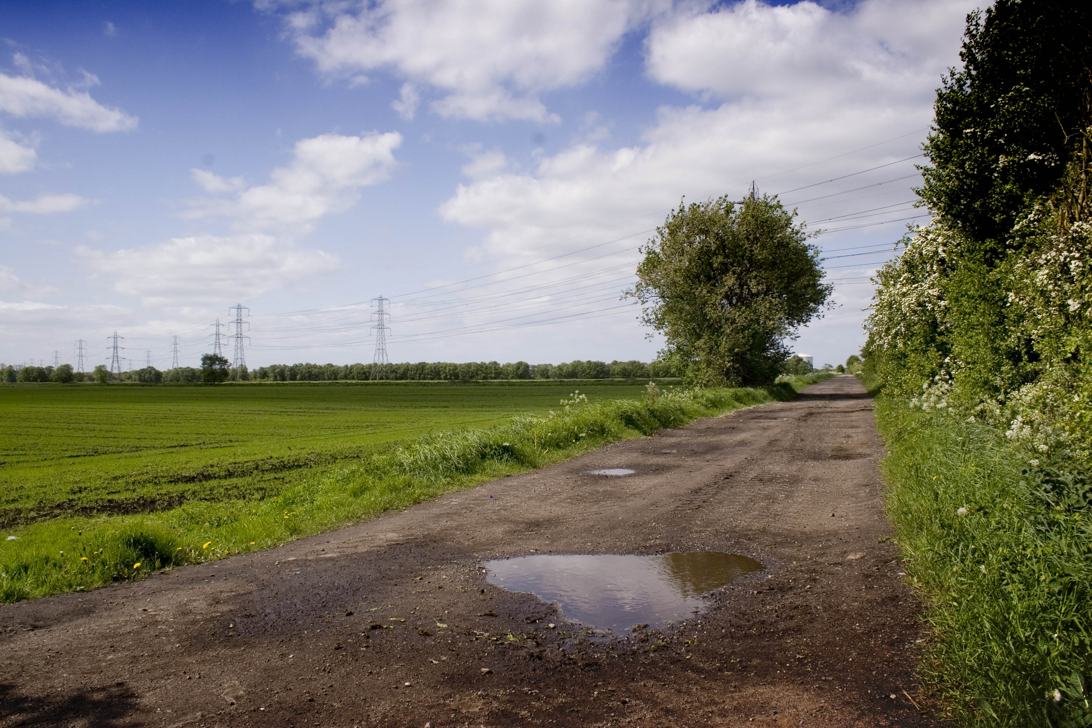
The Shell Chemicals plant is visible on the horizon.
Wikimedia Commons
The bog’s virgin moss was cultivated[14] and drainage channels cut through at regular intervals, the first step in the area’s reclamation. This drainage caused the characteristically convex Moss to sag noticeably; some residents of Dunham Town commented that they could see parts of Carrington previously obscured by the moss.[15] A network of tramways and roads was constructed using clinker and other materials brought from the city.[16] Drains were laid and the land cleared of scrub. A water supply was also installed. Some of the more dangerous buildings were demolished, while others were either repaired or replaced.[12]
Refuse was loaded from a number of locations and was first transported along the Mersey and Irwell Navigation, until that waterway was closed on 11 November 1888. For several years until the completion of its replacement, the Manchester Ship Canal, the corporation was reliant on Manchester’s local railway network.[17] Refuse was loaded at the corporation’s Water Street Depot[c]Located along the south bank of the Irwell, directly opposite the Wilburn Street basin on to Cornbrook sidings and in wagons to Carrington on a junction from the Cheshire Lines Committee’s (CLC) Glazebrook to Stockport Tiviot Dale line.[18] The canal company installed a temporary dock on the new canal, although this was considered impractical and was rarely used. A more permanent arrangement was made several years later.[17] New railway sidings were also built;[19] once complete, refuse was loaded from near Oldham Road railway station[20] and the corporation’s Water Street Depot.[18] It was then transported along the Ship Canal to a newly built wharf, and thereafter, by tramway across the moss.[21]
Once delivered, refuse was normally placed in heaps and allowed to dry before being put into the ground.[16] The naturally acidic water was a perfect receptacle for the contents of pail closets, rich in urea and nitrogen. Bacteria quickly broke the refuse down into ammonium compounds and free ammonia, which neutralised the soil’s acidity and created ammonium nitrate – an essential fertiliser for arable land.[18]
By the 1890s more than 70,000 long tons of excrement annually were being disposed of on the moss.[13] The land was a useful source of income for Manchester; for the year ending 31 March 1900 the estate made a profit of £777 5s 2d (by comparison, the larger Chat Moss Large area of peat bog that makes up 30 per cent of the City of Salford, in Greater Manchester, England made £2,591 13s 4d).[22] Its success helped persuade Manchester Corporation to purchase 2,583 acres (1,045 ha)[11] of nearby Chat Moss in 1895.[23][24] By 1897, 37,082 long tons of nightsoil, 587 tons of sweepings and litter and 11,673 tons of cinders were being sent to Carrington.[14] Various crops were grown on the land, including wheat, oats, potatoes and carrots. A variety of ornamental shrubs, including rhododendrons, were grown in a nursery and used in the parks and gardens of Manchester.[25]
20th century
By the 1930s, extensive use of the water closet meant that the amount of night soil being delivered to Carrington Moss had dropped significantly. During this period, the majority of refuse placed on the Moss came from ash bins,[18] although some was from slaughterhouses and lairage facilities.[26] In 1923 manure of only moderate value was being delivered, supplemented by sulphate of potash, sulphate of ammonia, and super-phosphates.[15] Altrincham Sewage Farm was used to flood the surrounding fields with sewage water. To the west, a series of disused marl-pits formed Timperley Sewage Beds, a further source of manure.[15] Because of the Moss’s history as a dumping ground for waste, bottle diggers often frequent the area.[27]
Carrington Wharf had fallen out of use by 1934, and with the advent of the Second World War, five miles (8 km) of railway were lifted and all the wagons scrapped. At the Ministry of Supply’s request, much of the infrastructure supporting both Carrington Moss and Chat Moss was sold. The sidings at Carrington continued to be used by the CLC for wagon storage, but Carrington Wharf was subsumed in 1946 by the construction of Carrington Power Station.[28] During the war, the moss became one of four sites in Manchester used as a Starfish siteLarge-scale night-time decoy created during the blitz of the Second World War to simulate burning British cities, diverting German night bombers from their intended targets.Large-scale night-time decoy created during the blitz of the Second World War to simulate burning British cities, diverting German night bombers from their intended targets. – decoy targets for enemy aircraft. Operational control was the responsibility of RAF Balloon Command. The site contained an air raid shelter for the operational crew and several combustible devices used to simulate fires and lights. The site was activated in December 1940, but closed a few years later owing to fewer attacks by enemy aircraft and a lack of manpower.[29]
In 1948 the estate was valued at £82,615. In the year ending March 1971, it produced an income of £20,268. By that time the entire moss had been fully reclaimed: 873 acres (4 km2) of cultivated land, 39 acres (0.2 km2) of roads and plantations, and 30 acres (0.1 km2) of “industrial area” were available for use. The principal land uses were dairy, arable farming, and glasshouse culture.[30] No refuse was delivered for the year ending March 1971, by which time the moss had taken more than 1.3 million tons of refuse.[26]
The estate was leased on 1 October 1968 to Shell Chemicals,[30] who in 1957 had purchased a propylene oxide plant along the Moss’s northern edge, and began to produce polyether polyols in 1959.[31] Council housing was built nearby at Carrington and Partington, for workers and their families.[32] By 1985 the Shell plant had a turnover of about £200 million and employed 1150 people, but a major restructuring of the business reduced the workforce to fewer than 500 by 1986.[33] The estate is currently managed by chartered surveyors Bell Ingram;[27] LyondellBasell is the only remaining chemical company, producing polypropylene at their 300-acre (121 ha) chemical plant on the Moss.[34]
Manchester United opened their training ground, currently known as the Aon Centre, in 2000,[35] on land formerly owned by Shell.[27]
Geography and geology
At 65.6 feet (20.0 m) above sea level, Carrington Moss lies along the southern edge of the Lancashire Plain, an area of Bunter sandstones overlaid with marls laid down during the Late Triassic period. These rocks are themselves overlaid by a layer of boulder clay deposited during the last ice age, about 10,000 years ago. The combination of the flat topography and the underlying clay resulted in extensive peat bogs developing along the Mersey Valley, and overflowing beyond the valley.[36] Along with large parts of Chat MossLarge area of peat bog that makes up 30 per cent of the City of Salford, in Greater Manchester, England and Holcroft Moss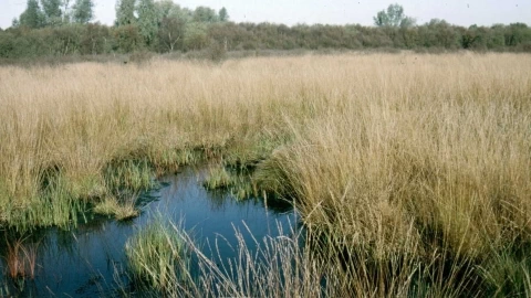 Site of Special Scientific Interest in Cheshire, and a European Union designated Special Area of Interest of Conservation., Carrington Moss began to form during the Flandrian period, from 7100 to 5000 BP.[37]
Flora and fauna

Wikimedia Commons
Carrington Moss is a lowland raised bog. The area drains slowly, which slows the decomposition of plant life and leads to the accumulation of peat. Over thousands of years this raises the level of peat and forms a gently sloping dome (hence, raised). Such areas support a wide range of flora and fauna;[5] Sphagnum balticum, a medium-sized bog moss, was recorded on Carrington Moss in the 1880s, although locally it is now presumed to be extinct.[38] Lancashire- or bog asphodel (Narthecium ossifragum), white beak-sedge (Rhynchospora alba), cranberries, bog-rosemary (Andromeda polifolia), and the cotton sedge have also been recorded.[39] In 1923 species of trees recorded by E. Price Evans for the Journal of Ecology included English oak (Quercus robur), and common ash (Fraxinus excelsior). Undergrowth included common hazel (Corylus avellana), blackberry (Rubus fruticosus), and European holly (Ilex aquifolium). Several species of ground vegetation included creeping soft grass (Holcus mollis), common bluebell (Hyacinthoides non-scripta), common foxglove (Digitalis purpurea), dog’s mercury (Mercurialis perennis), iris (Iris pseudacorus), mad-dog weed (Alisma plantago-aquatica), and cat-o’-nine-tails (Typha latifolia).[40]
The Cheshire Wildlife Trust manages a small nature reserve within Manchester United’s training ground. This provides a habitat for a number of species including the red admiral butterfly (Vanessa atalanta), meadow pipit (Anthus pratensis), and grey partridge (Perdix perdix).[41] Stigmella continuella (a species of moth occurring in southern and north-west England) has also been observed in the area.[42]
Notes
| a | Holt Town was an area to the east of Manchester, along the River Medlock. The “sanitary works” are visible on late 19th-century Ordnance Survey maps, along Upper Helena Street. |
|---|---|
| b | Varying figures are to be found for the purchase price; the Cleansing Committee 1971 visit booklet states £39,165 but no figure is given for the total cost, therefore only approximate figures from The Times newspaper are included in this article. |
| c | Located along the south bank of the Irwell, directly opposite the Wilburn Street basin |

