
Ribble Valley Council Offices, in Clitheroe
Wikimedia Commons
Wikimedia Commons
The local government district of Ribble Valley in North West England is one of the twelve local government districts and two unitary authorities that make up the ceremonial county of Lancashire. The borough contains eighteen of the seventy Grade I listed buildings in Lancashire.
Grade I structures are those considered to be “buildings of exceptional interest”.[1]
| Name | Location | Architect | Completed | Entry number | Image |
|---|---|---|---|---|---|
| All Hallows Church | Great Mitton | Late 13th century | 1163432 | 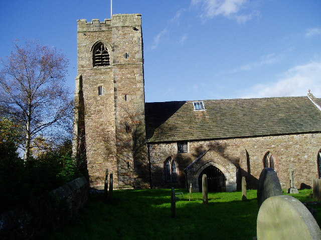 Wikimedia Commons | |
| Browsholme Hall | Clitheroe | Early 17th century | 1072272 |  Wikimedia Commons | |
| Church of St Andrew | Slaidburn | Early 15 and late 15th century | 1163738 |  Wikimedia Commons | |
| Church of St Mary and All Saints | Whalley | 13th century, with 15th-century additions | 1164684 |  Wikimedia Commons | |
| Clitheroe Castle | Clitheroe | 12th century | 1071553 |  Wikimedia Commons | |
| Gisburne Park | Gisburn | 1727–1736 | 1317877 |  Wikimedia Commons | |
| Hacking Hall with Wall Enclosing Garden to North West | Billington | Early 17th century | 1072065 |  Wikimedia Commons | |
| Hesketh End | Chipping | 1591 | 1072316 |  Wikimedia Commons | |
| North West Gatehouse of Whalley Abbey | Whalley | Early 14th century | 1362365 |  Wikimedia Commons | |
| Old St Leonard’s Church | Langho, Billington | c. 1557 | 1362341 |  Wikimedia Commons | |
| Sawley Abbey | Sawley | 1147 | 1072099 |  Wikimedia Commons | |
| St Peter and St Paul’s Church, Bolton-by-Bowland | Bolton-by-Bowland | Mid-15th century | 1362287 |  Wikimedia Commons | |
| St Saviour’s Church | Stydd | Late 12th century | 1147377 |  Wikimedia Commons | |
| St Wilfrid’s Church | Ribchester | 13th century, with 14th and 15th-century additions | 1147451 |  Wikimedia Commons | |
| Stonyhurst College, Old Quadrangle | Stonyhurst | Late 16th century | 1419714 | 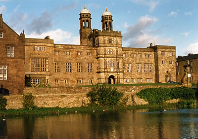 Wikimedia Commons | |
| The Garden Pavilions and Connecting Wall at Stonyhurst College | Stonyhurst | c. 1700 | 1146979 | 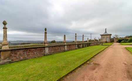 Historic England | |
| Vicarage House | Wiswell | Early 17th century | 1362371 |  Wikimedia Commons | |
| Whalley Abbey | Whalley | c. 1320 | 1164643 |  Wikimedia Commons |
See also
- Grade I listed buildings in LancashireGrade I listed buildings in the ceremonial county of Lancashire, split into the fourteen authorities making up the county.