

Cattle grazing on Hob Moor
Wikimedia Commons
Hob Moor in York is all that remains of medieval open fields belonging to Dringhouses and Acomb outside York city walls. It is now a local nature reserve and ancient common, of historic, archaeological and biological significance.
The moor’s species-rich unimproved pasture is grazed by cows in the summer months, and its tussocky grassland and scattered bushes are a habitat for meadow pipit and skylark. Patches of gorse occupy more acidic sandy soils at the north-east end.
The moor was divided into unequal parts when the York and North Midland Railway was built in 1840s.
History
Hob Moor is the remains of medieval open fields belonging to Dringhouses and Acomb outside York’s walls. It was part of the much larger Micklegate Stray that also included the Knavesmire, a large part of which is occupied by York racecourse. The Freemen of York managed the moor as common land for grazing from the 11th century. An area of the moor retains broad medieval ridge and furrow earthworks; 18th-century ridge and furrows are also visible. A water mill by the Holgate Beck was mentioned in a document from 1563.[1]
Wikimedia Commons
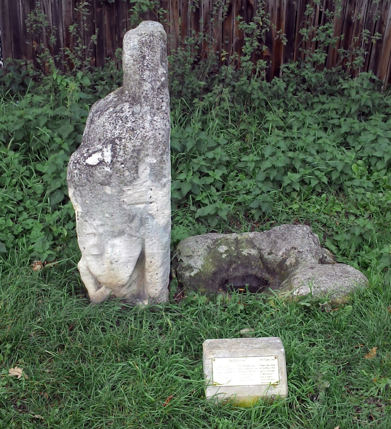
In the 16th and 17th centuries, a small area in the north-east corner of the moor housed plague victims, who reputedly placed money in water or vinegar in a depression in a plague stoneHollowed out stones or boulders containing vinegar to disinfect coins, usually placed at or near parish boundaries, relics of medieval plagues. to pay for food. The plague stone and adjacent Hob Stone are on Little Hob Moor off Tadcaster Road, which is separated from the main area of the moor by the railway line.[1] The Hob Stone is a metre-high coffin lid from the early 14th century. Set upright, it bears the much-eroded effigy of a knight who was a member of the De Roos family.[2]
Land surrounding the moor was enclosed in 1774. Clay pits and brick yards existed in the south-west area and towards Tadcaster Road in the 19th and 20th centuries. Kelsey’s Pond, a water-filled clay pit, remained until the 1950s. The York and North Midland Railway was built across the moor in the 1840s. Members of the Railway Institute had a golf course on part of the moor between 1920 and 1946. The moor continues to be used for recreation, and is criss-crossed by informal footpaths and a surfaced cycleway.[1]
Ecology
The common’s unimproved pasture, which is grazed by cows in the summer months, is species-rich, tussocky grassland with scattered bushes. Wildflowers and grasses include buttercup, common sorrel, pignut, common bent, cats ear, harebell, heath bedstraw, tormentil, sheep’s sorrel and heath grass. Guelder rose, and hazel grow in the hedgerows and patches of gorse occupy more acidic sandy soils at the north-east end, providing a habitat for endangered meadow pipit and skylark. Other birds observed there include whinchat, wheatear, yellow wagtail and merlin.[3]