

Howe Bridge, west side of Leigh Road
Wikimedia Commons
Howe Bridge, now a suburb of Atherton in Greater Manchester, was built as a model mining village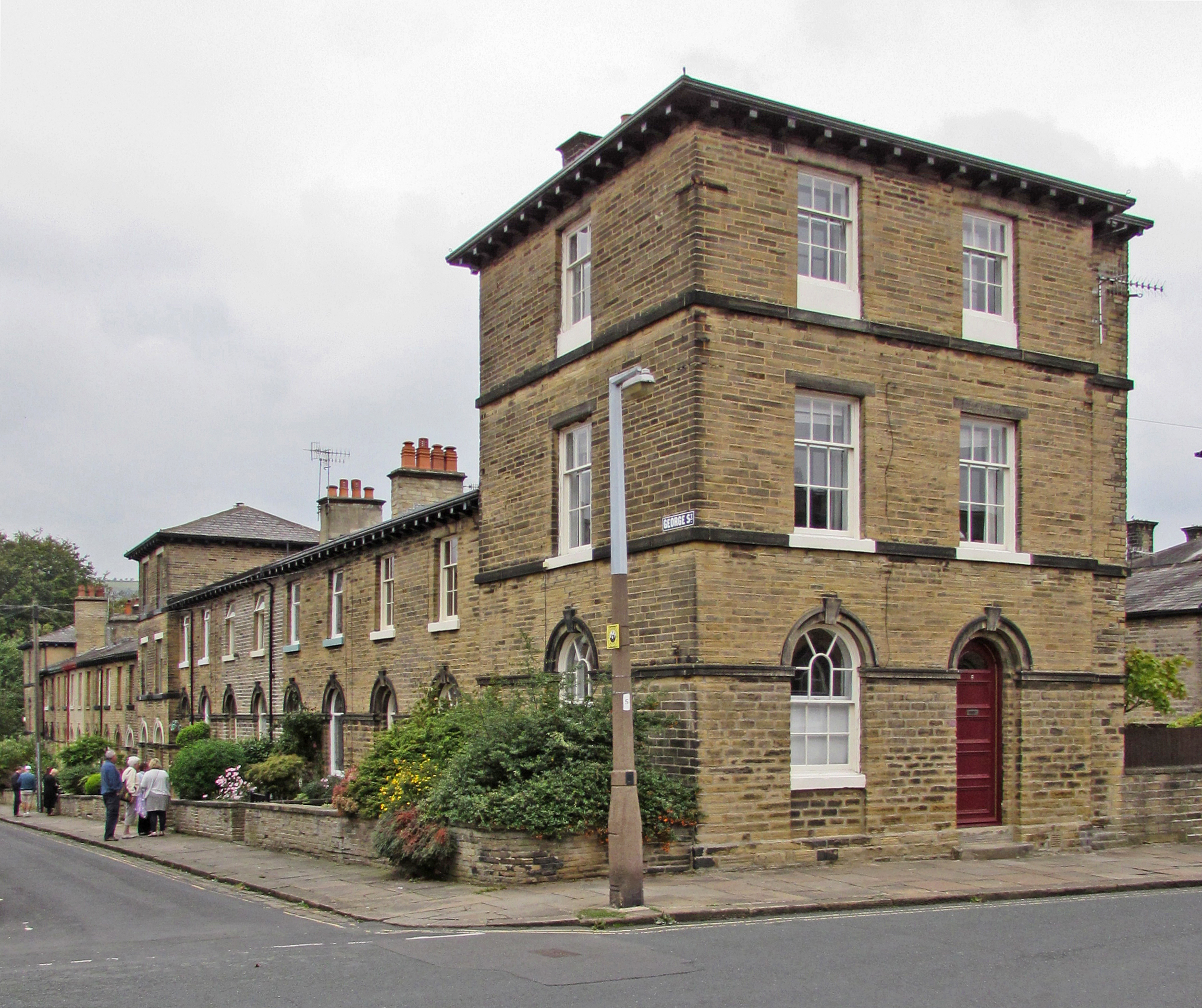 Type of mostly self-contained community, built from the late 18th century onwards by landowners and industrialists to house their workers. in the 1870s by the FletchersOwner of collieries and cotton mills in Atherton in North West England., the owners of several collieries in the town. Historically within Lancashire, the model village is situated to the south-west of Atherton town centre on the B5215, the old turnpike road from Bolton to Leigh.
The Fletchers employed architects J. Medland Taylor to design the self-contained village which was completed in 1875 in a distinctly Dutch style. They also designed the school. St Michael’s Church was designed by Paley and Austin of Lancaster. The village is a conservation area, and many of the buildings on Leigh Road are listed by Historic England.
Background
John Fletcher, from a family with mining interests in Bolton, arrived in Atherton in 1768 to sink two pits, which were developed over the years. Ownership passed to the Fletcher, Burrows and Company, formed in 1892, which owned all the coalmines in the town,[1] and were major employers. The site for the village was south-west of Atherton, where the London and North Western Railway’s Manchester to Wigan line crossed the Leigh to Bolton road at Chowbent Station.[a]Subsequently renamed Howe Bridge East of the station was a junction to the Bolton and Leigh RailwayLancashire's first public railway, promoted as a mineral line in connection with William Hulton's coal pits to the west of his estate at Over Hulton. line and the Fletcher’s Gibfield Colliery.[2]
Model pit village
The Fletchers built the model village on Leigh Road between 1873 and 1875 to house some of their workforce. The houses were designed by the architects J. Medland Taylor, Manchester architects renowned for quirky and unorthodox designs. The buildings on Leigh Road, such as the bath house, were designed in a distinctly Dutch style, with intricate brick details.[3] The western side of Leigh Road is raised above road level by a retaining wall on top of which is the Promenade, with small gardens in front of the houses. In the centre of the terrace is the large, projecting hipped-roof shop, which had a three-bay facade with an arcade of stone piers with Gothic capitals. The baths beneath the shop were accessed from road level.[4]

Wikimedia Commons
St Michael and All Angels Church was started in 1877 and completed two years later. It was designed by Paley and Austin of Lancaster, and the £7,000 cost was given by John Fletcher.[5] The schools, with a bell-cote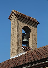 Shelter containing one or more bells., gables and chimneys on the east side of the road are dated 1887 and appear to be by J. Medland Taylor.[4] The Fletchers also built Briarcroft Hall,[6] which was their home until it was donated to the community in 1921.
The village provided quality housing for the miners’ families in rows of two-up, two-down terraced cottages; the self-sufficient community had shops, a village club and a bath house for the miners. The new settlement was close to several of the company’s collieries, and the Fletchers played an active role in village life.[3] The houses on either side of Leigh Road,[7][8] and St Michael and All Angel’s Church are all listed buildings in the conservation area.[9]
History
The Battle of Howe Bridge took place on 4 February 1881 during the miners’ strikeBitter and violent Lancashire miners' strike of 1881 that lasted for seven weeks, and ended with no resolution., which was characterised by mobs of miners picketing working pits.[10]
Howe Bridge became the centre of the South Lancashire TramwaysSystem of electric trams authorised by the South Lancashire Tramways Act of 1900. The South Lancashire Tramways Company built more than 62 miles (100 km) of track to serve the towns in south Lancashire between St Helens, Swinton, Westhoughton and Hulton Lane where it met the Bolton Corporation system. system in 1904 when tram sheds, power station and offices were built on the north side of Leigh Road.[11]
The mines rescue station First mines rescue station on the Lancashire Coalfield, opened in 1908 in Lovers Lane Howe Bridge, Atherton, Lancashire., the first on the Lancashire Coalfield, opened in 1908 in Lovers Lane.[12]
Notes
| a | Subsequently renamed Howe Bridge |
|---|

