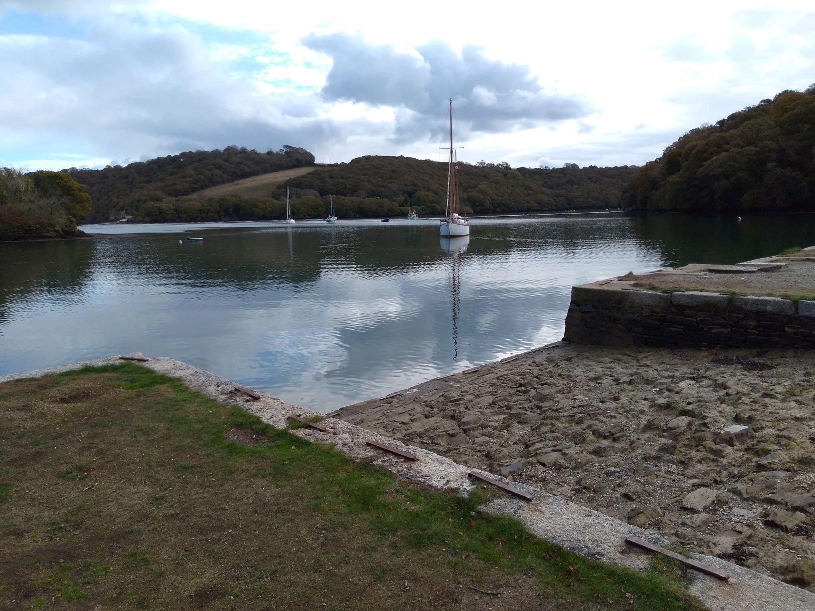
Roundwood is a wooded peninsula at the confluence of the Cowlands and Lamouth Creeks just west of where they join the navigable River Fal in the parish of Feock in Cornwall. The complex site is a scheduled monument that has evidence of occupation and settlement since at least the Iron Age, and in modern times was a trading site when a quay was built in the late 18th century.
Ralph Allen Daniell acquired Roundwood for the Trelissick Estate in 1805, and the quay was redeveloped as part of the ornamental landscape at Trelissick, but industry continued into the late 19th century. In the first half of the 20th century a coalyard, a boat-hire business and tea garden were established. Military activity may have taken place during the First World War, and the earthworks were possibly part of the defences for D-Day.
Multiple enclosure fort
During the late-Iron Age, sometime between 350 BC and about 50 AD, Roundwood Fort was constructed at the confluence of the Cowlands and Lamouth Creeks and the navigable River Fal. It is largely intact apart from alterations to the inner enclosure and western rampart. The site was listed as a Scheduled Monument in 1972. The multiple enclosure fort was constructed on a strategically important promontary in a semi-concealed position guarding the confluence of the Fal and Truro Rivers. The fort’s overall plan measures 280 metres (919 ft) east to west and 230 metres (755 ft) north to south.[1]

Between the creeks, the neck of the promontory is crossed on the west side by two banks and ditches about 60 metres (197 ft) apart, each with a central entrance. The outer earthwork, a rampart of earth and stone, is about 5 metres (16 ft) wide and 1.5 metres (4.9 ft) high. The southern half of the outer earthwork’s west side is truncated and revetted,[a]Revetted means faced with stone. and is now a modern field boundary. The inner rampart is up to 3 metres high behind a 1.5 metre deep ditch. The top of the promonary is enclosed by a metre high oval bank and parts of an external ditch. The entrance has a wide causeway, and faces west in line with entrances through the outer banks.[1]
The site, labelled Roundwood Camp on historic maps, is an example of a round, an Iron Age or Romano-British defended farmstead but displays characteristics of a promontory fort, and may have been more than a farming settlement. Its sheltered position overlooking the estuary suggests a link with trade, which was well-established between Cornwall and north-west Europe in the Iron Age. But as the site has not been excavated, details of its use and re-use are unclear.[2]
Quay
For centuries the area was predominantly rural, but Roundwood became an industrial site in the late 18th century. On the waterfront are remnants of the historic, 18th-century, Grade II listed quay.[3] It was constructed around the south, east, and north sides of the promontory, and a system of leats was created to supply water, one cutting through the outer earthworks on the south side, and a track crossed the fort to the quay which was constructed on a broad levelled terrace along with several industrial buildings. A copper smelting complex was built, and ore was brought to be smelted by mule-trains from the mines owned by the North Downs and Chacewater Copper Company, which was in production until the mid-1780s. Ships of up to 300 tons could be accommodated at the lowest tides. Copper and tin from the mines was shipped out, and coal for steam engines was brought in.[2]

The quay is built of slatestone rubble with granite quoins  Any external angle or corner of a structure.and copings linked by iron staples. It has six loading bays with side walls of horizontally coursed rubble and cobbled ramps between. At the end of the quay’s east wall is a flight of granite steps.[4]
Remains of calciners, lime kilns and a smelting house are visible, as are two leats that ran down from a reservoir to feed the smelting works. Slag from the processing works was used to surface the access road to Tregew.[2]
Ralph Allen Daniell acquired Roundwood for the Trelissick Estate in 1805 and possibly rebuilt the quay complex for ship building; copper ore was still shipped out and coal and timber brought in. Because Roundwood had poor access inland, the quay was redeveloped as part of the ornamental landscape at Trelissick, but industry including lime burning and ship-building continued into the late 19th century.[2]
In the first half of the 20th century a coalyard occupied part of the quay and in the 1930s a boat-hire business and tea garden were established. Canadian troops used the area for training and military activity may have taken place during the First World War and some of the earthworks were possibly part of the defences for the D-Day embarkation point at Tolverne.[2]

