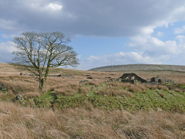

Anglezarke, signs of depopulation
Wikimedia Commons
Anglezarke is a sparsely populated civil parishSmallest administrative unit in England.Smallest administrative unit in England. in the Borough of Chorley, Lancashire. There is no village; the settlement consisted of scattered farms with the hamletRural settlement smaller than a village. of White Coppice, close to the quarries. Its western edge is dominated by reservoirs that were built to supply water to Liverpool, and it rises to a large expanse of moorlandDominant landscape of Britain's uplands, including many of its national parks. with evidence of Bronze Age settlements. Popular with walkers and tourists, it is on the edge of the West Pennine Moors, sandwiched between the moorland of Withnell and Rivington. It lies between the towns of Chorley, Horwich and Darwen.[1] The area was subjected to depopulation when the reservoirs were built.
Quarrying the hard millstone grit for building and paving, mining for lead and minerals, some small-scale coal mining and hill farming were important in Anglezarke particularly from the 17th to the 19th centuries.
Geography
Anglezarke covers 2793 acres (1,130 ha) of high moorland on the western slopes of the West Pennine Moors reaching about 1000 feet (305 m) above sea level. It is a settlement of scattered farmhouses with no village centre. The hamlet of White Coppice, where there was a cotton mill, is in the north-west corner. The township is crossed by the minor road from RivingtonVillage in the Borough of Chorley, to the northwest of Bolton, on the fringe of the West Pennine Moors. to Heapey on the western border.[2]
Water flowing off the moors cuts deep valleys or cloughs, which contain some woodland.[3][4] At the turn of the 20th century Liverpool Corporation acquired a large part of the land to protect the water supply to the Rivington ReservoirsThe Rivington Reservoir Chain, or Rivington Pike Scheme, was built for Liverpool Corporation Waterworks between 1850 and 1857 by Thomas Hawksley. and many properties were demolished, leaving only one or two working farms.[2] The source of the River Yarrow, which feeds the Yarrow Reservoir, is at Will Narr on Anglezarke Moor. The west of the area is dominated by Anglezarke Reservoir.
The underlying rocks are millstone grit and sandstones of the lower Lower Coal Measures.[5] There were lead mines and several quarries whose stone was used for road-making and building.
History
Wikimedia Commons
Anglezarke’s name is derived from the Old Norse Anlaf, a personal name and erg, a hill pasture or shieling. Together they mean “Anlaf’s hill pasture”.[6] In 1202 the name was recorded as Andelevesarewe, in 1225 as Anlavesargh, in 1351 Anlasargh, and by 1559 Anlazarghe.[2]
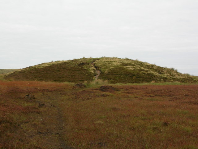
Human activity can be traced to pre-historic times. Pikestones, the only Neolithic chambered cairn in Lancashire, has an internal burial chamber with evidence of the original entrance, and Round Loaf, a Neolithic to late Bronze Age tumulus are scheduled monuments on Anglezarke Moor.[7][8]
Manor
After the Norman Conquest, Anglezarke was dependent on the barony of Manchester. Albert Grelley gave two oxgangs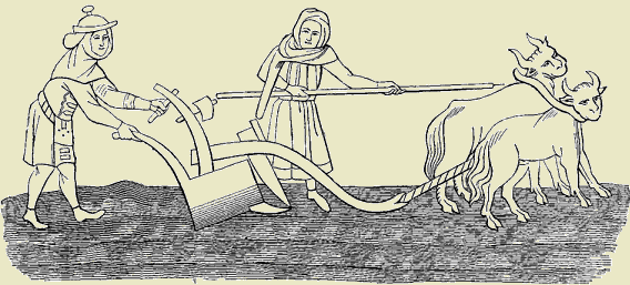
Old measurement of land. eight oxgangs equals one carucate or ploughland. One oxgang is the area that could be ploughed by a team of eight oxen in one year. of land to Robert de Lathom for an annual rent of three shillings. In 1339 Edward III granted free warren in Anglezarke to Thomas de Lathum. The Knights Hospitallers also held land in Anglezarke. The Manor House, now a Grade II Listed building, has a 1604 date stone inscribed “RS”, “W S” and “WL 1778”.[9] In the 17th century the Standishes bought the rights to the manor from the Earls of Derby. Percival Sumner Mayhew bought the Standish share in 1898, and held it until the turn of the 20th century when Liverpool Corporation acquired a large part of the manor to protect the water supply.[2]
Industry

Wikimedia Commons
It is possible that Romans mined lead in Lead Mines Clough, where shafts were finally sealed in the 1930s.[10] Records of mining in the clough date from 1692; the most productive years were between 1781 and 1790. Around this time the mineral, witherite (barium carbonate) was discovered in the spoil, and used secretly by Josiah Wedgwood to produce Jasperware at his works in Etruria. Witherite had been considered worthless, but because it contains arsenic, it was used as rat poison by locals.[11]
The mine ceased work in 1837.[8] Numerous shafts up to 240 feet (73 m) deep, a smelting mill, a smithy and a waterwheel were constructed at the mine.[12] The pit for an 18-foot (5 m) overshot waterwheel at the top of a pumping shaft is all that remains of the drainage system. The waterwheel may have also powered a set of rollers to crush lead ore.[5]
Coal was mined for local or personal use from drift mines where the coal seam outcropped from Fletcher Bank to Great Hill. The Margery Mine near White Coppice and the Sandbrook Mine in the Yarrow Valley were mined by six men in the 19th century.[13]
A cotton mill was built by the stream at White Coppice.[14] Roger Lester who lived in Anglezarke in 1769 had a small mill on the bank of the River Yarrow at the end of Bradley Wood of which no trace remains.[15] The mill gave its name to the Lester Mill Quarry, a major contributor to the economy in the 19th century,[11] producing gritstone flags, stone setts and kerbs for paving the streets of the industrialised towns.
Reservoirs
High Bullough Reservoir, built by John Frederic BatemanEnglish civil engineer whose work formed the basis of the modern United Kingdom water supply industry. for Chorley Waterworks was taken over by the Liverpool Corporation in 1856. It predates Anglezarke Reservoir, the largest of the Rivington Reservoirs that were constructed between 1850 and 1857. Yarrow Reservoir, fed by the River Yarrow and Limestone Brook, which rise on Anglezarke Moor, was started in 1867.[16]
Governance
Until the early 19th century Anglezarke was a townshipDivision of an ecclesiastical parish that had civil functions. in the ancient parishAncient or ancient ecclesiastical parishes encompassed groups of villages and hamlets and their adjacent lands, over which a clergyman had jurisdiction. of Bolton le Moors, in the hundredAdministrative subdivision of a shire. of Salford in Lancashire.[14] In 1837 Anglezarke joined with neighbouring townships to form the Chorley Poor Law Union, which took responsibility for the administration and funding of the Poor Law.[17] Anglezarke became a civil parishSmallest administrative unit in England.Smallest administrative unit in England. in 1866, and was part of the Chorley Rural Sanitary District from 1875 to 1894, and then part of the Chorley Rural District from 1894 to 1974.[18] Since 1974 Anglezarke has been a civil parish of the Borough of Chorley, and is part of the Chorley parliamentary constituency.[19]