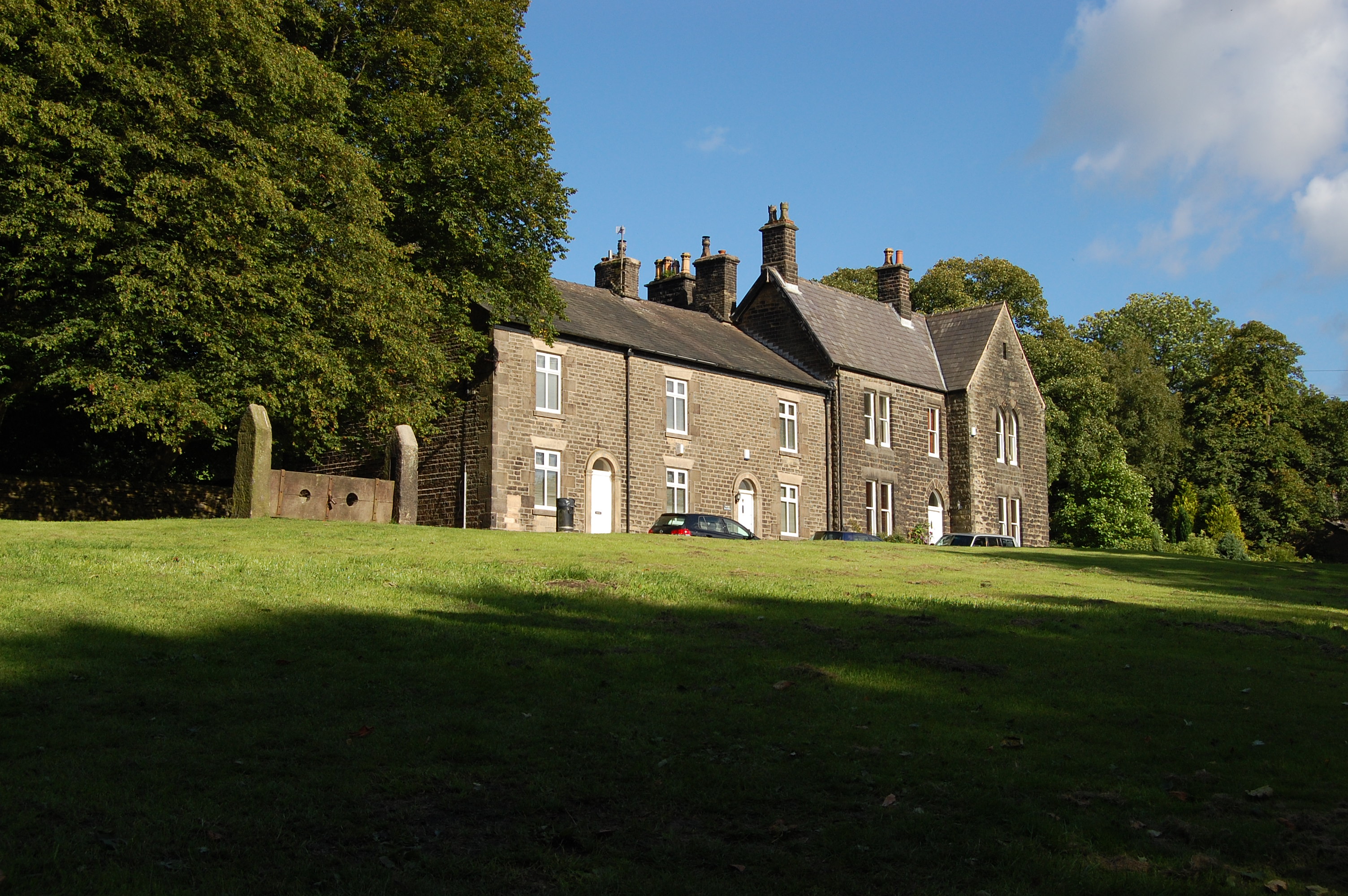

Village green and stocks
 Device used to publicly humiliate those found guilty of minor offences.
Wikimedia Commons
Rivington, a village and sparsely populated civil parish Smallest administrative unit in England. in the Borough of Chorley, Lancashire, is at the foot of Rivington Pike
 Hill summit on Winter Hill, part of the West Pennine Moors, overlooking the village of Rivington in Lancashire, England. on the western fringe of the West Pennine Moors. The village is about 6 miles (9.7 km) southeast of Chorley and about 8.5 miles (13.7 km) northwest of Bolton.
Life in the Middle Ages centred on the families who owned the manor in what was an isolated rural community. Agriculture, hand-loom weaving, quarrying and mining occupied the few inhabitants until the middle of the 19th century. A chapel built before 1541 was replaced by the present church in 1666, and by 1703 Nonconformists had built a Presbyterian church, now the Unitarian Chapel. The grammar school was founded by charter of Queen Elizabeth I in 1556.
Construction of the Rivington Reservoir Chain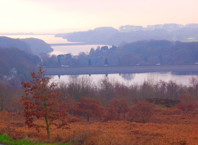 The Rivington Reservoir Chain, or Rivington Pike Scheme, was built for Liverpool Corporation Waterworks between 1850 and 1857 by Thomas Hawksley. for Liverpool Corporation in the mid-19th century led to a decrease in the population when farms were cleared, the valley flooded and property in the western part of the village demolished. William Lever bought the Rivington estate at the turn of the 20th century and used his wealth to renovate the old barns and create a large public park.
Geography
Wikimedia Commons
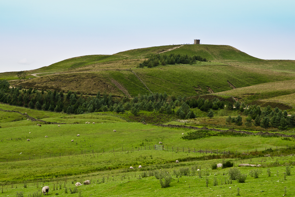
Rivington covers 2,538.0 acres (1,027 ha) of the moorland Dominant landscape of Britain's uplands, including many of its national parks. fringe between the high unenclosed moorland of Winter Hill
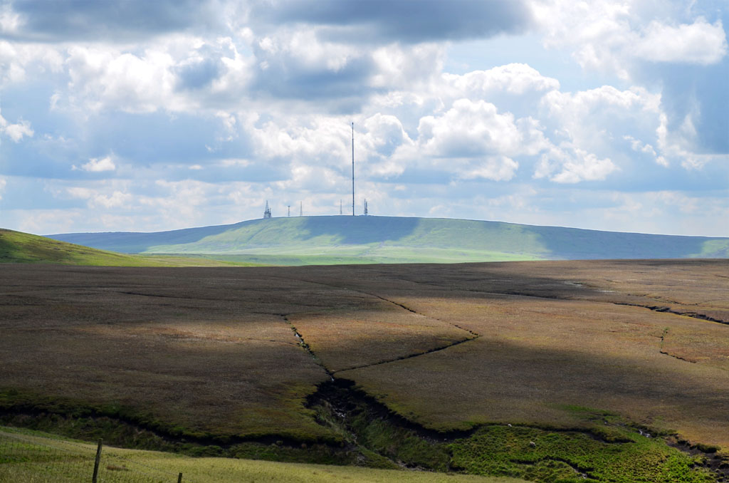 High point of Rivington Moor in the West Pennine Moors is 1,496 feet high and has been the site of mining, a mass trespass, aeroplane disasters and murder. in the West Pennine Moors and the fields below. The landscape is characterised by marginal pastures with isolated farmsteads, and disused coal mines and quarries scattered across the hillsides. An extensive network of footpaths provides public access.[1] The reservoir valleys are dominated by expanses of water and the Victorian gothic architecture of the dams and embankments surrounded by woodland.[2]
Rivington Pike rises to the east and to the west is the flatter land of the Lancashire Plain. Horwich and Bolton are to the south and Anglezarke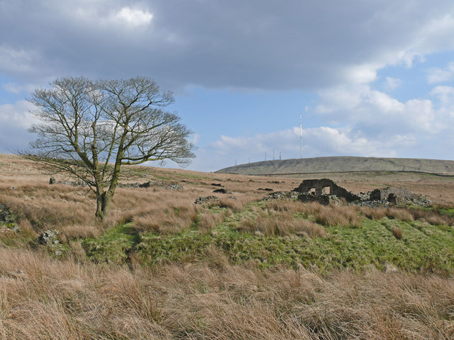 Sparsely populated civil parish near Chorley in Lancashire with no village, just scattered farms and the hamlet of White Coppice. Moor and Yarrow Reservoir to the north. To the west of the village is the wide shallow valley containing the Anglezarke and the Upper and Lower Rivington Reservoirs. The underlying geology is Millstone Grit overlaid with coal measures. Gritstone was quarried for building stone in the area. Around Rivington are chalybeate springs and in Dean Wood is a waterfall with a descent of 32 feet (9.8 m).[3] The River Douglas has its source on Winter Hill and flows in a southwesterly direction, forming part of Rivington’s southern boundary. The River Yarrow, the source of which is also on Winter Hill, forms the northern boundary.[4] The township covers 2,768.0 acres (1,120 ha),[3] the reservoirs and filter beds occupy 275 acres (111 ha).[5]
Governance
Rivington was a townshipDivision of an ecclesiastical parish that had civil functions. in the ecclesiastical parishAncient or ancient ecclesiastical parishes encompassed groups of villages and hamlets and their adjacent lands, over which a clergyman had jurisdiction. of Bolton le Moors, in the Salford hundredAdministrative subdivision of a shire. in Lancashire.[6] It became part of the Chorley Poor Law Union, formed in 1837, and took responsibility for the administration and funding of the Poor Law in that area.[7] In 1866 Rivington became a civil parish, and was part of the Chorley Rural Sanitary District from 1875 to 1894, and of Chorley Rural District from 1894 to 1974.[8]
Since 1974 the interests of the Rivington civil parish have been represented by its parish council,[9] and councillors who sit on Chorley Council[10] and Lancashire County Council.[11] Rivington is in the Chorley Parliamentary constituency.[12]
Demographics
Census data: Rivington
As at the 2011 Census, Rivington has a population of 109, with a median age of 48 years. The area occupies 1,121 hectares (2,769.23 acres), giving a population density of 0.1 persons per hectare.
History
Rivington’s name is made up of three elements: the first, hrēof is from the Old English meaning rough or rugged; the second, ing, is a placename forming suffix that has crept in over the years; the last is the Old English tūn, a farmstead, estate or settlement. Together they indicate a farmstead or settlement at the rough or rugged place.[13] Another suggestion is a place at the rowan trees.[14] Rivington was recorded as Rowinton, Rawinton, and Revington in 1202; Ruhwinton in 1212, Riuiton in 1226, Rowynton and Rouynton in 1278, Roynton in 1332, Rouyngton in 1400, Revyngton although rare, and Rovington and Ryvington from the 16th century.[4][13]
The area has been occupied since at least the Bronze Age.[15] Arrowheads, a flint knife, scrapers and the remains of cremations were excavated from a cairn at Noon Hill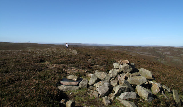 Area of the West Pennine Moors in North West England. At its summit is a Bronze Age burial mound. on Rivington Moor in 1958 and 1963–1964.[16] The name Coblowe on the eastern bank of the Lower Rivington Reservoir derives from the Old English hlaw, a hill, which denoted an ancient barrow or burial place.[17] Evidence for an Anglo-Saxon settlement is found in the Rivington and Coblowe placenames.
Manor
In 1212 Alexander de Pilkington held in thanage[a]Historical Anglo-Saxon term for land held by a thane (superseded by baron or knight), who held lands of the king by military service.[18] six oxgangs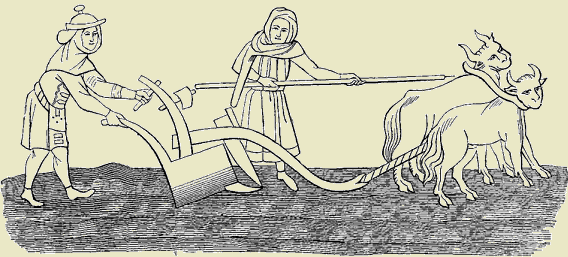 Old measurement of land. eight oxgangs equals one carucate or ploughland. One oxgang is the area that could be ploughed by a team of eight oxen in one year., most of the land in the Manor of Rivington. The village in 1290 was home to a junior branch of the Pilkington family, who held it until 1611.[4] Robert Pilkington extended the original Rivington Hall
 Grade II* listed former manor house in Rivington, Lancashire, England, the successor to a 15th-century building that was built near to the present building. in the 15th century. His son, Richard, rebuilt the chapel, and his son James, Bishop of Durham from 1560 to 1575, founded Rivington Grammar School.[15]
Wikimedia Commons
After the death of George Pilkington in 1597, the estate passed to his son, Robert who died in 1605, but by then it was in decline.[4] In 1611, the Pilkingtons sold the estate to Robert Lever and Thomas Breres. In 1729 John Andrews of Little Lever bought the Breres’ share. He was responsible for building the Pike Tower in 1733.[19] His descendant, Robert Andrews, partially rebuilt Rivington Hall in red brick in the Georgian style in 1774.[20] After his death the property passed to his sister Hannah Maria Andrews who had married Robert Fletcher of Liverpool. Their daughter, Lucy, married Woodhouse Crompton in 1834 and their descendants remained resident at the hall until 1910. In 1900 the Cromptons sold their interest in the manor and estate of 2,169 acres to William Hesketh Lever.[4]
Industry
Mill Hill and a water mill were mentioned in a grant in 1544.[4] A smithy and the foundations of what could have been a water mill and mill ponds, were shown on the 1848 first edition Ordnance Survey map.[21] Handloom weavers occupied Mill Hill and Pall Mall Cottages.[15]
The village grew around around the green but most of its inhabitants were employed in agriculture on scattered local farms, hand loom weaving in their own homes, working in the local quarries or the small coal mines on Winter Hill.[3][4] Coal was mined on a very small scale. Nicholas Fish, Brooker and Company’s coal pit on Wilders Moor was recorded on the 1869 and 1880 mines lists.[22][23] in 1896 the Rivington Moor Colliery employed two workers mining coal from the Mountain coal seam for their own or local use.[24] At Tiger’s Clough, in the River Douglas Valley, the Knoll Bleachworks and a calico-printing works were operating before 1800.[4]
Reservoirs
In the 1850s the Rivington Reservoir Chain was built to provide Liverpool with safe, clean water.[15] Thomas Hawksley designed five reservoirs, a water treatment works and the 17-mile (27 km) pipeline to storage reservoirs at Prescot. The Rake Brook and Lower Roddlesworth Reservoirs were connected to the lower reservoirs by the Goit, a man-made channel. The scheme was expanded to include High Bullough Reservoir, and further expanded by the Upper Roddlesworth Reservoir.[25][26] Yarrow Reservoir, on which work began in 1867, was designed by Thomas Duncan, the Liverpool Borough Engineer.[27]
In 1900 Liverpool Corporation attempted to acquire the area of the Rivington watershed to safeguard the water supply, and proposed demolishing the entire village. The Liverpool Corporation Act 1902 protected some buildings[28] but others were acquired by compulsory purchase including the Black-a-Moors Head public house and New Hall, which were demolished between 1902 and 1905. The result was the small settlement that has remained largely unchanged.
Lever era

Wikimedia Commons
In 1902 the estate was compulsory purchased by Liverpool Corporation to protect the reservoir scheme. Lever was allowed to build Roynton Cottage, a single-storey wooden bungalow high on the hillside below Rivington Pike. He used it for weekend visits and entertaining until it was destroyed in an arson attack by Edith Rigby, a suffragette from Preston, on 8 July 1913.[29][b]Phoebe Hesketh lived at Fisher House on the village green. She wrote a biography, My Aunt Edith, about Edith Rigby the suffragette, several volumes of poetry and two partly autobiographical books, Rivington: the story of a village and Rivington: village of the mountain ash.[30][31] Lever rebuilt the bungalow on a grander scale in stone and Thomas Mawson Early 20th-century garden designer, landscape architect and town planner. designed its 45-acre (18 ha) gardens between 1905 and 1922.[4] Lever’s private gardens
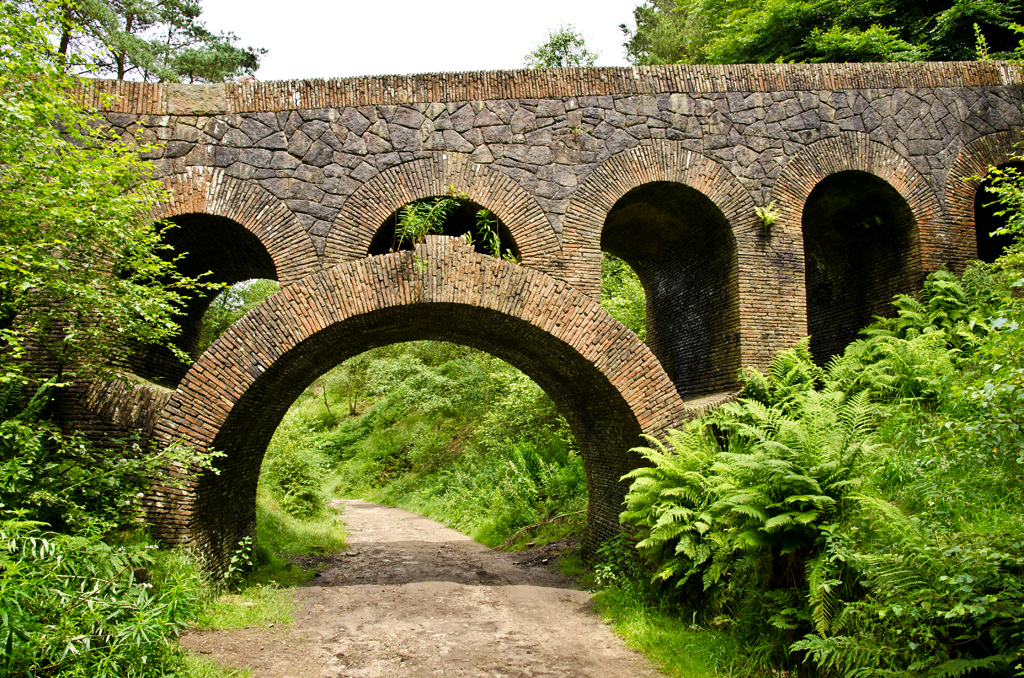 Rivington Gardens cover about 45 acres of the steep west-facing slopes of Rivington Moor at the edge of the West Pennine Moors in Lancashire. contained terraces and a pool, a Japanese lake and pagoda, Italian-style gardens, a seven-arched bridge and the Pigeon Tower, with Lady Leverhulme’s sewing room on the top floor.[32]
Wikimedia Commons
The artist Alfred East spent the summer of 1909 at Roynton Cottage, to fulfil Lever’s commission of a series of paintings of the surrounding landscape, reservoirs, country park, village and the pike.[33] Lever gave fifteen paintings to Bolton Art Gallery and others to Bolton School, the Walker Art Gallery in Liverpool and the Lady Lever Art Gallery at Port Sunlight. East gave two water colours, A glimpse of Rivington Water and In Rivington Park to Kettering Museum and Art Gallery. East’s oil painting [From] Rivington Pike was exhibited at the Royal Academy in 1913.[33] The Walker Art Galley holds a painting, Rivington Valley (1857), by Frederick William Hulme.[34]
After Lever’s death Roynton Cottage was acquired by the Bolton brewer, John Magee. During the Second World War it was requisitioned to billet troops, and nissen huts were erected in the grounds. After the war the site was acquired by Liverpool Corporation, who decided to demolish it.[29]
Lever’s legacy is Lever Park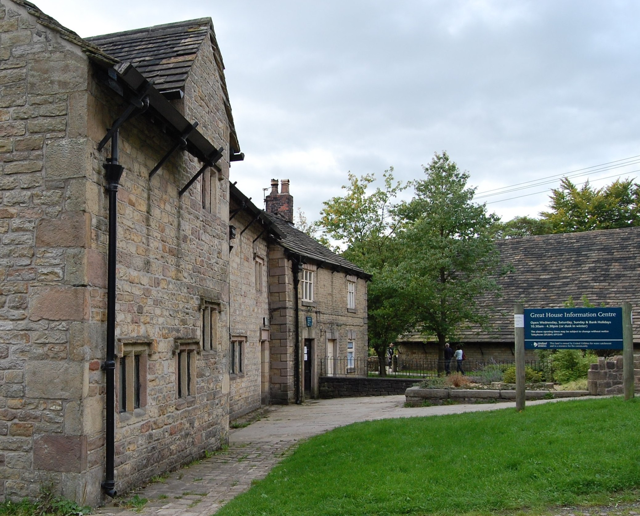 Grade II listed country park between Rivington in Lancashire and Horwich in Greater Manchester., the designed landscape between the open moorland and the reservoirs which incorporates the village into its overall design and is “one of the largest and most impressive examples of landscape design in Edwardian England”. Lever donated the 364-acre (147 ha) park to the people of his native Bolton. Under the terms of Liverpool Corporation’s compulsory purchase order, Lever laid out the park at his own expense and maintained it during his lifetime.[35] In 1974 the park and gardens passed to the North West Water Authority from Liverpool Corporation, and to United Utilities on privatisation. They are maintained as a public country park, protected by rights afforded by the 1902 Act ensuring “free and uninterrupted enjoyment by the public”.[29] In 2016 the Rivington Heritage Trust and Groundwork Cheshire Lancashire and Merseyside were awarded £3.4 million from the Heritage Lottery Fund to conserve, repair and protect Rivington Gardens and remaining Grade II listed structures.[36]
Religion and education

Wikimedia Commons
Rivington was a chapelry Church subordinate to a parish church serving an area known as a chapelry, for the convenience of those parishioners who would find it difficult to attend services at the parish church. in the ancient parishAncient or ancient ecclesiastical parishes encompassed groups of villages and hamlets and their adjacent lands, over which a clergyman had jurisdiction. of Bolton le Moors. Its church is built on the site of an earlier chapel that was named in a deed by Margaret Pilkington and her son Robert in 1476. The chapelry covered Rivington and the surrounding areas. In 1628 a chapel was built by the local population “upon a little toft and quillet of land”, where divine service had been celebrated “for many years of antiquity”.[4] This chapel was rebuilt as Rivington ChurchActive Anglican parish church and Grade II listed building in Rivington, Lancashire. in 1666 and was altered and restored in 1861.[37] Rivington Unitarian Chapel
 Active place of Unitarian worship in Rivington, Lancashire whose congregation dates from 1662 but the stone chapel was not built until 1703. was built in 1703 for the Presbyterians; it became Unitarian in the late 18th century.[38]
Queen Elizabeth I granted a charter to Rivington Grammar School in 1566. The school opened in 1575 and was rebuilt in 1714. Blackrod Grammar School merged with it in 1875 and in 1882, renamed Rivington & Blackrod Grammar School, it moved to a site on the boundary with Horwich. Now Rivington and Blackrod High School.[39] Rivington Foundation Primary School occupies the old grammar school premises.[40]
Sport
The Rivington Pike Fell Race, held on Easter Saturday, started from the Horwich railway works in 1892, but since 1930 starts from the park entrance at Lever Park Avenue. It attracts around 400 runners. The course is 3.25 miles long and has a 700-foot ascent.[41] The 2002 Commonwealth Games mountain biking competition was held around Rivington and Anglezarke.[42] The area is well used by hikers and hillwalkers.
Notes
| a | Historical Anglo-Saxon term for land held by a thane (superseded by baron or knight), who held lands of the king by military service.[18] |
|---|---|
| b | Phoebe Hesketh lived at Fisher House on the village green. She wrote a biography, My Aunt Edith, about Edith Rigby the suffragette, several volumes of poetry and two partly autobiographical books, Rivington: the story of a village and Rivington: village of the mountain ash.[30][31] |

