Wikimedia Commons
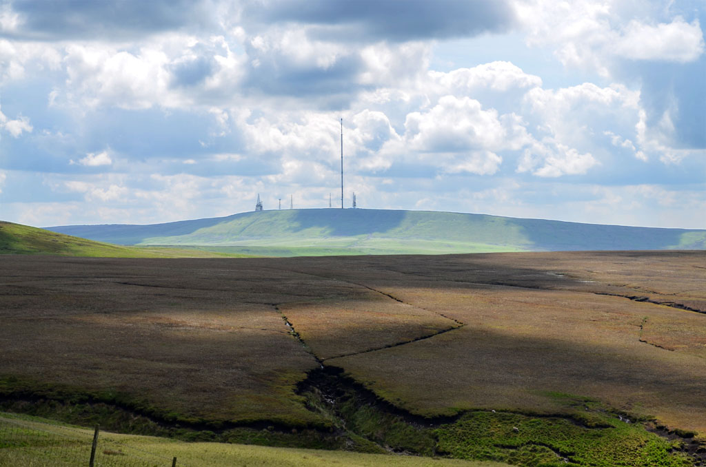
Winter Hill is the high point of Rivington Moor in the West Pennine Moors in North West England. On the border of the boroughs of Chorley, Blackburn with Darwen and Bolton, it is 1,496 feet (456 m) high. It is a popular walking area and has been the site of coal mining, a mass trespass1896 protest organised when the landowner Colonel Ainsworth closed a track leading to Winter Hill, denying the right of access to the local population.1896 protest organised when the landowner Colonel Ainsworth closed a track leading to Winter Hill, denying the right of access to the local population., aeroplane disasters and murder. The landmark TV transmitter broadcasts digital terrestrial television signals for the North West.
The River Douglas, which is part of the catchment for the Rivington reservoir chain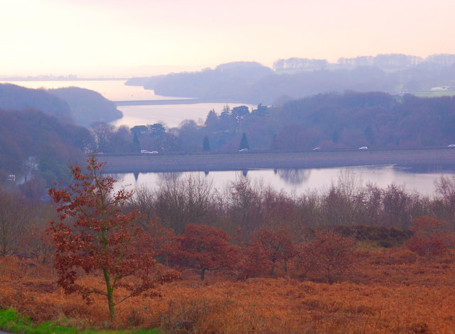 The Rivington Reservoir Chain, or Rivington Pike Scheme, was built for Liverpool Corporation Waterworks between 1850 and 1857 by Thomas Hawksley., rises at Douglas Springs not far from the summit, close to the 1,440-foot (439 m) contour.
Geography
Wikimedia Commons
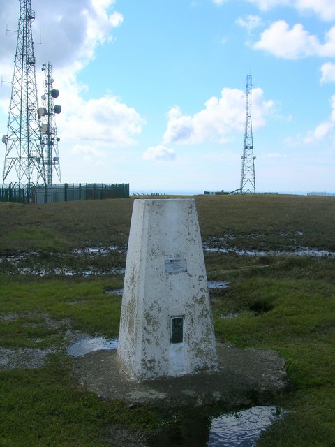
The West Pennine Moors is a spur of moorland Dominant landscape of Britain's uplands, including many of its national parks. on the western side of the Pennine hills. The moorland is lower in altitude than the South Pennine spine, but Winter Hill on Rivington Moor is a notable high point at 1,496 feet (456 m) that is visible from long distances.[1] Several communications masts occupy high ground near the summit where there is a trig pointPillars erected by the Ordnance Survey to allow more accurate maps of Great Britain to be produced. marking the highest point in Blackburn with Darwen. The highest point in the Metropolitan Borough of Bolton is Counting Hill, 440 yards (402 m) away on its south east slope, at 1,467 feet (447 m) above sea level. The distinctive summit of Rivington Pike
 Hill summit on Winter Hill, part of the West Pennine Moors, overlooking the village of Rivington in Lancashire, England. is to the southwest.
The A675 road through Belmont passes Winter Hill’s eastern slopes, and a minor road over the moors from Belmont heads west to Rivington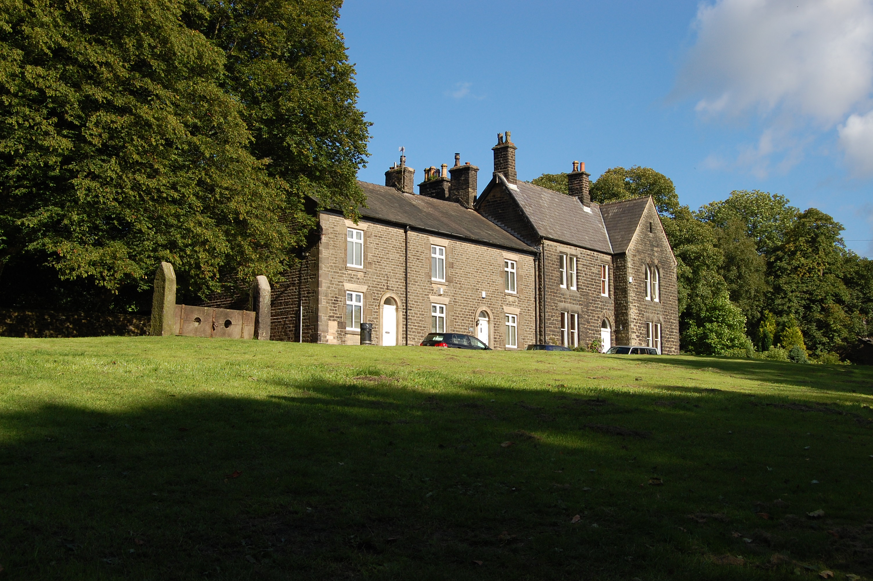 Village in the Borough of Chorley, to the northwest of Bolton, on the fringe of the West Pennine Moors.. A network of footpaths lead to the summit from the surrounding settlements. Much of the moorland surrounding the summit is access land.[2]
Water flowing off the hill cuts deep valleys or cloughs in a radial drainage pattern. The River Douglas rises at Douglas Springs not far from the summit close to the 1,440-foot (439 m) contour.[3] It is part of the water catchment for the Rivington Reservoirs and feeds into the Lower Rivington Reservoir. The deep cloughs contain some woodland. The hill is covered by moorland, with grass moor, wet flushes and springs, blanket bogs and semi-natural woodlands containing a range of plants and animals. Heather is returning to some areas after a reduction in sheep grazing.[1]
Geology

Wikimedia Commons
The area is underlain with rocks of the Carboniferous age. The oldest, around Belmont in the north, belong to a group called the Marsdenian. Yeadonian rocks including the Rough Rock and Haslingden Flags that underlie Rivington Moor, Winter Hill and Smithills Moor. The youngest rocks, the Lower Coal Measures, are found on Smithills Moor to the south. Most of the rocks are coarse-grained sandstones, shales, and mudstones interspersed with coal seams in the coal measures.[4] The coal measures contain mostly sandstones, including flagstones and coal seams.[5]
Rock strata were laid down when the area was part of a large landmass with large river systems carrying sands and gravels that formed huge deltas.[6] Plant fossils in the coal seams give clues about the vegetation, which was different from the plants growing today.[7] The workable coal seams, the Sandrock and Six Inch, Upper and Lower Mountain mines, were exploited more than 200 years ago.The remains of coal mining are evident in several places, including the top of Winter Hill. Bell pits, holes dug into the ground to access shallow coal seams, are visible as raised circular areas with central depressions.[7] Seams of fireclay and gannister below the coal were excavated to make fire bricks for furnaces.[8]
The horizontal strata of Carboniferous rocks have been slightly folded in some areas but faulting had a larger impact and in some places older rocks sit beside younger ones. Harder sandstones are more resistant to erosion than softer mudstones and shales and form edges while the softer rocks form levels.[9] The topography of Winter Hill is a product of repeated glaciations over 2.5 million years, particularly the last, when ice from the southern Lake District covered the West Pennines.[10] Smithills Moor is covered by glacial till, deposited 12,000 years ago at the end of the last ice age, and peat deposits.[11]
The Rough Rock was quarried to build Rivington Pike Tower, and the Eiffel Tower in Paris stands on 24 huge blocks that were from exported from Lancashire. The Haslingden Flags are sandstones that can be spilt into flagstones. They were used to pave the streets of Britain during the Industrial Revolution, and were also exported to New York and Sydney.[4] The sandstones were used to build the area’s vernacular buildings, and flags were also used for roofing.[8]
History
Wintyrheld or Wintyrhold, the 13th-century name for the hill, is probably derived from the Old English words, wynter and hyll.[12] Another possibility is hyld meaning protector or guardian in Old English. The hill was once covered with trees, suggesting that it offered shelter from cold winds and a supply of firewood. The area encompassing the hill and the Dean Brook valley was recorded as Egberden on 17th and 18th-century maps.[13]
A Bronze Age burial mound dating to somewhere between 2000 and 700 BCE has been excavated on Noon Hill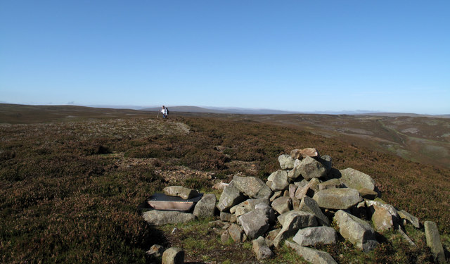 Area of the West Pennine Moors in North West England. At its summit is a Bronze Age burial mound. on the north-western slopes of the hill. It contained the cremated remains of three people and flint tools providing evidence of early human occupation.[14] A Bronze Age round cairn a short distance away dates from between 1600 and 1400 BCE.[15]
Wikimedia Commons
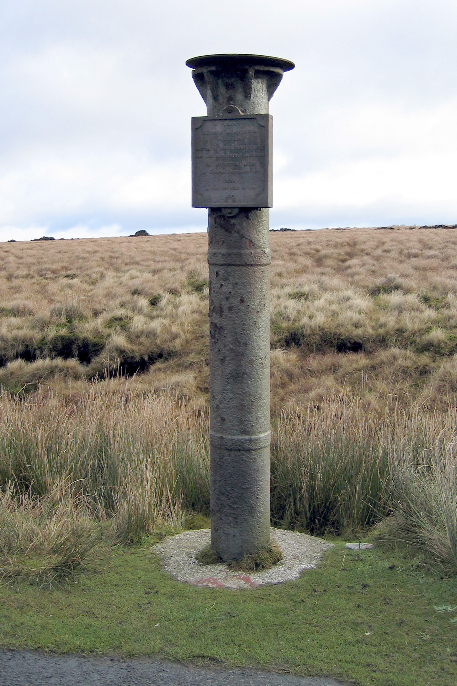
Scotsman’s Stump, an iron post not far from the summit, was erected in memory of a Scottish merchant, George Henderson, who was murdered whilst walking there in 1838.[16]
A mass trespass1896 protest organised when the landowner Colonel Ainsworth closed a track leading to Winter Hill, denying the right of access to the local population.1896 protest organised when the landowner Colonel Ainsworth closed a track leading to Winter Hill, denying the right of access to the local population. was organised in 1896 after landowner Colonel Ainsworth decided to close a track leading to Winter Hill, denying the right of access to the locals who had used it to walk in the fresh air and enjoy the countryside. When the small coal pits on the moors became exhausted, Ainsworth saw the potential for grouse shooting, and decided to close the moor to the public.[17] The Bolton Branch of the Social Democratic Federation (SDF) proposed a march on Sunday 6 September 1896, when a large group assembled and the police were present in force. The following Sunday at least ten thousand people assembled on Halliwell Road to march over Coalpit Road in a procession that stretched for about two miles (3 km). Ainsworth took the leaders to court and closed the access.[18] The “Right to Roam” was enacted in 2000 in the Countryside and Rights of Way Act, more than 100 years after the Winter Hill trespass .
The first television transmission mast at the I.T.V. transmitting station entered service in 1956. It was replaced by the current 1,015-foot (309.5 m) tower in 1966. The landmark mast is one of the tallest structures in the UK. Several other telecommunication masts providing signals for mobile phones and the emergency services have been erected near the hill summit.[19]
In February 1958, a Bristol Wayfarer aircraft of Silver City Airways flying from the Isle of Man to Manchester crashed near the I.T.V. transmitting station. In what became known as the Winter Hill air disaster, 37 people died and seven were injured.[20] A plaque commemorating the incident remains near the site.[21]
Ecology
Winter Hill is a part of the West Pennine Moors Sites of Special Scientific Interest (SSSI), an area of diverse semi-natural upland habitats centred on blanket bog with associated heathlands, flushes, woodlands and grasslands. The different habitats support breeding birds and some nationally rare and scarce plant species.[22]

