
Moorland site of Cheetham Close monument
Wikimedia Commons
Cheetham Close is a hill in the West Pennine Moors above Turton in Lancashire. The moorlandDominant landscape of Britain's uplands, including many of its national parks. contains several prehistoric monuments from the Early Bronze Age, including the stone circle and ring-bank cairn on a plateau below the summit of Cheetham Close.[1] The stone circle, a scheduled ancient monument, was in good condition in the 1870s, but at some time before 1893 a tenant farmer smashed some of the stones of the “Druidical” circle to discourage trespassers.[2]
Location
A stone circle, a ring cairn and two round cairns are located on a gentle north-east facing slope about 329 metres (1,079 ft) above sea level below the summit of Cheetham Close in the moorland above Turton in Lancashire. The West Pennine Moors contain several prehistoric monuments from the Early Bronze Age, but Cheetham Close contains the only stone circle. The stone circle and ring-bank cairn are scheduled ancient monuments on private land, although public access exists. Cheetham Close was probably named after the merchant and philanthropist Humphrey ChethamEnglish merchant responsible for the creation of Chetham's Hospital and Chetham's Library, the oldest public library in the English-speaking world. , who bought the Turton
Former manor house incorporating a pele tower, in Turton, Lancashire. manor in the 17th century.[1]
Archaeological surveys

Wikimedia Commons
The area was surveyed in 1850 by Sir Henry Dryden, who identified a circle of six stones with single outliers to the south-east and south-west. Greenhalgh subsequently discovered a seventh stone, and drew attention to the destruction of the site in the 1870s. In 1894 French excavated the newly discovered ring-bank cairn. A saddle quern was found in 1954, and three barbed and tanged arrowheads were discovered in the surrounding peat in 1959.[3]
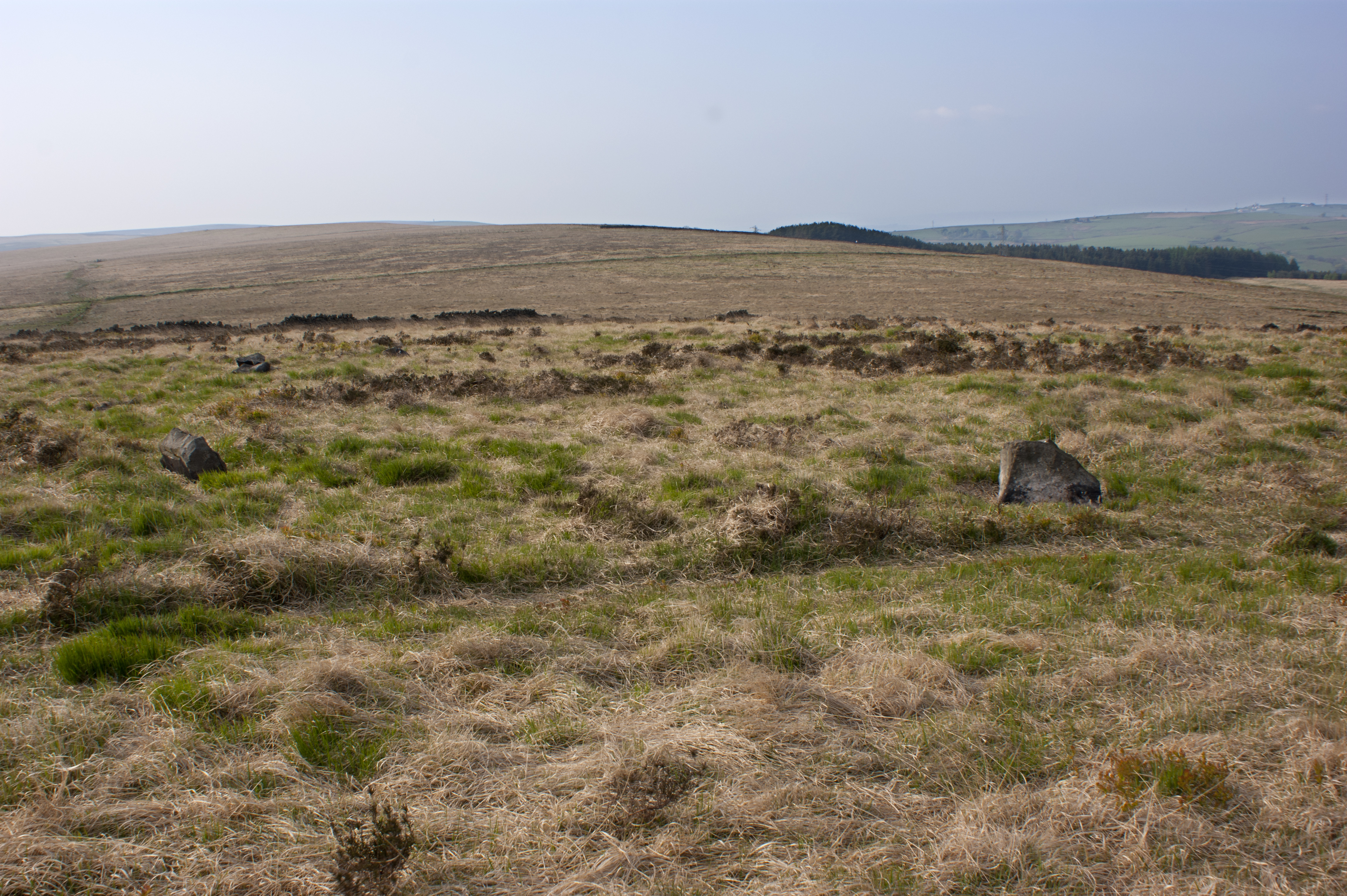
In 1983 a large-scale survey was undertaken by M. Fletcher of the Greater Manchester Archaeological Unit at the University of Manchester and the Bury Archaeological Group. The stone circle was in a severely damaged state, with only two of the seven megaliths still in situ; originally the site probably consisted of ten equally spaced gritstone slabs.[3]
Description
The stone circle is eliptical in plan measuring 18 metres (59 ft) at its widest by about 16 metres (52 ft). Seven of the original ten stones were in place in 1850, but damage after 1870 has displaced all but two that are definitely part of the circle; other smaller stones are scattered.[3]
The entire site is a scheduled ancient monument.[2] It possibly dates from the Early Bronze Age, between 2100 and 1500 BC.[4] Quern and arrowhead finds suggest the settlers were a pastoral community who supplemented their diet by hunting. A ring cairn lies to the south of the stone circle.[1]