Dovestone and its associated reservoirs occupy the valleys of the Greenfield and Chew Brooks above the village of Greenfield, on Saddleworth Moor in Greater Manchester in the South Pennines. The reservoirs, Yeoman Hey, Greenfield, Chew and Dovestone are on the western edge of the Peak District National Park. The reservoir scheme was started by the Ashton-Under-Lyne, Stalybridge and Dukinfield Waterworks Joint Committee who obtained an Act of Parliament to construct the first reservoir in 1870. Yeoman Hey was completed in 1880 and the scheme was finished with Dovestone in 1966. The reservoirs supply drinking water to the surrounding area and are a tourist attraction, providing several walks amongst picturesque landscapes.
Geography
Yeoman Hey and Greenfield Reservoirs lie in the valley of the Greenfield Brook, Dovestone is at the convergence of the Greenfield and Chew Brooks and Chew Reservoir is at the head of the Chew Valley on the north-west edge of the Peak District’s Dark Peak. Dovestone is the lowest and largest of three reservoirs in the Greenfield Valley.
The reservoirs are surrounded by moorlandDominant landscape of Britain's uplands, including many of its national parks. and, above the valley, high rocky outcrops. The catchment for the reservoirs is on moorland above impervious Millstone Grit that rises above 1000 feet (305 m). The Greenfield and Chew Brooks originate in deep ravines that widen out until the valley is about a mile wide (1.6 km) from summit to summit at their confluence.[1] The A635 road from Greenfield to Holmfirth passes to the west and north above the reservoirs.[2]
Background
John Platt of Oldham built a Neo-Gothic mansion at Ashway Gap on the south side of the valley in 1850 for use as a shooting lodge. After his brother James died after a shooting accident on the moor above the house, it was left empty.[3]
The 1870 Act of Parliament authorised the formation of the Ashton-Under-Lyne, Stalybridge and Dukinfield (District) Waterworks Joint Committee (ASDWJC) to provide a safe and ample water supply to the inhabitants of the area. The ASDWJC bought the house when it had plans to build a reservoir in the valley. Boundary stones demarcating the extent of the estate are located at intervals along the footpaths along the south side of the reservoir. During the First World War the waterworks board offered the house for use as a hospital. It was demolished in 1981.[3]
By 1939 demand had grown and underground water sources in the Swineshaw Valley were investigated. After the Second World War, demand had risen sharply and the joint committee investigate alternatives. Only a limited area of the catchment area was being used.[4]
Yeoman Hey
Yeoman Hey Reservoir Wikimedia Commons
The reservoir scheme in the Greenfield and Chew Valleys by the Ashton-Under-Lyne, Stalybridge and Dukinfield Waterworks Joint Committee commenced in 1870 when it obtained its Act of Parliament to build in the Greenfield Valley.[5] Yeoman Hey was completed in 1880. The dam was engineered by George Henry Hill,[6] and has a masonry cascade spillway.[7] The 1894 Ordnance Survey map shows a tramway along Yeoman Hay Reservoir and along Greenfield Brook.[8]
Greenfield
Greenfield Reservoir Wikimedia Commons
Greenfield Reservoir, further up the valley and fed by the Greenfield Brook was also engineered by Hill. It was completed in 1902.[6] The narrow-gauge tramway, built to move materials to build the dam ran along the reservoir’s western side, continued to the confluence of Holme and Birchen Cloughs where a tunnel was driven through the hillside.
To appease millowners further down the valley who were concerned about losing their water supply, water for the mills passes through a 1260-yard (1,152 m) tunnel on the east side of the reservoir and does not enter the reservoirs.[6]
Chew
Chew Reservoir Wikimedia Commons
Chew Reservoir is at the edge of a boggy plateau above the ravine made by the Chew Brook some distance from the earlier reservoirs. It was engineered by G. H. Hill and Sons and the contractors were Morrison and Mason of Glasgow. It was started in 1907 and completed in 1914. Because of the terrain, men and materials were moved using a three-foot gauge tram road built from Mossley to the entrance to the Chew Brook ravine. A cable- hauled incline then rose for 50 feet (15 m), and another level tramroad accessed the work site. A system of weirs, conduits and pipelines delivered its water into Yeoman Hey and a tunnel under the moorland delivered water to Ashton’s other reservoirs in the Swineshaw Valley.[6] When completed Chew, at 1600 feet (488 m) above sea level, was the highest reservoir in the British Isles.[2]
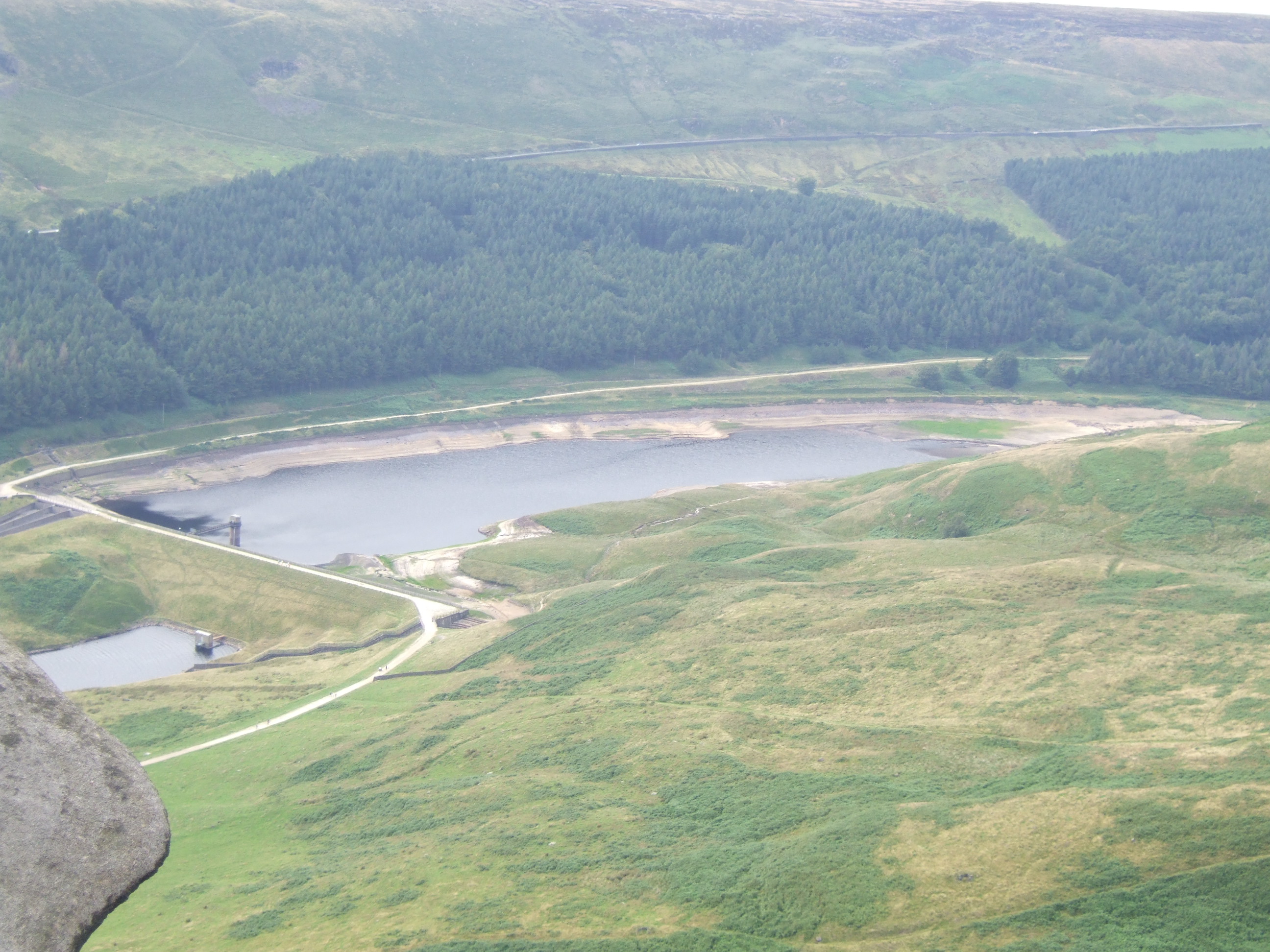
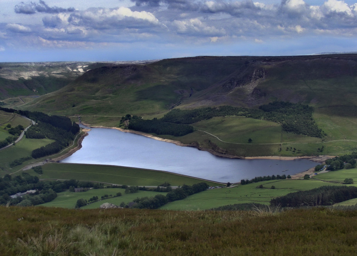
Dovestone
Dovestone Reservoir Wikimedia Commons
By 1939 demand for water had grown and the company investigated underground water sources in the Swineshaw Valley. After the Second World War, demand had risen sharply and the joint committee investigated alternatives. Only a limited area of the catchment was being used.[4] The catchment for the reservoirs is on moorland above Millstone Grit rising above 1000 feet (305 m). Surveys and trial boreholes determined whether an embankment could be made at the confluence of the Greenfield and Chew Brooks.[1]
When the Dovestone Reservoir scheme was announced it attracted considerable opposition from ramblers, rock climbers and others who had used the area for recreation as well as from Greenfield Paper Mill, which would be close to the proposed embankment. The paper mill was dependent on clean water from the two brooks via leets and pipes. Legal measures were taken to prevent its construction. An Act of Parliament was obtained in 1958 and measures had to be taken to ensure the paper mill’s water supply.[1] As the new reservoir was within the Peak District National Park, a landscape architect was appointed to preserve the area’s natural beauty.[9]
Completed in 1966, Dovestone was the last large earth embankment dam with a puddle clay core to be constructed in Britain. It was engineered by G. H. Hill and Sons and the contractor was A. E. Farr.[7] Dovestone’s 125-foot (38 m) high embankment is similar to the existing embankments in the valley. Its cut off trench varies from 50 to 100 feet in depth and is 6 feet wide and filled with concrete. The core of the embankment is puddle clay faced on each side with different materials.[1][7] The embankment is 1840 yards (1,683 m) long, 125 feet (38 m) high and is made of 1.2 million cubic yards of built up material. It impounds 1,100 million gallons of water and has a drop-shaft overflown with a tunnel under valley side which is unusual for Pennine reservoirs.[7] On the dam wall near the drop shaft is an ingeniously designed emergency overflow consisting of three metal troughs that, when full, tip water over a wall, from where it runs across the road and into the river below. It is activated if a flash flood of approximately two metres (7 ft) of water occurs.
Recreation
Access to the reservoir is via the A635 road to a pay and display car park. There are toilets at Binn Green and at the main car park. The Peak District Park Ranger Service maintains an office next to the main car park and rangers patrol the reservoirs and park at weekends.
The reservoirs and surrounding moorland attract walkers and hikers. The circular footpath around Dovestone is well maintained, relatively flat and other paths lead to Chew Reservoir and along the Greenfield Valley past the Yeoman Hey and Greenfield Reservoirs. Dovestone Sailing Club uses the reservoir. The Chew Valley is a gritstone climbing area visited by climbers and boulderers.
The RSPB manages almost 10,000 acres (40 km2) of the surrounding moorland and woodland in association with United Utilities. Much of the area is a Site of Special Scientific Interest and Special Area of Conservation, including internationally important blanket bog.[10]
We use cookies to optimise our website and our service. By clicking on “All cookies”, you consent to us using all cookies and plug-ins as described in our Cookie policy.
Functional cookies
Always active
The technical storage or access is strictly necessary for the legitimate purpose of enabling the use of a specific service explicitly requested by the subscriber or user, or for the sole purpose of carrying out the transmission of a communication over an electronic communications network.
Preferences
The technical storage or access is necessary for the legitimate purpose of storing preferences that are not requested by the subscriber or user.
Statistics
The technical storage or access that is used exclusively for statistical purposes.The technical storage or access that is used exclusively for anonymous statistical purposes. Without a subpoena, voluntary compliance on the part of your Internet Service Provider, or additional records from a third party, information stored or retrieved for this purpose alone cannot usually be used to identify you.
Marketing
The technical storage or access is required to create user profiles to send advertising, or to track the user on a website or across several websites for similar marketing purposes.