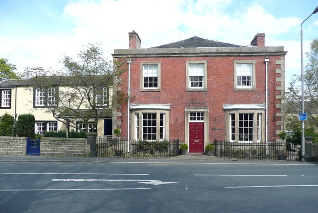

Cottages and Manor House in West Bretton
Wikimedia Commons
West Bretton is a village and civil parishSmallest administrative unit in England.Smallest administrative unit in England. in the Wakefield District of West Yorkshire on the A637 road, the former Barnsley to Grange MoorA tract of moorland more than 700 feet above sea level gave its name to this Yorkshire village. turnpike. The civil parishSmallest administrative unit in England.Smallest administrative unit in England. occupies hilly land from 122 to 152 metres (400–500 ft) above sea level. The River Dearne flows through the landscaped valley in Bretton Park, where it is dammed to form two lakes.
Until 1947 the village was dominated by the estate. Bretton Hall College opened in 1949, and student accommodation was built in the grounds. The Yorkshire Sculpture Park was established in 1977 in the college grounds.
Geography
West Bretton is a rural village on the former Barnsley to Grange Moor turnpike, the A637. Seven miles (11 km) from Wakefield, eight miles (13 km) from Barnsley and eleven miles (18 km) from Huddersfield, it is close to junction 38 of the M1 motorway. The village is at the centre of the former Bretton HallCountry house on the north slope of the valley of the River Dearne in West Bretton near Wakefield, West Yorkshire, England. Country house on the north slope of the valley of the River Dearne in West Bretton near Wakefield, West Yorkshire, England. estate, with its hall, home farm, estate office and workers cottages.[1] West Bretton occupies hilly land from 400 to 500 feet above sea level, near the watershed of the Rivers Calder and Dearne; the demesne of Bretton Hall covers 760 acres (308 ha).[2] The parkland has been the home of the 224-acre (91 ha) Yorkshire Sculpture Park since 1977[3] and the adjoining 100-acre (40 ha) Bretton Country Park has been a designated Local Nature Reserve since 1994.[4]
The underlying geology is that of the Carboniferous period and comprises 18 coal seams of the Middle Coal Measures and the Tankersley ironstone bedNamed from its outcrop at Tankersley near Barnsley in South Yorkshire. . Millstone grit outcrops were quarried for building stone and for constructing dry-stone boundary walls.[5]
History
The Bretton name is derived from the Old English Brettas, the Britons, and tūn meaning an enclosure, farmstead, village or estate. The farmstead of the Britons was recorded as “Bretone” in the Domesday Book of 1086 and West Bretton in 1200.[6]
Wikimedia Commons
After the Norman Conquest this part of Yorkshire was laid waste in the Harrying of the North.[7] William the Conqueror granted most of West Bretton to the de Lacys, lords of the Honour of Pontefract, and a small part was in the Manor of Wakefield.[8] After the devastation, the settlement grew slowly but more land was eventually put into cultivation to sustain a growing population.
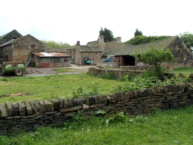
A water-powered corn mill was recorded in 13th century, and by 1379 the population of approximately 70 people included a smith. The three-field system operated in the village in medieval times.[9] Its fields were enclosed by 1759. Home Farm was built by 1800. Other farms were Town Farm and Manor Farm. Evidence of brewing is the old malt kiln at the farm of the same name.[10] Christopher Saxton’s Yorkshire map of 1577 records the old hall which was built on a different site to the present hall, but its exact location is unknown.[1]
Families
One family adopted the surname “de Bretton”.[11] The de Bretton, Dronfield and Wentworth families became pre-eminent and Sir Willian Dronfield held the manor at the time of his death in 1406.[12] Swein de Bretton granted the monks of Byland Abbey the right to pasture 200 cattle and sheep on land north of the village.[13]
Richard Wentworth inherited the manor and hall in 1477.[14] His great grandson, Sir Thomas Wentworth, Knight Marshall to Henry VIII, was keeper of Sandal CastleRuined medieval castle in Sandal Magna, Wakefield in West Yorkshire, England. One of two castles built overlooking the River Calder, it was built by the Warrennes, the Earls of Surrey who were Lords of the Manor of Wakefield.. Thomas Wentworth who fought with the Royalists in the English Civil War was captured at the Battle of Naseby (1645). His estates were confiscated, but were returned and he was knighted in 1660 when the monarchy was restored.[15]

The current Bretton HallCountry house on the north slope of the valley of the River Dearne in West Bretton near Wakefield, West Yorkshire, England. Country house on the north slope of the valley of the River Dearne in West Bretton near Wakefield, West Yorkshire, England. was built by Sir William Wentworth who inherited the estate in 1706. He was a Captain of Horse in the Jacobite rising of 1745. He was buried in the park chapel.[16] His son, Sir Thomas Wentworth (1735–1792) who married the heiress, Diana Blackett, transformed the parkland to what it is today. Their son, another Thomas, changed his name to Blackett when he inherited the Blackett family fortune. He never married but he fathered several children. His eldest illegitimate daughter DianaEldest illegitimate daughter of Sir Thomas Wentworth of Bretton Hall near Wakefield in Yorkshire. , wife of Lt Colonel Thomas Beaumont MP for Northumberland, inherited the estate.[16]
The Beaumonts spent a considerable amount of money on the hall.[17] Their son Thomas Wentworth Beaumont was Liberal MP for seats in Stafford and Northumberland and supporter of the Reform Act 1832.[18] His son Wentworth Blackett Beaumont, who spent more time in the North East where he owned more than 14,000 acres (5,666 ha) of land as well as the Bretton estate, was ennobled as Baron Allendale of Allendale. His son Wentworth Canning Blackett Beaumont was MP for Hexham and a lord-in-waiting to George V.[17] Wentworth Henry Canning Beaumont made Bretton his home.[19] During the Second World War the hall was used by the military, but the cost of maintenance led to its purchase by the West Riding County Council for use as a teacher training college in 1947, followed by the estate land ten years later.[20] The National Union of Mineworkers had wanted to turn the hall into a convalescent home.[21]
Industry
Matthew Wentworth bought “all the myne, and delff of ironstone” around Bentley GrangeShaft mounds and earthworks south of Bentley Grange Farm are the remains of a medieval iron mining site between Emley and West Bretton in West Yorkshire. , the Byland Abbey property after the Dissolution of the Monasteries. Though the ironstone was exhausted by the mid-1600s, smithies continued to operate fuelled by charcoal. The furnace at Bretton supplied pig iron to Colnebridge, Wortley Top Forge and Kirkstall in 1728.[22] The furnace at Bretton was taken over by the Cockshutts of Wortley and pig iron was produced there in 1806,[23] but the site had closed by 1820.[24] Small scale attempts were made to exploit shallow seams of coal that outcropped in Bretton. A pit was operated by Thomas Wood in 1806, Bretton Colliery, managed by Tweedale and Watson, paid rent to the estate in 1820s and bell pits, the Gate Royd Pits, (near the motorway service area) were worked in 1849. The Jagger Brothers, who owned Emley Moor CollieryEmley Moor Colliery refers to several sinkings and drift mines over a large area of Emley, towards the television mast, between Flockton to the north and particularly towards Skelmanthorpe to the south, opened shafts on Malt Kiln Farm between 1856 and 1871.[24]
Between the 17th and 19th centuries millstone grit was quarried where it outcropped for use as building stone for farmhouses and boundary walls. A brickworks produced rustic red bricks from fireclay outcrops near Bower Hill Lane.[25] From 1723 until 1737 William Harrison, who had moved from Burslem, made pots in the village.[26]
Governance
Historically in the West Riding of Yorkshire, the chapelryChurch subordinate to a parish church serving an area known as a chapelry, for the convenience of those parishioners who would find it difficult to attend services at the parish church. of West Bretton was divided between the ancient parishesAncient or ancient ecclesiastical parishes encompassed groups of villages and hamlets and their adjacent lands, over which a clergyman had jurisdiction. of Sandal Magna in the wapentakeAnglo-Saxon administrative unit. of Agbrigg and Morley and Silkstone in the wapentake of Staincross. It became part of the Wakefield Poor Law Union in 1837.[27] West Bretton became part of Wakefield Rural District in 1894, and in 1974 became part of the City of Wakefield Metropolitan District.
Demographics
Census data: West Bretton
As at the 2011 Census, the parishSmallest administrative unit in England. of West Bretton has a population of 459, with a median age of 52 years. The area occupies 846.39 hectares (2,091.47 acres), giving a population density of 0.5 persons per hectare.[28]
Education
Some time after he inherited the estate in 1763 Sir Thomas Wentworth (who changed his name to Blackett) built a school, paying a schoolmaster £20 per year. It became a national schoolSchools set up by Anglican clergy and their local supporters, initially run by single teachers using the monitorial system. and was also used as a Sunday School. In 1865–1866 it had 65 pupils, and when education was made compulsory to the age of 13 in 1881, 100 pupils were on role.[29] West Bretton J & I School still occupies the original Grade II listed school house.[30]
Bretton Hall was sold to the West Riding County Council in 1947. Bretton Hall College opened in 1949 as a teacher training and specialist arts college of higher education. Among its more well-known alumni are the writers and actors of the The League of Gentlemen, writers Colin Welland, Kay Mellor and John Godber and educationalist, Sir Ken Robinson. Godber wrote a play about life as a drama student at the college, It Started With a Kiss. The college awarded University of Leeds degrees and was subsequently affiliated to that university, but closed in 2007.[31]
Religion

Wikimedia Commons
West Bretton was divided between the parishes of Sandal Magna and Silkstone and a chapel of easeChurch subordinate to a parish church serving an area known as a chapelry, for the convenience of those parishioners who would find it difficult to attend services at the parish church. was built by the Dronfields in 1358.[32]] St Bartholemew’s ChapelFormer estate chapel in the grounds of Bretton Hall, West Yorkshire. was mentioned in a will of 1406.[12] In 1744 the old chapel was replaced on a different site by the present park chapel which contained the Wentworth’s family pew.[11] It was given to the Diocese of Wakefield in 1959.[33]
Methodism arrived in the village in 1811. A cottage, rented from the estate, was registered as a place of worship for Protestant Dissenters, Primitive Methodists in 1861.[34] Methodists and Anglicans created a Local Ecumenical Partnership, the Church in West Bretton, in 1982. Since 1995 it has used the mid-19th century Methodist premises, which have been enlarged and modernised.[35]