

Former Tannery on Whitley Road
Wikimedia Commons
Whitley Lower is a village near ThornhillFormer township now a suburb of Dewsbury in Kirkless, West Yorkshire. in Kirklees, West Yorkshire.
The village occupies high undulating ground one mile (1.6 km) south of the River Calder and the same distance north of Grange MoorA tract of moorland more than 700 feet above sea level gave its name to this Yorkshire village. . The land falls more sharply south of the village into the valley made by the Howroyd Beck. It is in a sparsely populated rural area linked to Dewsbury and Huddersfield by a network of minor roads and lanes.[1] Whitley Reservoir, at the junction of Whitley Road and Scopesley Lane, was built by the Dewsbury and Heckmondwike Water Works in the 19th century.
The underlying geology is formed from the Lower and Middle Pennine Coal Measures. Old mine shafts, small disused quarries and the chimney of the former tannery on Whitley Road are relics of the village’s industrial past.[1]
Wikimedia Commons
Whitley Lower was a township and chapelryChurch subordinate to a parish church serving an area known as a chapelry, for the convenience of those parishioners who would find it difficult to attend services at the parish church. in the ancient parishAncient or ancient ecclesiastical parishes encompassed groups of villages and hamlets and their adjacent lands, over which a clergyman had jurisdiction. of Thornhill in the West Riding of Yorkshire.[2] The township contained the hamlets of Briestwhistle (Briestfield) and Falhouse.[3] In the mid-19th century the village had two scribbling mills, a quarry, a tannery and a colliery (at Falhouse).[4] In 1905 Howroyd CollieryName for a number of day holes and drifts that worked the coal at the outcrop. was started by the Jagger Brothers, it lasted until 1962.[5]
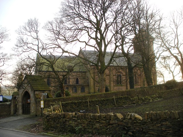
St Mary and St Michael’s Church was built at the expense of Thomas Wheatley on a site on Howroyd Lane given by the Earl of Dartmouth.[4] It was consecrated in 1846.[6] Now a Grade II listed building, it is in the Norman style.[7] A Wesleyan Methodist Chapel was built on Scopesley Lane in 1826.[6]