
Whitley Upper
Reproduced with the permission of the National Library of Scotland
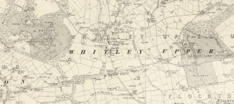
The townshipDivision of an ecclesiastical parish that had civil functions. of Whitley Upper in the ancient parishAncient or ancient ecclesiastical parishes encompassed groups of villages and hamlets and their adjacent lands, over which a clergyman had jurisdiction. of Kirkheaton, in the West Riding of Yorkshire covered 1955 acres (791 ha) of fertile hilly land and the hamlets of Whitley Upper and Denby Grange. The Beaumonts of Whitley Hall, descendants of a Knight Hospitaller of St John of Jerusalem, were granted the manor in the reign of Henry III. Also in the township was Denby GrangeEstate and mansion in Whitley Upper, between Huddersfield and Wakefield, in the West Riding of Yorkshire, seat of the lister Kaye baronets., seat of the Lister Kayes who owned Caphouse CollieryEx-colliery in Overton, near Wakefield, West Yorkshire, now the National Coal Mining Museum for England..[1] The village of Grange MoorA tract of moorland more than 700 feet above sea level gave its name to this Yorkshire village. midway between the Whitley Beaumont and Denby Grange estates developed during the Industrial Revolution when coal mining became important.[2][3]
Whitley Upper Urban District was established in 1894 and abolished on 1 April 1938 to become part of Kirkburton Urban District.[4][5] It is now in the Kirkburton ward of the Kirklees Council in West Yorkshire.
At crossroads south of Grange Moor the east-west Huddersfield to Wakefield (A642) road intersects with the A637 to Barnsley heading south and the B6118 road to Cooper Bridge heading north. The underlying geology is the coal measures of the South Yorkshire Coalfield.