

Basingstoke and Dearne shown within Hampshire
Wikimedia Commons
Wikimedia Commons
The local district authority of Basingstoke and Dearne is one of the eleven district councils and two unitary authorities that make up the ceremonial county of Hampshire.[1]
The borough contains thirty-one of the Grade I listed buildings in Hampshire. Grade I structures are those considered to be “buildings of exceptional interest”.[2]
| Name | Location | Architect | Completed | Entry number | Image |
|---|---|---|---|---|---|
| Barn approximately 40 metres south-west of Manor Farmhouse | Old Burghclere | 1451–1453 | 1157463 | ||
| Berrydown Court House | Overton | Sir Edwin Lutyens | 1897–1898 | 1302517 | 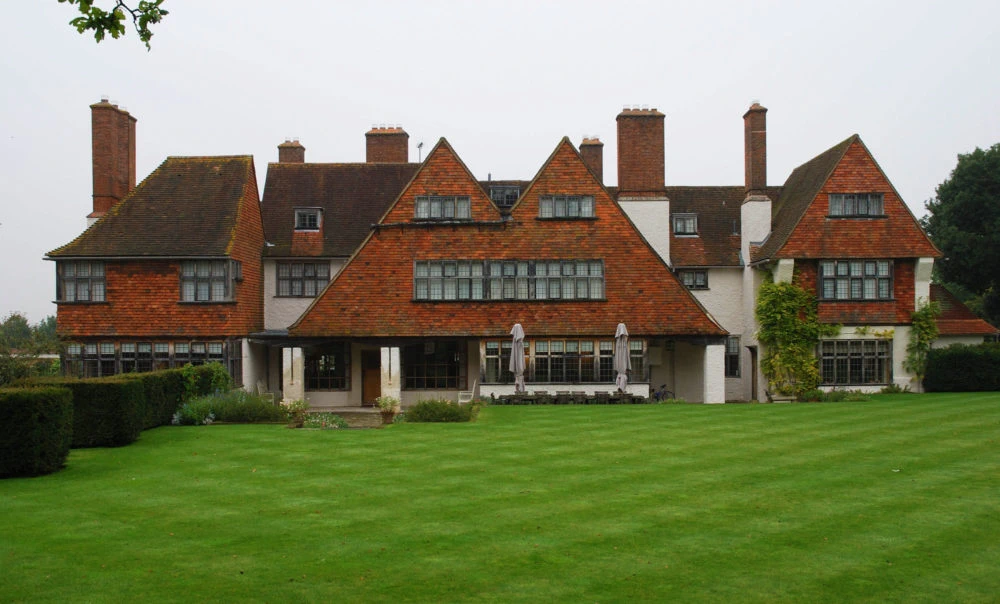 Institute of Classical Architecture & Art |
| Church of All Saints | Dummer | c. 1200 | 1093019 |  Wikimedia Commons | |
| Church of All Saints | Hannington | Saxon | 1339767 |  Wikimedia Commons | |
| Church of All Saints | Monk Sherborne | c. 1140 | 1339517 |  Wikimedia Commons | |
| Church of All Saints | Old Burghclere | c. 1100 | 1157301 |  Wikimedia Commons | |
| Church of St Andrew | Sherborne St John | c. 1150 | 1339594 |  Wikimedia Commons | |
| Church of St Catherine | Wolverton | Medieval | 1092569 |  Wikimedia Commons | |
| Church of St James | Ashmansworth | 12th century | 1092445 |  Wikimedia Commons | |
| Church of St Mary | Old Basing and Lychpit | Norman | 1339555 |  Wikimedia Commons | |
| Church of St Mary | Silchester | 12th century | 1339600 |  Wikimedia Commons | |
| Church of St Mary | Tufton | Saxon | 1175684 |  Wikimedia Commons | |
| Church of St Mary | Upton Grey | 12th century | 1296652 |  Wikimedia Commons | |
| Church of St Mary the Blessed Virgin | Hartley Wespall | 14th century | 1339496 |  Wikimedia Commons | |
| Church of St Mary the Virgin | Stratfield Saye | Possibly John Pitt | 1758 | 1167723 |  Wikimedia Commons |
| Churh of St Michael | Basingstoke | 14th century | 1092618 |  Wikimedia Commons | |
| Church of St Nicholas | Basingstoke | Late medieval | 1092725 |  Wikimedia Commons | |
| Church of St Peter | St Mary Bourne | Norman | 1092390 |  Wikimedia Commons | |
| Church of St Peter | Tadley | Mainly 17th and 18th century | 1092438 |  Wikimedia Commons | |
| Church of St Swithin | Nately Scures, Newnham | 12th century | 1092926 |  Wikimedia Commons | |
| Entrance Lodge to Berrydown Court | Overton | 1302479 | 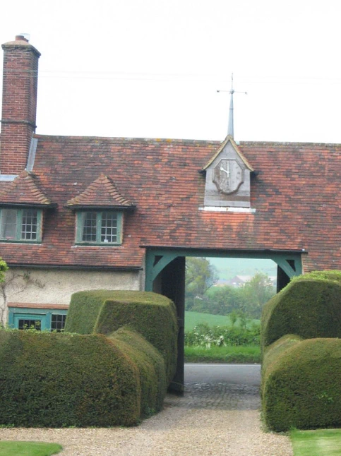 Flickr | ||
| Highclere Castle | Highclere | 1839–1842 | 1092528 |  Wikimedia Commons | |
| Jackdaws Castle | Highclere | Possibly Lord Pembroke | c. 1740 | 1092530 |  Wikimedia Commons |
| Milford Lake House | Highclere | Probably Lord Pembroke | Early 18th, mid 19th century | 1092532 |  Racing Post |
| Pamber Priory Church of the Holy Trinity, Our Lady, and St John the Baptist | Monk Sherborne | 12th and 13th century | 1092954 |  Wikimedia Commons | |
| Priory Farmhouse | Mapledurwell and Up Nately | 12th, 17th and 19th centuries | 1339548 |  Historic England | |
| Sandham Memorial Chapel | Burghclere | Lionel Pearson, of Adams, Holden, and Pearson | 1926 | 1339741 |  Wikimedia Commons |
| Stratfield Saye House | Stratfield Saye | c. 1640 | 1092773 |  Wikimedia Commons | |
| The Vyne | Sherborne St. John | 1500–1520 | 1296972 |  Wikimedia Commons | |
| Tithe Barn | Old Basing and Lychpit | c. 16th century | 1166768 |  Wikimedia Commons | |
| Walls to Kitchen Garden, Forecourt, and Roadside Boundary, With Garden Store Buildings, Berrydown Court | Overton | Sir Edwin Lutyens | 1897–1898 | 1092705 |  Wikimedia Commons |
See also
- Grade I listed buildings in Hampshire
 Grade I listed buildings in the ceremonial county of Hampshire.
