

Test Valley shown within Hampshire
Wikimedia Commons
Wikimedia Commons
The local district authority of Test Valley is one of the eleven district councils and two unitary authorities that make up the ceremonial county of Hampshire.[1]
The borough contains twenty-one of the Grade I listed buildings in Hampshire. Grade I structures are those considered to be “buildings of exceptional interest”.[2]
| Name | Location | Architect | Completed | Entry number | Image |
|---|---|---|---|---|---|
| Abbey Church of St Mary and St Ethelflaeda | Romsey | Mainly 12th century | 1092649 |  Wikimedia Commons | |
| Barn 40 Metres East of Berry Court Farmhouse | Nether Wallop | 15th century | 1339452 |  Wikimedia Commons | |
| Broadlands House | Romsey | 1768–1771 by Capability Brown, and 1788 by Henry Holland | 18th century | 1166489 |  Wikimedia Commons |
| Church of St Andrew | Mottisfont | 12th century | 1172913 |  Wikimedia Commons | |
| Church of St Andrew | Nether Wallop | 11th century | 1339423 |  Wikimedia Commons | |
| Church of St Leonard | Grateley | Norman | 1093259 |  Wikimedia Commons | |
| Church of St Margaret | Wellow | Early 13th century | 1339214 |  Wikimedia Commons | |
| Church of St Mary the Less | Chilbolton | Norman | 1339283 |  Wikimedia Commons | |
| Church of St Mary the Virgin | Abbotts Ann | 1716 | 1228703 |  Wikimedia Commons | |
| Church of St Michael and All Angels | Knights Enham | Norman | 1093461 |  Wikimedia Commons | |
| Church of St Nicholas | Middleton | c. 1200 | 1339297 |  Wikimedia Commons | |
| Church of St Peter | Goodworth Clatford | Norman | 1339285 |  Wikimedia Commons | |
| Church of St Peter | Hurstbourne Tarrant | Late 12th century | 1093367 |  Wikimedia Commons | |
| Church of St Peter and St Paul | Kimpton | 13th century | 1093222 |  Wikimedia Commons | |
| Church of St Peter and St Paul | Thruxton | 13th century | 1093204 |  Wikimedia Commons | |
| Grove Place House Northcliffe School | Nursling and Rownhams | Mid-16th century |  Wikimedia Commons | ||
| King John’s House | Romsey | Medieval | 1231745 |  Wikimedia Commons | |
| Marsh Court | King’s Somborne | 1901–1905 | 1093803 | 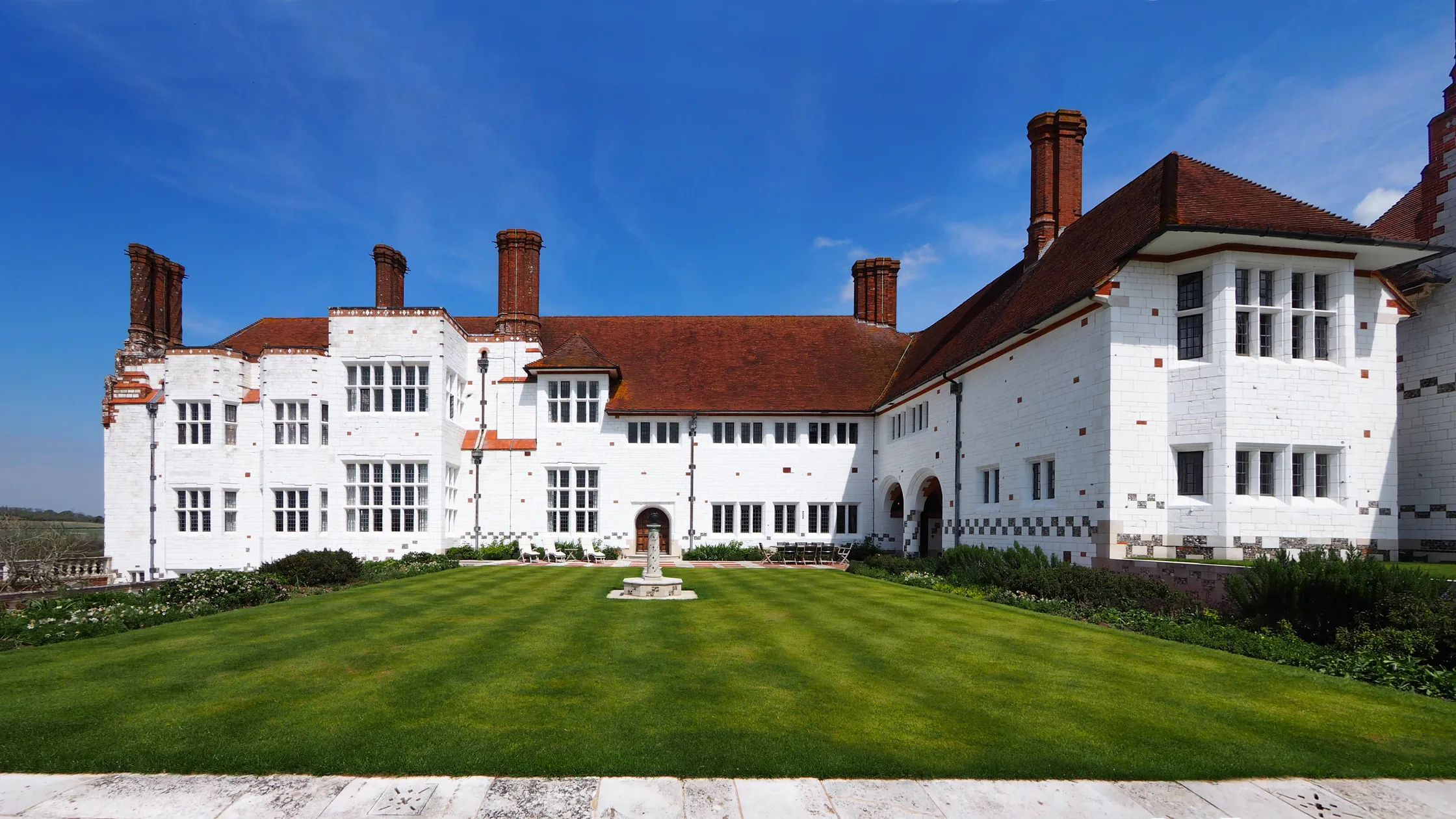 Architectural Digest | |
| Middle Bridge | Romsey | 1788 | 1339680 |  Wikimedia Commons | |
| Mottisfont Abbey House | Mottisfont | 16th century | 1093730 |  Wikimedia Commons | |
| Stable Block (30 Yards South of Wherwell Priory) | Wherwell | Second quarter of 13th century | 1093391 |
See also
- Grade I listed buildings in Hampshire
 Grade I listed buildings in the ceremonial county of Hampshire.
