Wikimedia Commons
The River Kennall in south-west Cornwall is about eighteen kilometres (11 mi) long. During the 19th century its waters powered significant industrial complexes in Kennall Vale, where the remains of a gunpowder works line its banks, and at the Perran FoundryCornish foundry established in 1791 to supply steam-engine pumps and heavy machinery to mines, waterworks and ironworks. at Perran Wharf.
The river rises near Carnmenellis and flows through part of the Cornwall and West Devon Mining Landscape a World Heritage Site to enter Restronguet Creek and the Fal Estuary.
Geography
The River Kennall is about eighteen kilometres (11 mi) long, with a catchment area of 32 square kilometres (12 mi2). The southern branch of its headwaters rises near Carnmenellis and flows into Stithians Reservoir, and the northern branch rises near Four Lanes village. They join south of Stithians village and continue into the deep, wooded Kennall Vale.[1] The river then flows past the village of Ponsanooth and under the Falmouth to Truro railway line, before passing alongside the A39 road and Perran Wharf in PerranarworthalMostly rural parish in West Cornwall.. The Kennall meets the Carnon RiverHeavily polluted river in West Cornwall, draining the historic mining area of Gwennap. at DevoranRural village in West Cornwall. and becomes the Restronguet Creek. After Restronguet Point it joins the River Fal to form Carrick Roads. [2]
Industry
George Croker Fox, a Falmouth businessman, leased wasteland on the south side of the Kennall opposite Perranarworthal from Lord Mount Edgcumbe in 1789. This began industrial development in the Kennall Valley by the Fox family, whose industrial empire was important in the early 19th century. The Perran Foundry Company was founded on the south bank of the river in 1791 by his sons George Croker Fox II (1752–1807) and Robert Were Fox I (1754–1818).[3]
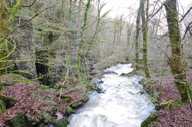
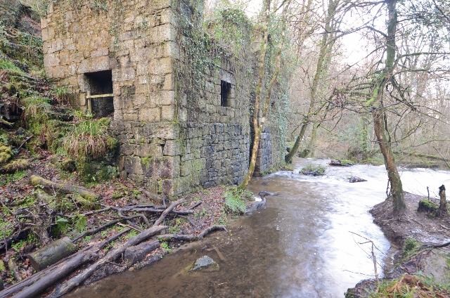
Members of the Fox family also founded the Kennall Vale Gunpowder Company in 1811 in Kennall Vale, upstream of Ponsanooth. The valley became heavily industrialised; water from the river was diverted into a system of leats to power water wheels at the gunpowder works, along with corn and paper mills and a tape mill in Ponsanooth. The Kennall also powered machinery at the Perran Foundry.
Post-industrial
Wikimedia Commons
Kennall Vale is part of the Cornwall and West Devon Mining Landscape a World Heritage Site.[4] The remains of the gunpowder works are a scheduled monument.[5]
Kennall Vale is now a nature reserve managed by the Cornwall Wildlife Trust. The ruins of several buildings and leats connected with the gunpowder works are accessible by following footpaths along the river.[6] The reserve supports many varieties of birds and three species of bats in the deciduous woodland and along the moss and lichen lined water courses, in which brown trout, sticklebacks and European eels have been recorded.[7]