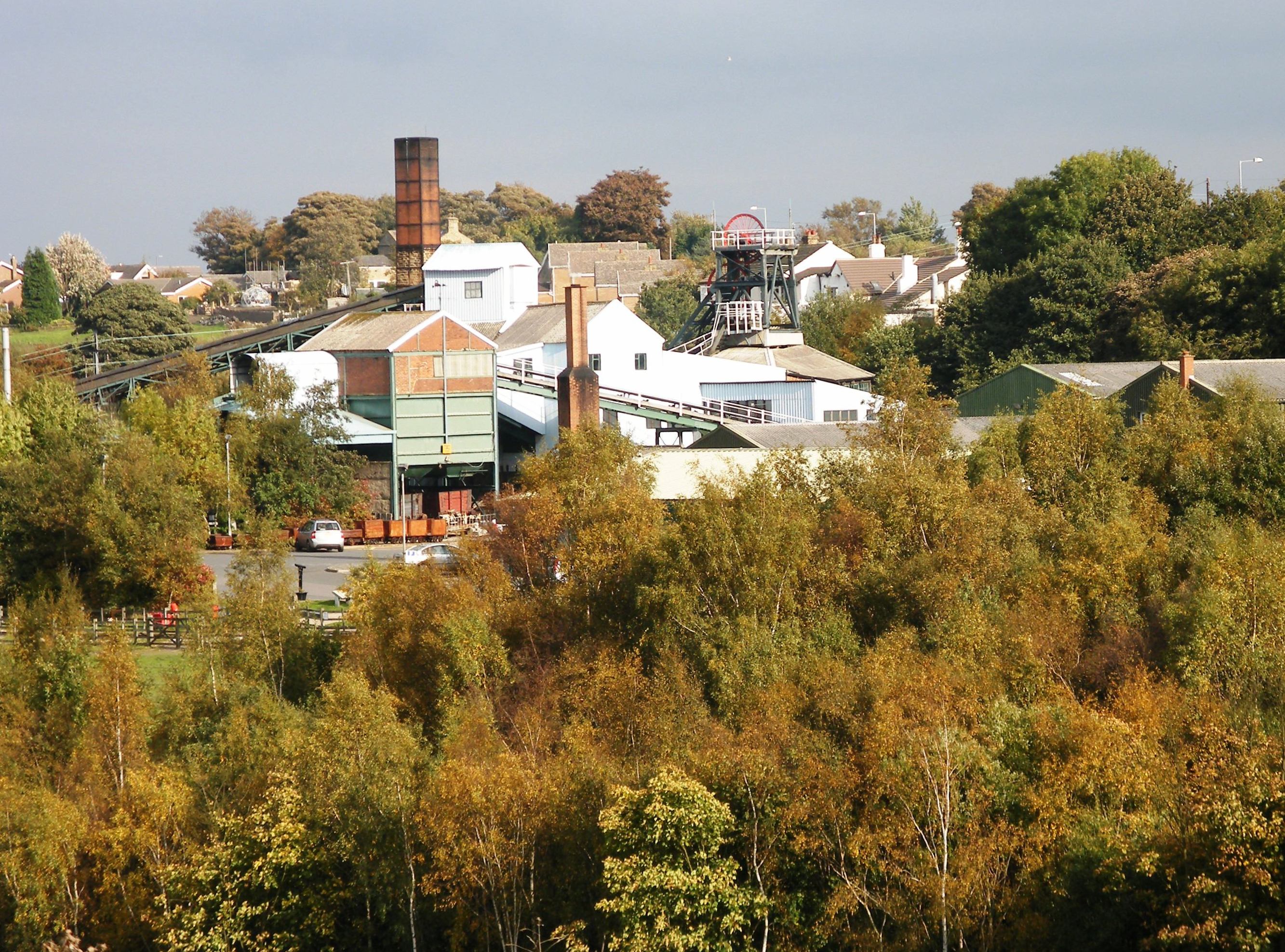

National Mining Museum at Caphouse Colliery in Overton
Wikimedia Commons
Sitlington, historically Shitlington, was a townshipDivision of an ecclesiastical parish that had civil functions. in the ancient ecclesiastical parishAncient or ancient ecclesiastical parishes encompassed groups of villages and hamlets and their adjacent lands, over which a clergyman had jurisdiction. of ThornhillFormer township now a suburb of Dewsbury in Kirkless, West Yorkshire. in the wapentakeAnglo-Saxon administrative unit.Anglo-Saxon administrative unit. of Agbrigg and Morley in the West Riding of Yorkshire, comprising the villages and hamletsRural settlement smaller than a village. of Middlestown, Netherton, Overton, Midgley and Coxley. It is about five miles (8 km) south-west of Wakefield on the A642 road towards Huddersfield on the south side of the River Calder, which is its north-eastern boundary with Horbury. Its north-western boundary, separating it from Thornhill, is the Smithy Brook.
Shitlington was renamed Sitlington in 1929, with the approval of the West Riding County Council. The population of the civil parishSmallest administrative unit in England. at the 2011 census was 5963. The National Coal Mining Museum for England in Overton is a reminder of the area’s mining history and heritage.
Geography and geology
Sitlington occupies 3412 acres (1,381 ha) of hilly land south the River Calder about five miles (8 km) west-south-west of Wakefield. Netherton and Midgley in the south-west of the township are separated from Overton and Middlestown in the north-east by the wooded valley of the Coxley Beck.[1] The A642 road between Wakefield and Huddersfield passes through Middlestown and the National Mining Museum at Caphouse CollieryEx-colliery in Overton, near Wakefield, West Yorkshire, now the National Coal Mining Museum for England.Ex-colliery in Overton, near Wakefield, West Yorkshire, now the National Coal Mining Museum for England. in Overton. It has a junction at Horbury Bridge with the B6117 which passes through Netherton and Midgley, where it meets the A637 between FlocktonRural village stretched out along the Barnsley to Huddersfield road in Kirklees, West Yorkshire, taking its name from a Viking settler. and West BrettonVillage and civil parish in the Wakefield District of West Yorkshire.. The River Calder flows in an easterly direction, and is its northern boundary with Horbury. The Calder was made navigable beyond Wakefield after an Act of Parliament authorised the Calder and Hebble Navigation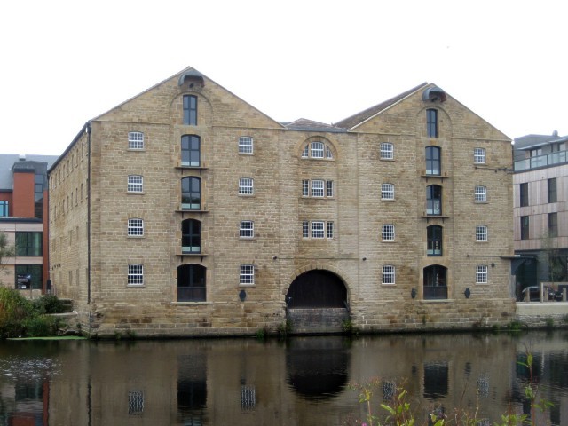
Constructed between 1758 and 1834, the navigation makes the River Calder navigable between Sowerby Bridge and Wakefield in the West Riding of Yorkshire. in 1758.
The geology of the area comprises the Coal Measures of the South Yorkshire Coalfield, sandstone, coal seams and Millstone Grit. In medieval times ironstone was mined from the Tankersley ironstoneNamed from its outcrop at Tankersley near Barnsley in South Yorkshire. seam that outcrops in Overton and Emroyd Common in Middlestown. Opencast mining took place in 1975, removing all evidence of the former industry.[2] A disused quarry in Coxley Woods is cut into the Thornhill Rock, sandstone laid down 300 million years ago in the Carboniferous Period.[3]
History
Shitlington has Anglo-Saxon origins. It possibly began as the settlement, tun, connected with scyttel, either a personal name or a bar or gate that bolts shut, or might mean a farm or settlement on a steep slope.[4] Schelingtone is recorded in the Domesday Book. Other spellings have included Shytlington, Sittlington, Schetlinton, and Scyllinton.[5]
Netherton was recorded as Schiteliton Inferior in the 13th century and subsequently Nether Shitlington meaning the lower town. Middlestown was Midelshitelington in the 14th century and a 15th-century document records it as Mydleston. Overton was recorded as Overshitlyngton in the 11th century. Midgley was Migelie in the 12th century and could mean either the large pasture or midge-infested clearing. Coxley, recorded as Cockesclo at the end of the 12th century, meant a dell where there were cocks. Hollinhurst possibly means the “holly wood”.[5]
Shitlington was part of the extensive Manor of Wakefield. At the Domesday survey in 1086 its six oxgangs
Old measurement of land. eight oxgangs equals one carucate or ploughland. One oxgang is the area that could be ploughed by a team of eight oxen in one year. of land were described as waste. Within the township were three manors, Netherton, New Hall and Overton which belonged to a family named Everingham. New Hall, originally a moated manor house, became the property of Sir Thomas Wortley and subsequently the Earls of Wharncliffe. Land changed hands frequently and the Armitages bought land in Middlestown and Overton in 1598.[6] New Hall, held by Sir Richard Touche in the late 13th century, is now the site of a farmhouse.[7] Netherton Hall, a gentleman’s residence built around 1775 for the Perkins family is now a Grade II* listed building.[8]
A water-powered woollen mill was built at Coxley in about 1787 and tenterframes for stretching the cloth were located near the mill dam; the mill burned down in 1926.[9]
The Wakefield to Huddersfield road along Sandy Lane was turnpiked in 1720. Tollhouses were built at Sandy Lane and Overton. The road had been rerouted by 1850 through the crossroads in Middlestown and past Caphouse Colliery in Overton.[10] An Act of Parliament authorised the Calder and Hebble Navigation in 1758 and it was completed from Wakefield to Sowerby Bridge by the early 1770s.[11] The Midland Railway built an eight-mile (12.9 km) line from Royston Junction to Thornhill through the township south of the Calder and Hebble Navigation. It was completed in 1905 and had two landmark viaducts at Horbury Bridge and Calder Grove.[12]

Wikimedia Commons
The Wesleyans had built a chapel at Smithy Brook in Middlestown by 1830, but Anglicans had to travel to Thornhill Parish Church for baptisms, marriages and funerals until 1870, when a mission church was built in Middlestown. It was replaced by St Luke’s Church in 1877.[13] St Luke’s fell into disrepair and was demolished in 1969 and a new church was dedicated in 1974. St Andrew’s Church in Netherton was built in 1881.[14] The Wesleyans replaced their chapel on a new site on Thornhill Road in 1876 and built Trinity Wesleyan Chapel in Netherton in 1886. Primitive Methodists built chapels at Overton in 1876, Cross Roads in Middlestown in 1886 and Blacker Lane in Netherton in 1890.[15] A United Methodist Church was built in Midgley in 1910.[16]
The first schools in the area were private schools but today’s primary schoools in Middlestown and Netherton were founded as national schoolsSchools set up by Anglican clergy and their local supporters, initially run by single teachers using the monitorial system. by supporters of the Anglican church.[17]
A prison without bars, New Hall Prison Camp opened in 1936. After its closure in 1959 it became a detention centre, and subsequently a women’s prison.[18]
Mining
In medieval times monks from Kirkstall, Rievaulx and Byland Abbeys and St John’s Priory in Pontefract obtained ironstone from Sitlington. The Tankersley ironstone bedNamed from its outcrop at Tankersley near Barnsley in South Yorkshire. lay between the Joan and Flockton coal seams that underlie the area. Ironstone was mined at Emroyd from 1798 and a blast furnace powered by a steam engine built there closed around 1821. When the ironstone was exhausted, Emroyd was exploited for its coal, which was transported to Horbury Bridge and the navigation.[2]
Coal had been mined in the Overton area since about 1515 where the Flockton seams outcropped. It was worked from bell pits and ladder pits on land leased by James Milnes, builder of the Flockton waggonwayFlockton Collieries comprised several pits, some started before 1700, around Flockton and Middlestown between Wakefield and Huddersfield in the West Riding of Yorkshire. in the early 1770s, who died in 1803.
Sir John Lister Kaye of Denby Grange who owned the land decided to work the coal himself in 1817 and sank shafts on the site that became known as Caphouse CollieryEx-colliery in Overton, near Wakefield, West Yorkshire, now the National Coal Mining Museum for England.Ex-colliery in Overton, near Wakefield, West Yorkshire, now the National Coal Mining Museum for England. in 1943.[19] His son built a railway line to connect his pits to the Calder and Hebble Navigation at Calder Grove in the 1850s. Emma Lister-KayeColliery owner in Overton near Wakefield in the West Riding of Yorkshire from 1871 until 1905. owned the colliery from 1871 until 1905.[20] The Victoria Colliery was sunk next to the mineral line at Little London in Netherton in 1854 and the Prince of Wales Colliery[a]later known as Denby Grange Colliery or more usually Wood Pit was sunk by the mineral railway in Stonycliffe Wood between Netherton and Midgley in 1865.[21]
Other small pits had been sunk near Blacker Lane in Netherton and close to the navigation. The largest was Hartley Bank CollieryFormer colliery in Netherton, West Yorkshire, opened in 1841 and closed in 1968. which survived until 1968.[22]
Caphouse Colliery was converted into a museum after itS closure, and as the National Coal Mining Museum for England provides a glimpse into centuries of coal mining in Sitlington and the English coalfields.
Governance
The communities making up the township of Sitlington, historically Shitlington, – Middlestown, Netherton, Overton and Midgley and Coxley – were in the ancient parishAncient or ancient ecclesiastical parishes encompassed groups of villages and hamlets and their adjacent lands, over which a clergyman had jurisdiction. of Thornhill in the wapentakeAnglo-Saxon administrative unit.Anglo-Saxon administrative unit. of Agbrigg and Morley in the West Riding of Yorkshire.[23] In 1863 Shitlington was in the Thornhill Local Board area, and in 1892 prominent residents were agitating for a Shitlington Local Board.[24] The 1894 Local Government Act placed Shitlington in Wakefield Rural District, in which it remained until 1974, when it became a ward of Wakefield Metropolitan District Council.[25]
The h was dropped from Shitlington and Sitlington was adopted in 1929, with the approval of the county council.[1]
Demographics
Census data: Sitlington
At the 2011 Census, the built-up area of Sitlington had a population of 5,963, with a median age of 43 years. The area occupies 1381.05 hectares (3,412.64 acres), giving a population density of 4.3 persons per hectare.[26]