
Combermere Colliery 1907[1]
Reproduced with the permission of the National Library of Scotland
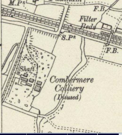
Combermere Colliery was sunk by the Tyldesley Coal CompanyCoal company was formed in 1870 in Tyldesley on the Manchester Coalfield, in the historic county of Lancashire, England. on the Lancashire CoalfieldThe Lancashire and Cheshire Coalfield in North West England was one of the most important British coalfields. Its coal seams were formed from the vegetation of tropical swampy forests in the Carboniferous period more than 300 million years ago. after 1867 in ShakerleySuburb of Tyldesley in Greater Manchester, anciently a hamlet in the northwest of the township., TyldesleyFormer industrial town in the Metropolitan Borough of Wigan, in Greater Manchester. in Lancashire, England.
The colliery exploited the Middle Coal Measures of the Manchester CoalfieldPart of the Lancashire Coalfield. Some easily accessible seams were worked on a small scale from the Middle Ages, and extensively from the beginning of the Industrial Revolution until the last quarter of the 20th century., laid down in the Carboniferous period, and where coal was mined from more than a dozen seams between the Crumbouke and Arley mines.[a]In this part of Lancashire a coal seam is referred to as a mine and the coal mine as a colliery or pit. The seams generally dip towards the south and west and are affected by small faults. The Upper Coal Measures are not worked in this part of the coalfield.[2]
The Tyldesley Coal Company sank two shafts just north of the Coxe or Wharton Hall Fault, which had a downthrow of some 225 feet (69 m) to the north, and where the seams dipped at approximately 1 in 4.5 southwards.[3] The shafts intersected the Rams mine at 315 feet (96 m) and the Black and White mine at 600 feet (183 m).[4] Coal was worked to the rise northwards from the shafts. Coal extraction ended in 1893, but the production of fireclay to supply the adjacent brickworks continued, as did pumping.[3][5] Coal and bricks transported on the company’s tramwayMineral railway that connected Yew Tree Colliery in Tyldesley to the Bridgewater Canal at Astley. towards Manchester Road.[6][7]

The Rams mine was drained by a 12-inch (30 cm) ram pump that raised water to the surface in a single lift. Steam was supplied by three Lancashire boilers, 7 feet (2 m) in diameter by 26 feet (8 m) long, pressurised to 45 psi.[3]
The brickworks were revived after the Second World War, but the site was derelict by the early 1950s, by which time two Lancashire boilers and a small winch in the winding engine house were all that remained.[3]