

19th-century houses in Devoran
Wikimedia Commons
Devoran is a rural village Small rural collection of buildings with a church. about halfway between Truro and Falmouth in the parish of Feock in west Cornwall. It was developed as a port in the early 1800s to service the Gwennap
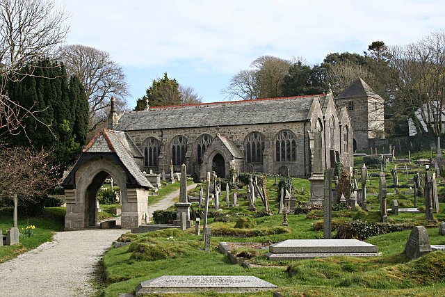 Hamlet and civil parish in West Cornwall.Hamlet and civil parish in West Cornwall. mining area. A thriving and important port during the mid-19th century, its importance waned along with the Cornish mining industry after 1870. The Redruth and Chasewater Railway operated from its headquarters in the village from 1826 until 1915.
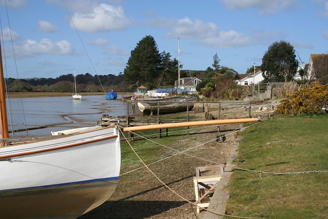
Devoran today is a residential commuter village, its conservation area and river frontage are within the Cornwall and West Devon Mining Landscape World Heritage Site.
Geography
Wikimedia Commons
Devoran lies on a south-facing slope where the Carnon River Heavily polluted river in West Cornwall, draining the historic mining area of Gwennap. joins the River Kennall
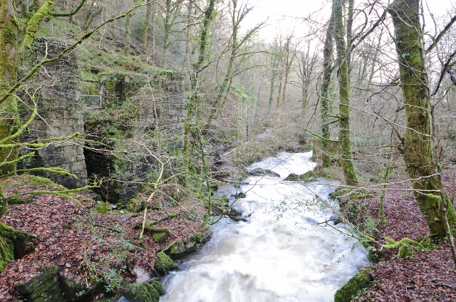 River in south-west Cornwall. overlooking the tidal estuary and beyond to the parkland and woods of the Carclew Estate. The Carnon flows from headwaters near Chacewater into Restronguet Creek, a branch of the Fal Estuary, and onwards into Carrick Roads and the sea.[1]
Devoran Lane and Greenbank Road link the village to the A39 Truro to Falmouth Road. The nearest railway station is at Perranwell. The line of the disused railway is part of the coast-to-coast footpath and cycle route that passes through the Cornwall and West Devon Mining Landscape between Devoran and Portreath.
History
Devoran was recorded as Deffrion in 1278. A Bronze Age barrow is located north of the village.[2] A Bronze Age roundhouse, built some 3,300 and 3,500 years ago near the Carnon shoreline, was discovered when the Carnon Gate roundabout on the A39 was constructed in 2008.[3] Medieval fields recorded in the area were probably part of Tresithick Manor. The area that is now Devoran village was largely undeveloped until the 19th century, except for scattered farms.[2]
Mining
Tin streaming Process for extracting the tin oxide mineral cassiterite from alluvial deposits. took place in the Carnon Valley from prehistoric times and the Carnon Streamworks were established in 1785 at Point.[2][4] Small amounts of gold were also found in the sediments.[5] The smelting works at Point was in operation from 1827 until 1880, and Penpol tin smelting works operated from 1870 until 1921.[6]
Port and mineral railway
William Jenkin, agent for the landowners, the Agar-Robartes family, had seen the potential of a port on the tidal estuary in 1790.[6] It was developed in the early 1800s when mining in the Redruth and Gwennap area was flourishing and better transport was in demand. The Fox family who owned the nearby Perran Foundry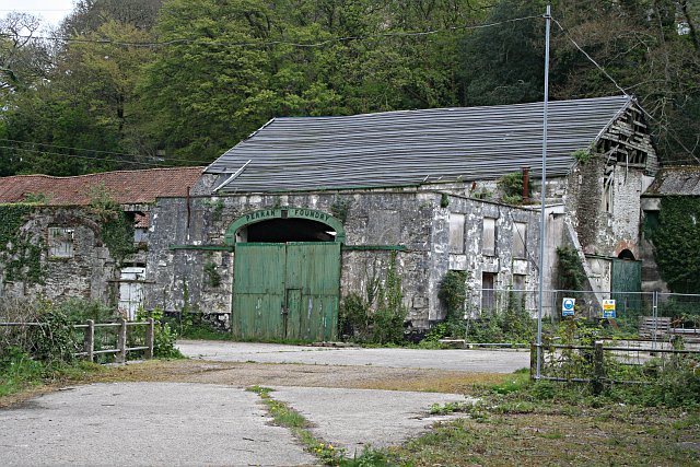 Cornish foundry established in 1791 to supply steam-engine pumps and heavy machinery to mines, waterworks and ironworks. in Perranarworthal
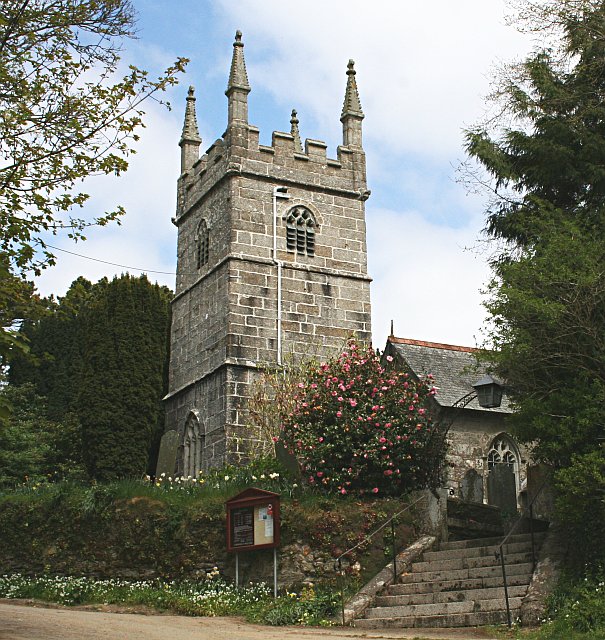 Mostly rural parish in West Cornwall. and the Williams family of GwennapHamlet and civil parish in West Cornwall.Hamlet and civil parish in West Cornwall. were also interested in its development.[6] Wharves to facilitate the import and export of bulky goods were built downstream at Point, and a mineral railway was planned to link Redruth to Point.
The Redruth and Chasewater single-track railway, initially horse-drawn, opened to Devoran in 1826. The railway company established its headquarters in the village, which at the time consisted of a few cottages. Industry, railway sidings and the port quays grew up along the river.[7] The railway was extended for another mile to Point where the deep-water channel curved alongside the quay.[8]

Wikimedia Commons
By the 1830s the port was busy exporting ore and importing timber and coal.[9] The proposed street grid, including Market Street, St John’s Terrace and Carclew Terrace was evidenced on the 1841 Tithe Map. The village was linked to the turnpike road by Devoran Lane, and another lane on the alignment of Greenbank Road. The main line of the mineral railway ran eastwards past Carclew Terrace and along the Old Tram Road. A parallel branch followed the alignment of Quay Road towards Narabo Wharf, and a spur ran from the southern end of Market Street towards Devoran Boatyard.[9]
Industry, railway sidings and the port quays grew up along the river.[7] When the railway was converted to steam in the 1850s, more buildings were constructed close to the quay.[9]
Poor weather in 1876 caused flooding in the Great County Adit System of underground tunnels that drained tin and copper mines between Redruth and Bissoe in west Cornwall. that drained many deep mines in the Gwennap area into the Carnon River. Torrents of water and thousands of tons of mining debris and silt were expelled into the river and deposited downstream at Devoran, preventing access to the upsteam quays, which were never reinstated.[10][11] The railway was closed in 1915 and schooners stopped using Devoran in 1916, but barges bringing limestone and coal continued to use the quays for some time after that.[11]
Village
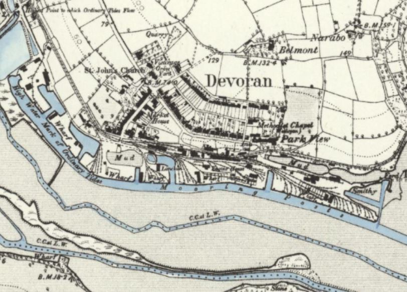
Reproduced with the permission of the National Library of Scotland
After 1845, houses on St John’s Terrace, Market Street and Belmont Terrace were built along with a school in 1846, St Petroc and St John’s Church ten years later, and after that the market hall. The village thrived until the mining industry, and with it the railway, started to decline in the 1870s.[11]
Houses and bungalows at the western end of Devoran Lane were built for commuters in the mid-20th century and more were built later in the 20th century to the south and west of the village on former industrial and agricultural land. Some industrial buildings on Quay Road were converted to residences; the railway workshop is now the village hall.
Devoran is now a largely residential commuter village.[7][11] Its conservation area and river frontage are within the Cornwall and West Devon Mining Landscape, a World Heritage Site.[13][14]

