
Gwennap Parish Church
Wikimedia Commons
Gwennap is a hamlet Rural settlement smaller than a village.Rural settlement smaller than a village. and civil parish
 Smallest administrative unit in England. in West Cornwall, eight miles east of Truro. Its ancient church dedicated to St Wenappa was the centre of a large ecclesiastical parishAncient or ancient ecclesiastical parishes encompassed groups of villages and hamlets and their adjacent lands, over which a clergyman had jurisdiction. that included several more villages and hamlets.
In the mid-19th century Gwennap was at the centre of one of the world’s greatest metal mining areas and its legacy is part of the Gwennap Mining District with Devoran, Perran & Kennall Vale.[1]
Although it has an ancient church, Gwennap is known for its association with Methodism and John Wesley.
Geography
Gwennap, a hamletRural settlement smaller than a village.Rural settlement smaller than a village. of about twenty houses,[2] and rural civil parishSmallest administrative unit in England. is situated in West Cornwall, to the southwest of Truro, southeast of Redruth and northeast of Falmouth. Its eastern boundary is the Carnon River and to the southeast is Perranarworthal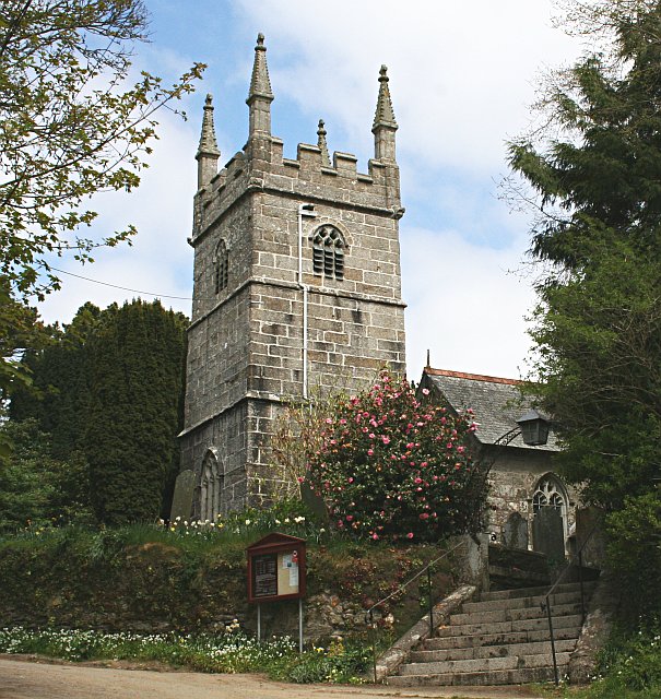 Mostly rural parish in West Cornwall. and Stithians is to the south. It is a mainly rural area of low hills and valleys and includes the villages and hamlets of Gwennap, Burncoose, Comford, Coombe, Crofthandy, Cusgarne, Fernsplatt, Frogpool, Goon Gumpas, Hick’s Mill, Tresamble and United Downs.[3]

Wikimedia Commons
The A393 between Redruth and Penryn and the B3298 are the main roads in the parish.[4] The area is criss-crossed by numerous small lanes, tracks and footpaths as well as local roads across and through the parish.[5]
Gwennap’s soils are poor and granite outcrops in the south. The high point is in the south-west, and streams flow in an easterly direction towards Carnon Heavily polluted river in West Cornwall, draining the historic mining area of Gwennap. and Kennall Rivers
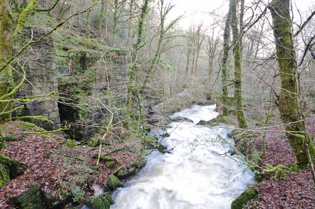 River in south-west Cornwall.. Woodland occupies the valleys and around estates, and improved grassland and pasture cover most of the rural area where there is evidence of medieval field patterns.[5]
The parish’s extensive mining heritage is evident; old mine sites have large areas of disturbed ground and derelict land with areas of heath and scrub. The former mine sites at United Downs and Mount Wellington have been reused for industry. Derelict engine houses and shafts are distinctive features particularly along United Downs and the Wheal Maid and Poldice Valleys.[5]
History
Gwennap (Cornish: Lannwenep) in the HundredAdministrative subdivision of a shire. of Kerrier was named after the little-known Saint Wenappa. The ancient parish was larger than today’s civil parish. As well as the churchtownEcclesiastical parishes in Cornwall sometimes have a parish church situated in a churchtown., Gwennap included St Day, which became a chapelry Church subordinate to a parish church serving an area known as a chapelry, for the convenience of those parishioners who would find it difficult to attend services at the parish church. in 1833, and Lanner, which was made a parish in 1845. Carharrack became a civil parish in 1985.[4][6]
Religion
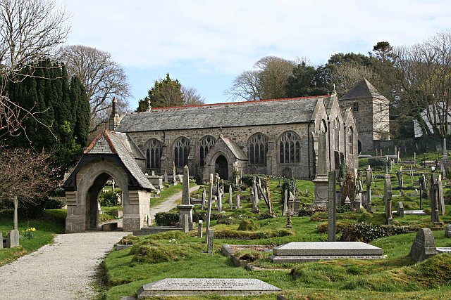
The Grade I parish church is of ancient foundation and has a detached tower.[4] It is dedicated to the little-known Celtic Saint Wenappa, who reputedly built a monastery cell at or near its site about 1400 years ago. The church was rebuilt in three phases in the 15th century, incorporating some 13th and 14th-century walling. It was restored and extended between 1862 and 1882–1891. Its walls are built of roughly coursed granite moorstone and granite ashlar Masonry of squared and finely cut or worked stone, commonly used for the facing of a building. and has Delabole slate roofs.[7]
Methodism spread rapidly after John Wesley made his first visit in 1743. Wesley made 32 visits to the county between 1743 and 1789, and after 1762 preached to open-air crowds at Gwennap Pit Amphitheatre in which John Wesley preached between 1762 and 1789, occupying a depression that was possibly formed by the subsidence of underground mine workings..[8] The first congregations were miners and agricultural labourers, and there was opposition and persecution from the established church.
Mining
Mining had started in the Poldice Valley by 1512. An adit, driven from Wheal Nangile, to the Poldice sett to dewater the mines, was started in 1748 and by 1756 had reached Poldice. It was extended over time with branches to dewater other mines and became known as the Great County AditSystem of underground tunnels that drained tin and copper mines between Redruth and Bissoe in west Cornwall..[9] In the 18th and early 19th centuries, Gwennap became known as “the richest square mile on Earth”. Among the several mining companies were Treskerby, Wheal Jewell, Wheal Damsel, United Mines Group, Poldice, Wheal Unity and Wheal Gorland, Consolidated Mines which was the largest and Tresavean which made vast profits for its owners. In 1840 the total value of the products of the mines in Gwennap was £293,218 as against £819,949 for the whole county.[6]
The Gwennap mines were inland, some distance from the north and south coasts, and transport along the narrow lanes was difficult and expensive. John Williams of Scorrier built a horse-drawn mineral tramway from Poldice via Scorrier to a new harbour at Portreath on the north coast in 1809. From here tin ore was shipped to the smelters of South Wales, and coal was shipped back to fuel the pumping engines.[10]
John Taylor built the Redruth and Chasewater Railway from his mines near Carharrack and St Day to new wharves at Devoran to the south in 1824. It ran from Redruth via Carharrack and Lanner but the line to Chacewater was never built. Timber, coal and iron was shipped into Devoran for the mines and the Perran Foundry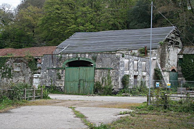 Cornish foundry established in 1791 to supply steam-engine pumps and heavy machinery to mines, waterworks and ironworks.. Traffic on the line lasted into the 20th century.[10]

