33 suggestions for "coal-mining+greater-manchester"
Andrew Knowles & SonsAndrew Knowles & Sons was a coal mining company that operated on the Manchester Coalfield in and around Clifton, in the historic county of Lancashire, England.
Astley and Tyldesley CollieriesColliery company formed in 1900, became part of Manchester Collieries in 1929, and some of its collieries were nationalised in 1947.
Bedford CollieryColliery in Leigh sunk by John Speakman at Wood End Farm in the northeast part of Bedford in 1875.
Boothstown Mines Rescue Station Mines rescue station serving the collieries of the Lancashire and Cheshire Coal Owners on the Lancashire Coalfield, opened in 1933.
Bradford CollieryBradford Colliery was a coal mine in Bradford, Manchester, England.
Bradford Colliery BrickworksBradford Colliery Brickworks operated on the site of the Bradford Colliery in Bradford, Greater Manchester, then in the historic county of Lancashire, England,
Bridgewater CollieriesCoal mining company on the Lancashire Coalfield with headquarters in Walkden near Manchester.
Burning wellsPhenomenon known in the area around Wigan in Lancashire from at least the 17th century.
Chanters CollieryFormer colliery in Hindsford, Atherton where coal was mined from 1854 until 1966.
Cleworth Hall Colliery
Cleworth Hall Colliery on the Lancashire Coalfield operated between 1880 and 1963 in Tyldesley, Lancashire, England.
Combermere CollieryColliery sunk by the Tyldesley Coal Company on the Manchester Coalfield after 1867 in Shakerley, Tyldesley in Lancashire, England.
Edward OrmerodEnglish mining engineer and inventor who worked at Gibfield Colliery in Atherton, Lancashire where he devised and tested his safety device, the Ormerod safety link or detaching hook.
Ellenbrook tramwayTramway built by the Bridgewater Trustees in the 1830s to transport coal to the Bridgewater Canal.
Ellesmere CollieryEllesmere Colliery in Walkden, on the Lancashire Coalfield, was sunk in 1865 by the Bridgewater Trustees. Production ended in 1923.
Fairbottom BobsFairbottom Bobs, an 18th-century Newcomen-type beam engine, was used to pump water from a coal pit near Ashton-under-Lyne, is probably the world’s second-oldest surviving steam engine.
Fletcher, Burrows & CompanyOwner of collieries and cotton mills in Atherton in North West England.
Gin Pit CollieryColliery that operated on the Lancashire Coalfield from the 1840s in Tyldesley Lancashire, England.
Great Boys CollieryGreat Boys Colliery in Tyldesley was a coal mine operating on the Manchester Coalfield in the second half of the 19th century in Lancashire, England.
Great Haigh SoughTunnel or adit driven under Sir Roger Bradshaigh’s Haigh Hall estate between 1653 and 1670, to drain his coal and cannel pits.
Howe Bridge Mines Rescue StationFirst mines rescue station on the Lancashire Coalfield, opened in 1908 in Lovers Lane Howe Bridge, Atherton, Lancashire.
Hulton CollieriesThe Hulton Colliery Company operated on the Lancashire Coalfield from the mid-19th century in Over Hulton and Westhoughton, Lancashire.
Manchester CoalfieldPart of the Lancashire Coalfield. Some easily accessible seams were worked on a small scale from the Middle Ages, and extensively from the beginning of the Industrial Revolution until the last quarter of the 20th century.
New Lester Colliery Colliery on the Manchester Coalfield opened after 1872 by James and William Roscoe in Tyldesley, Lancashire, England.
Nook CollieryCoal mine on the Manchester Coalfield after 1866 in Tyldesley, Lancashire, England.
Peelwood CollieryPeelwood Colliery on the Manchester Coalfield in Shakerley, Tyldesley, Lancashire, began producing coal in 1883.
Pendleton CollieryFormer colliery that operated on the Manchester Coalfield from the late 1820s. It was a major employer but was subject to water ingress, which ultimately bankrupted its owner.
Ramsden’s Shakerley CollieriesRamsden’s Shakerley Collieries was a coal mining company operating from the mid-19th century in Shakerley, Tyldesley in Lancashire, England.
St George’s Colliery
St George's Colliery, known locally as Back o't' Church, was a coal mine on the Manchester Coalfield that was sunk in 1866 in Tyldesley, Lancashire, England.
Walking Horse (locomotive)Lancashire’s first steam locomotive, built by Robert Daglish in 1812 at the Haigh Foundry for colliery owner, John Clarke; it entered service the following year.
Wharton Hall CollieryWharton Hall Colliery was in Little Hulton on the Lancashire Coalfield in Lancashire, north west England.
Worsley dry docksEarliest surviving example of a dry dock on Britain's canals.
Worsley Navigable LevelsExtensive network of underground canals that drained the Duke of Bridgewater's coal pits emerge into the open at the Delph in Worsley, Greater Manchester.
Yew Tree CollieryFormer coal mine operating on the Manchester Coalfield after 1845 in Tyldesley, which was then in the historic county of Lancashire, England.
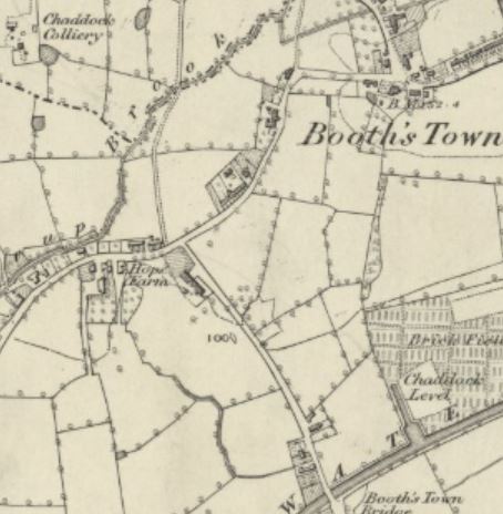

 Part of the Lancashire Coalfield. Some easily accessible seams were worked on a small scale from the Middle Ages, and extensively from the beginning of the Industrial Revolution until the last quarter of the 20th century.. The underground workings were connected to the Leigh arm of the Bridgewater Canal at Boothstown by the Chaddock Level, an extension of the Worsley Navigable Levels
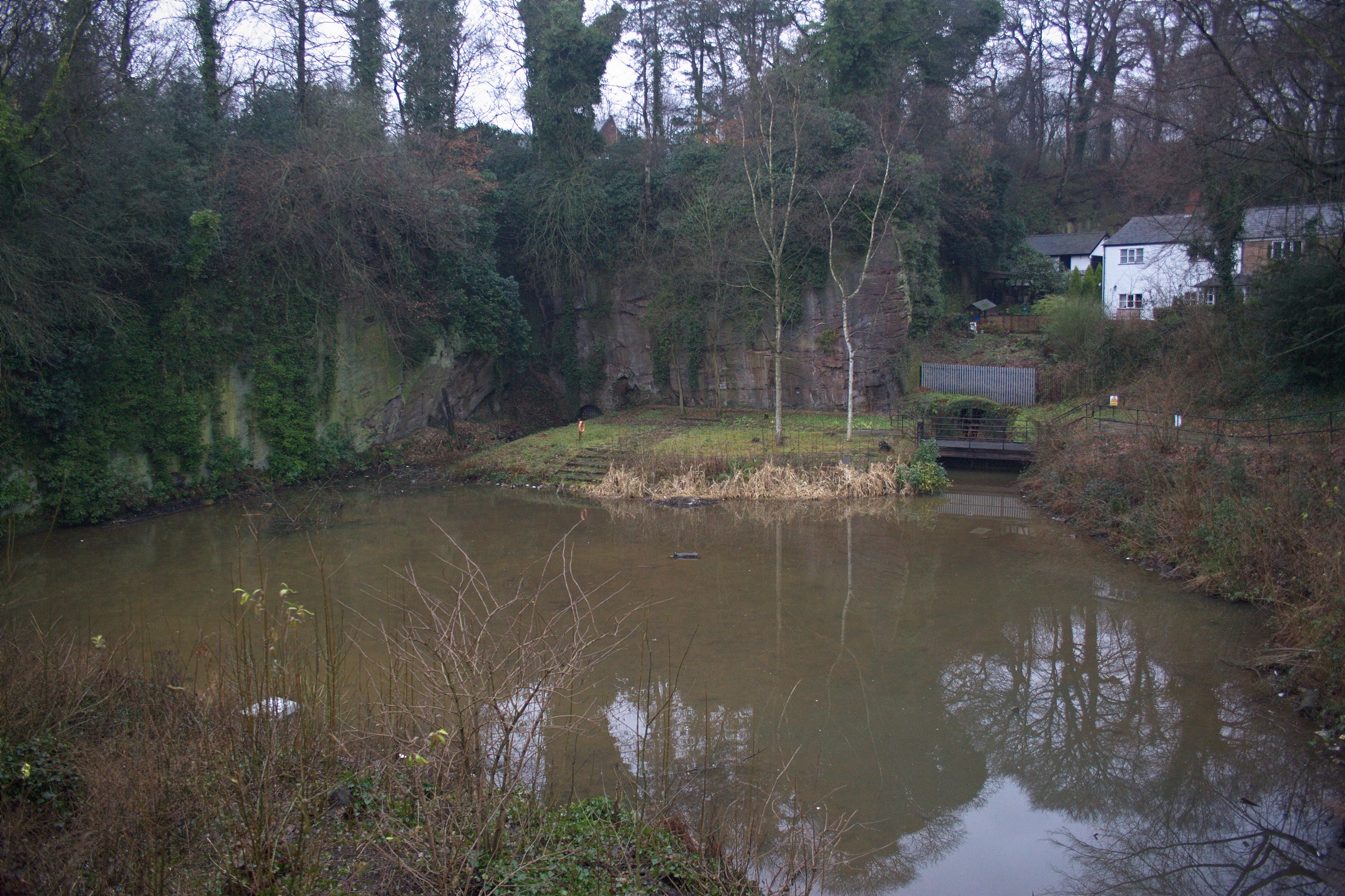 Extensive network of underground canals that drained the Duke of Bridgewater's coal pits emerge into the open at the Delph in Worsley, Greater Manchester..
