Calder and Hebble Navigation
Constructed between 1758 and 1834, the navigation makes the River Calder navigable between Sowerby Bridge and Wakefield in the West Riding of Yorkshire.
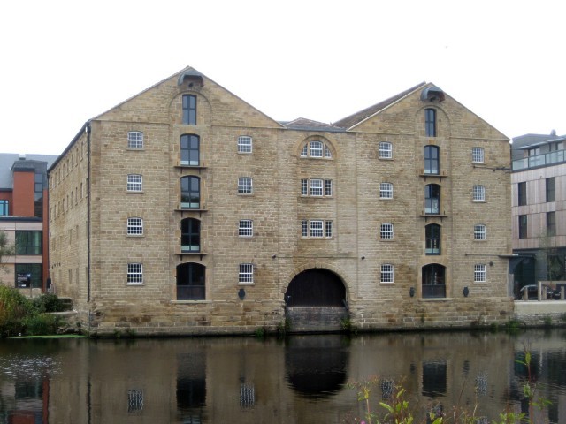
Constructed between 1758 and 1834, the navigation makes the River Calder navigable between Sowerby Bridge and Wakefield in the West Riding of Yorkshire.
Ancient township of four villages, renamed from Shitlington to Sitlington in 1929.
Standedge has been a major Pennine crossing point for more than 2,000 years.
Tract of moorland more than 700 feet above sea level that gave its name to Grange Moor, a residential village.
Relatively flat expanse of lowland in North West England, the surface expression of the Cheshire Basin, an area of sedimentary rocks overlain by Mercia Mudstones laid down about 250 million years ago.
Built-up area and civil parish in the unitary authority of Cheshire East.
Earliest surviving example of a dry dock on Britain’s canals.

Former manor house incorporating a pele tower, in Turton, Lancashire.
Roundwood is a wooded peninsula on the River Fal in Cornwall, where there is evidence of occupation and settlement since at least the Iron Age.
Village in the Borough of Chorley, to the northwest of Bolton, on the fringe of the West Pennine Moors.