
Cheshire East shown within Cheshire
Wikimedia Commons
Wikimedia Commons
The Borough of Cheshire East in North West England is one of the four unitary authorities comprising the ceremonial countyArea with an appointed Lord Lieutenant and High Sheriff to represent the monarch's interest. of Cheshire.[1]
The historic railway town of Crewe is the largest in the borough, which also includes the towns of Sandbach, Macclesfield, Congleton, Wilmslow, Nantwich, Poynton, Knutsford, Alsager, Bollington and Handforth.[2]
Cheshire East contains 48 of the 142 Grade I listed buildings in Cheshire. Grade I structures are those considered to be “buildings of exceptional interest”.[3]
| Name | Location | Architect | Completed | Entry number | Image |
|---|---|---|---|---|---|
| Adlington Hall | Adlington | 1505 | 1234130 | 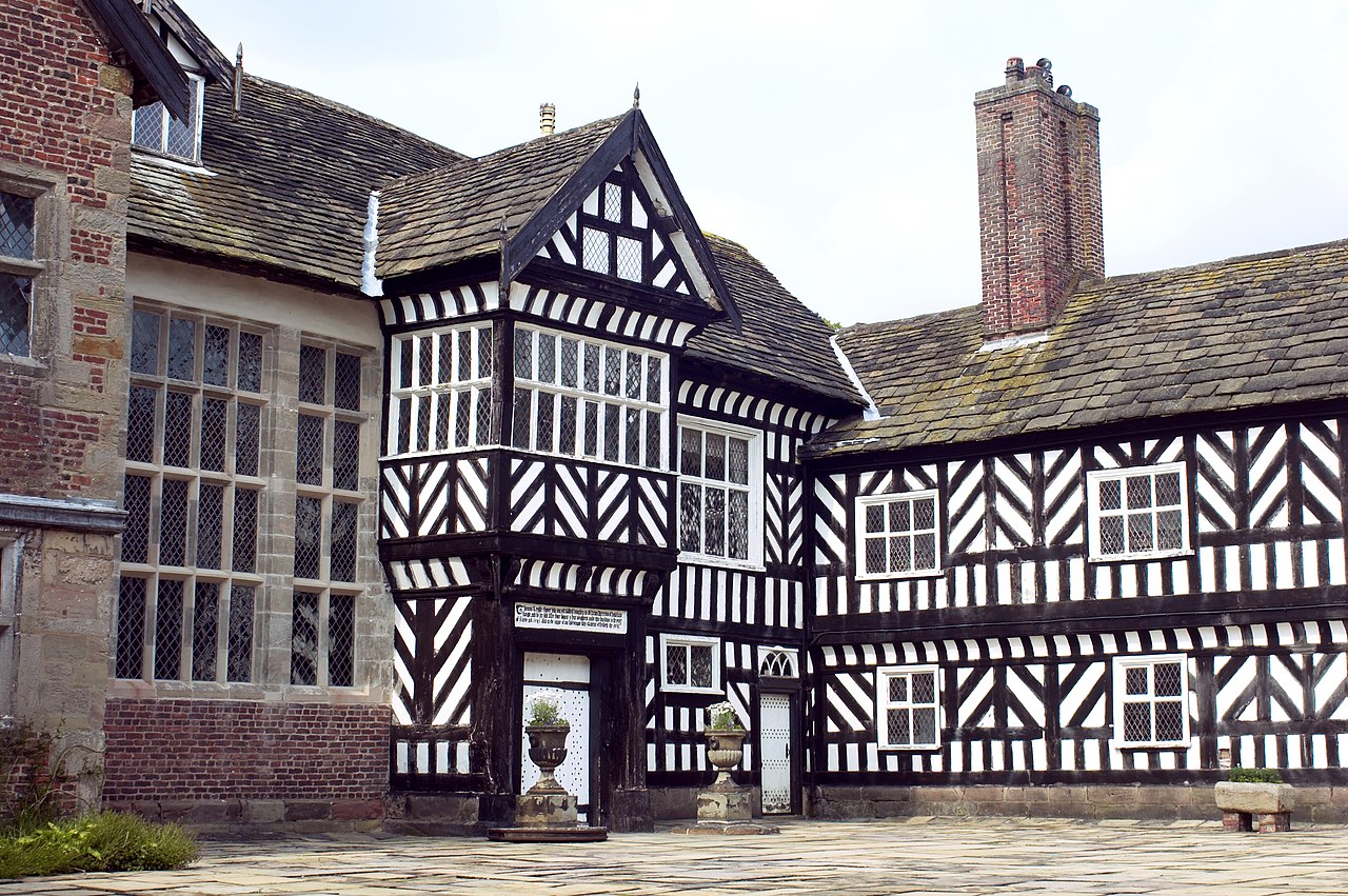 Wikimedia Commons | |
| Brereton Hall | Brereton Green, Brereton | 1585 | 1229329 |  Wikimedia Commons | |
| Brook Street ChapelGrade I listed active Unitarian and Free Christian chapel in Knutsford, Cheshire. | Adams Hill, Knutsford | 1689 | 1388306 |  Wikimedia Commons | |
| Chapel of St Nicholas | Cholmondeley Park, Cholmondeley | Late 15th century | 1138593 | 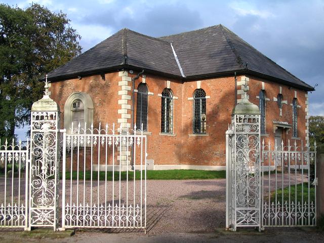 Wikimedia Commons | |
| Chorley Old Hall | Ryleys Lane, Alderley Edge | c. 1330 | 1234539 |  Wikimedia Commons | |
| Church of St Bartholomew | Wilmslow | 1898 | 1222475 |  Wikimedia Commons | |
| Church of St Bertoline | Barthomley | 12th century | 1330063 |  Wikimedia Commons | |
| Church of St Boniface | Bunbury | 14th century | 1138626 |  Wikimedia Commons | |
| Church of St Christopher | Pott Shrigley | 15th century | 1277234 | 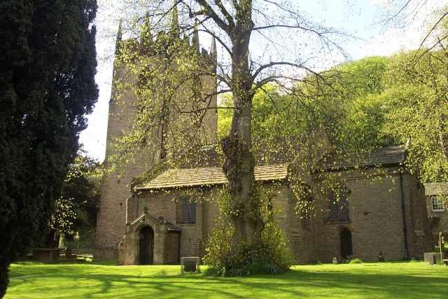 Wikimedia Commons | |
| Church of St James | Stafford Street, Audlem | Late 13th century | 1136872 |  Wikimedia Commons | |
| Church of St James | Gawsworth | 15th century | 1139497 |  Wikimedia Commons | |
| Church of St James and St Paul | Marton | c. 1370 | 1139465 |  Wikimedia Commons | |
| Church of St Lawrence | Peover Hall Park, Peover Superior | 1456 | 1139274 | 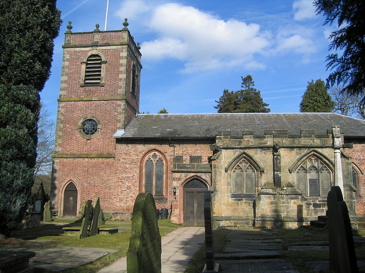 Wikimedia Commons | |
| Church of St LukeGrade 1 listed building and an active Anglican parish church in Holmes Chapel, Cheshire, dating from about 1430. | Holmes ChapelBuilt-up area and civil parish in the unitary authority of Cheshire East. | c. 1430 | 1231322 |  Wikimedia Commons | |
| Church of St Mary | Nantwich | 14th century | 1206059 |  Wikimedia Commons | |
| Church of St Mary | Nether Alderley | 14th century | 1138849 | 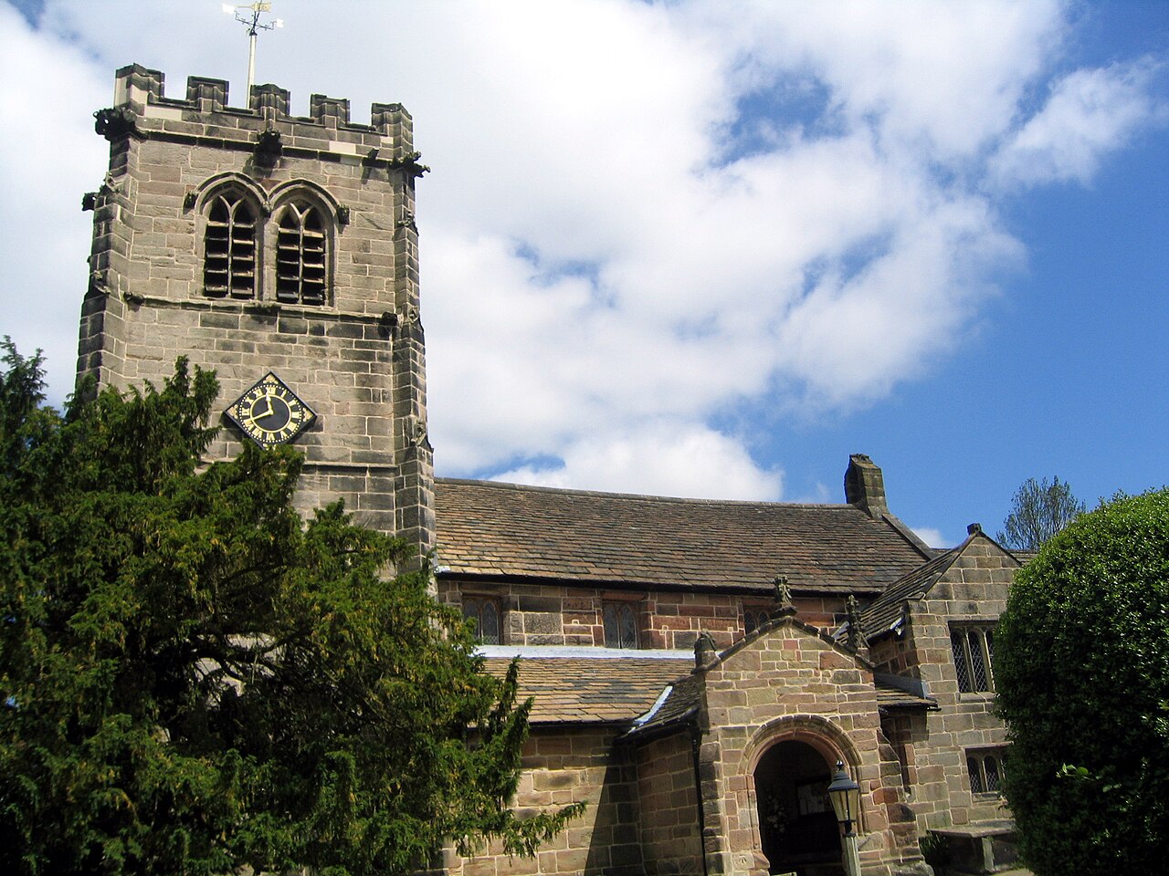 Wikimedia Commons | |
| Church of St Mary | Newbold Astbury | 12th century | 1138740 | 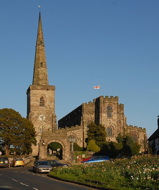 Wikimedia Commons | |
| Church of St Mary | Rostherne | 14th century | 1230301 |  Wikimedia Commons | |
| Church of St Mary the Virgin | Monks Lane, Acton | 13th century | 1330112 |  Wikimedia Commons | |
| Church of St Michael | Baddiley | 1308 | 1138586 |  Wikimedia Commons | |
| Church of St Peter | Congleton | 1740–1742 | 1330322 |  Wikimedia Commons | |
| Church of St Peter | Prestbury | Early to mid-13th century | 1221919 | Wikimedia Commons | |
| Church of St Peter (at Tabley House) | Tabley InferiorCivil parish in the borough of Cheshire East, part of the ceremonial county of Cheshire.Civil parish in the borough of Cheshire East, part of the ceremonial county of Cheshire. | c. 1714 | 1329685 | 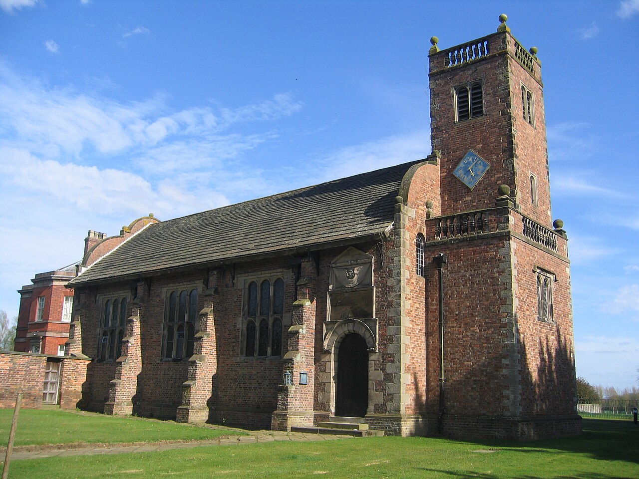 Wikimedia Commons | |
| Church of St Wilfrid | Mobberley | 14th–15th century | 1139554 |  Wikimedia Commons | |
| Churche’s MansionTimber-framed, black-and-white Elizabethan mansion house in Nantwich, Cheshire, one of the very few buildings to have survived the Great Fire of Nantwich in 1583. | Hospital Street, Nantwich | 1577 | 1039605 |  Wikimedia Commons | |
| Combermere Abbey | Combermere Park, Dodcott cum Wilkesley | Early 16th century | 1136900 |  Wikimedia Commons | |
| Crewe Hall | Crewe Hall Park, Crewe Green | 1615–1636 | 1138666 | 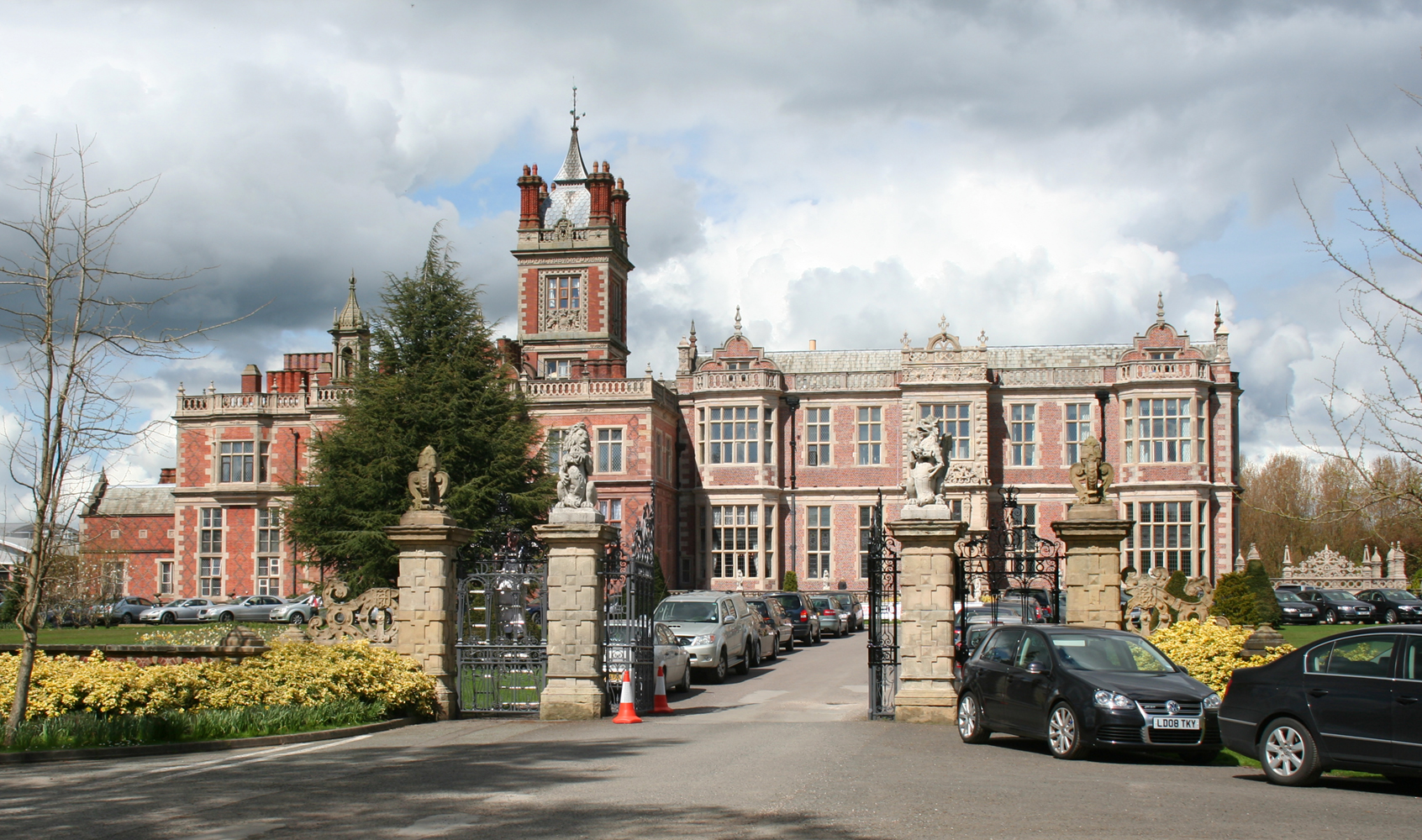 Wikimedia Commons | |
| Crown Hotel | 24 & 26 High Street, Nantwich | c. 1584 | 1330054 |  Wikimedia Commons | |
| Cruck barn approximately 100 yards to west of Arley Hall | Arley Hall, Aston By Budworth | Early 16th century | 1329696 |  Wikimedia Commons | |
| Delves HallGrade I listed tower house in Doddington Park, Cheshire. | Doddington Park, Doddington | Late 14th century | 1330165 |  English Heritage | |
| Doddington Hall18th-century Grade I listed country house in Doddington, Cheshire. | Doddington Park, Doddington | 1777–1798 | 1136840 |  Wikimedia Commons | |
| Dorfold HallGrade I listed Jacobean mansion house in Acton, Cheshire. | Dorfold Park, Acton | 1616 | 1312869 | 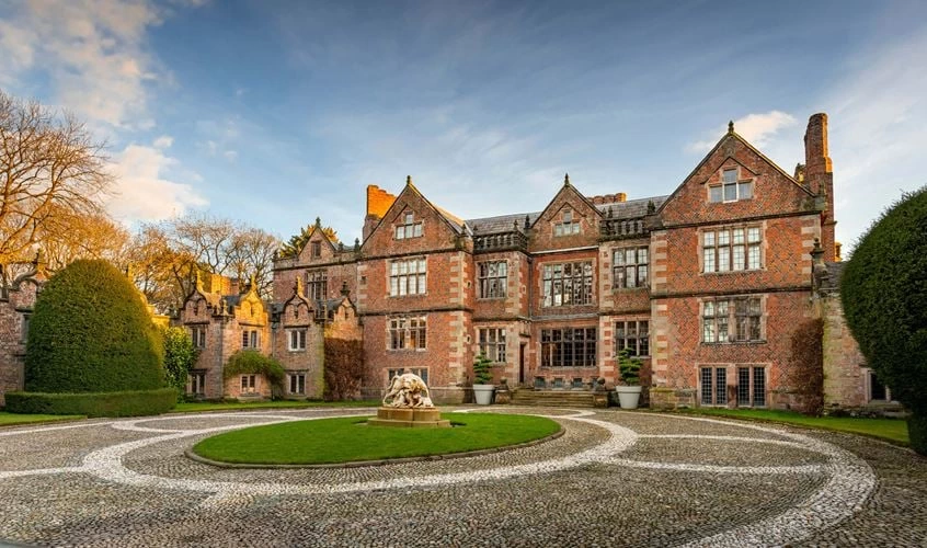 Historic England | |
| Gawsworth Old Hall | Gawsworth | 15th century | 1139500 | 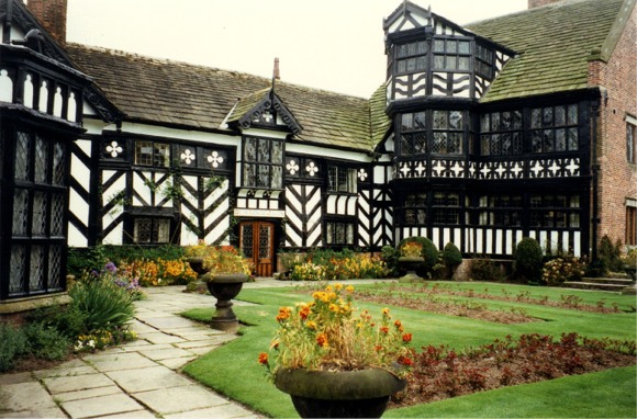 Wikimedia Commons | |
| Haslington Hall | Holmshaw Lane, Haslington | Late 15th century | 1136283 |  Wikimedia Commons | |
| HighfieldsSmall Grade I listed country house in the civil parish of Buerton, Cheshire. | Woodhouse Lane, Buerton | 1615 | 1330162 |  Wikimedia Commons | |
| Little Moreton HallMoated half-timbered manor house 4.5 miles (7.2 km) southwest of Congleton in Cheshire, England, the earliest parts of which date from about 1504–1508. | Parish of Odd Rode | Early 16th century | 1161988 | 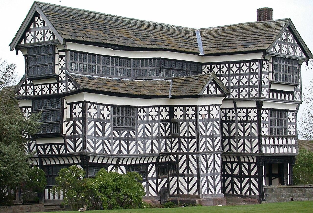 Wikimedia Commons | |
| Lovell Telescope | Jodrell Bank, Goostrey | 1952–1957 | 1221685 | 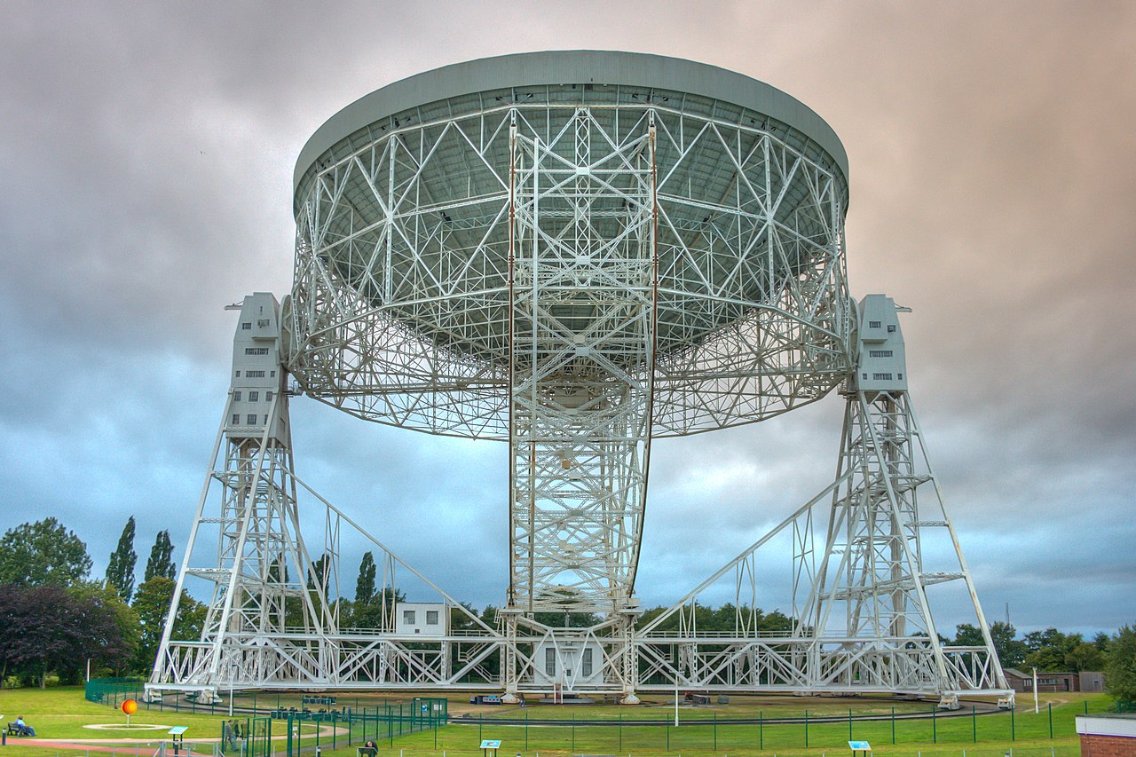 Wikimedia Commons | |
| Lyme Park | Lyme Park Country Park, Lyme Handley | c. 1570 | 1231685 | 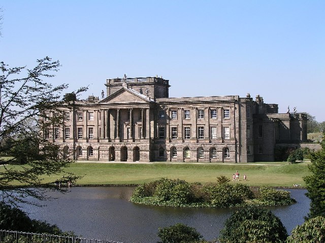 Wikimedia Commons | |
| Mark II (radio telescope) | Jodrell Bank Observatory | 1964 | 1443087 |  Wikimedia Commons | |
| Moss HallGrade I listed country house near the village of Audlem, Cheshire, built in 1616. | Audlem | Early 17th century | 1138519 |  Wikimedia Commons | |
| Old Hall Hotel | Sandbach | 1656 | 1310849 | 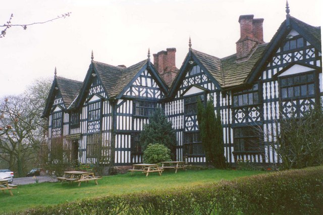 Wikimedia Commons | |
| Peckforton Castle | Peckforton | 1844–1850 | 1135729 |  Wikimedia Commons | |
| Sandbach CrossesTwo early 9th-century stone Anglo-Saxon crosses in the market place of Sandbach, Cheshire. | Sandbach | Early 9th century | 1159937 |  Wikimedia Commons | |
| Tabley House | Tabley InferiorCivil parish in the borough of Cheshire East, part of the ceremonial county of Cheshire.Civil parish in the borough of Cheshire East, part of the ceremonial county of Cheshire. | 1760–1767 | 1115424 |  Wikimedia Commons | |
| Tatton Hall | Tatton Park, Tatton | Samuel Wyatt, Lewis Wyatt, G H Stokes | 1780–1884 | 1329670 |  Wikimedia Commons |
| The Old Rectory | Church Lane, Gawsworth | Late 16th century | 1139496 |  Wikimedia Commons | |
| The Old Stable Block, Peover Hall | Peover Hall Park, Peover Superior | 1654 | 1335855 | 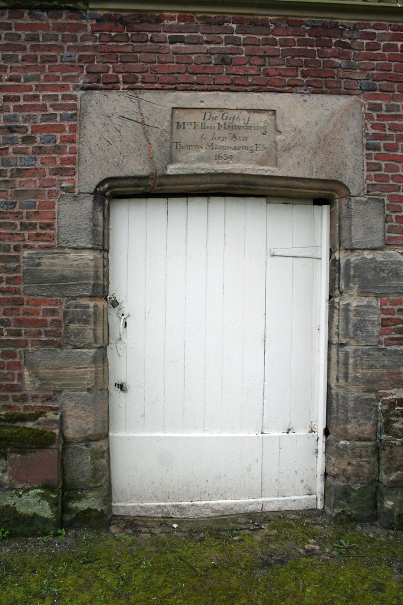 Wikimedia Commons | |
| Woodhey Chapel | Woodhey, Faddiley | Early 17th century | 1312896 | 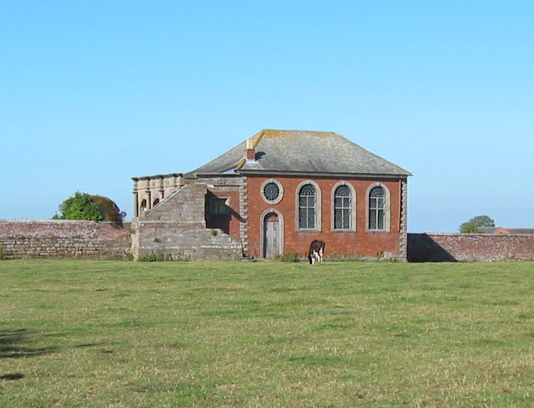 Wikimedia Commons |
See also
- Grade I listed buildings in CheshireGrade I listed buildings in the ceremonial county of Cheshire, split into the four unitary authorities making up the county.