
Dobcross in Saddleworth
Wikimedia Commons
Saddleworth is a civil parish Smallest administrative unit in England. and former townshipDivision of an ecclesiastical parish that had civil functions. in the Metropolitan Borough of Oldham in Greater Manchester. Until local government boundaries were reorganised in 1974, Saddleworth was in the West Riding of Yorkshire. It is about twelve miles (19 km) from Manchester and the same from Huddersfield on the edge of the moorland in the South Pennine hills. There is no village, but the civil parish is comprised of several villages, of which Delph, Dobcross, Denshaw, DiggleOne of several villages in the Saddleworth parish in the Metropolitan Borough of Oldham, in Greater ManchesterOne of several villages in the Saddleworth parish in the Metropolitan Borough of Oldham, in Greater Manchester, Uppermill and Greenfield are the largest, and several hamlets
 Rural settlement smaller than a village.. Saddleworth is at a major Pennine crossing
  Standedge has been a major Pennine crossing point for more than 2,000 years. point where road, canal and railway link the Greater Manchester and West Yorkshire connurbations.
The Romans built a fort at Castleshaw on their military road from Manchester to York, and after the Norman Conquest Saddleworth became a manor and a chapelry Church subordinate to a parish church serving an area known as a chapelry, for the convenience of those parishioners who would find it difficult to attend services at the parish church.Church subordinate to a parish church serving an area known as a chapelry, for the convenience of those parishioners who would find it difficult to attend services at the parish church. dependent on the parish church in Rochdale after 1200. The textile industry developed in domestic homes until mills powered by Pennine streams were built at the start of the Industrial Revolution. Trade between towns on both side of the Pennines increased after the Wakefield to Austerlands turnpike road was completed, and developed further after the Standedge tunnels for canal in 1811, and railways after 1840, were completed.
Geography
Wikimedia Commons
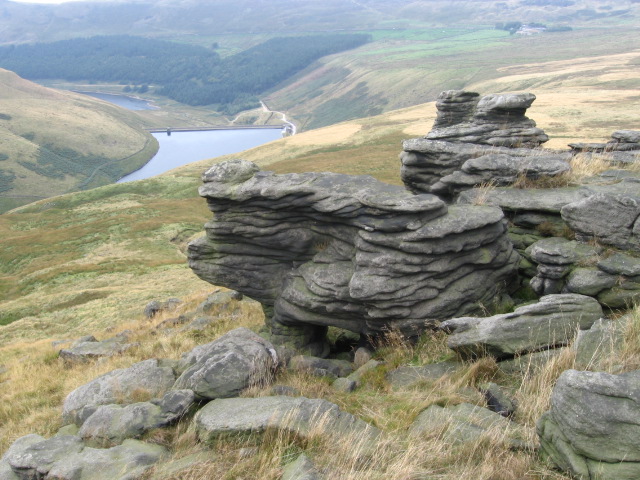
Saddleworth civil parish in the South Pennine hills is about 12 miles (19 km) from Manchester and 12 from Huddersfield. It covers more than 20,000 acres of hilly land, about seven miles long and about five wide, of which 6000 acres are the unenclosed moorland of Saddleworth Moor. Streams emerging in the moorland drain into tributaries of the River Tame and once provided power for the many textile mills that were built alongside them.[1] Moorland in the south eastern part of Saddleworth is in the Peak District National Park.
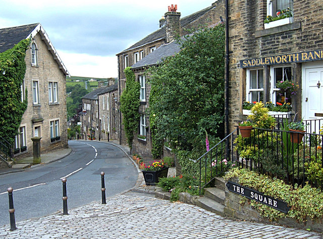
Saddleworth is comprised of several villages, Delph, Dobcross, Denshaw, DiggleOne of several villages in the Saddleworth parish in the Metropolitan Borough of Oldham, in Greater ManchesterOne of several villages in the Saddleworth parish in the Metropolitan Borough of Oldham, in Greater Manchester, Uppermill and Greenfield and many more hamlets. Uppermill is the largest village.[2] Dobcross, at the cross-roads at the end of Harrop Edge that separates the Delph and Diggle valleys, was once the most important village.[3] Delph, at the confluence of the River Tame and the Hull Brook, is surrounded by hills. Diggle’s scattered farmsteads in the valley below the moors developed in the late 19th century, when rows of Victorian terraced houses were built.[4]
The moorland is a valuable water catchment area and twelve reservoirs have been constructed in Saddleworth, eight, the Upper and Lower Strinesdale Reservoirs, Readycon Dean, Crook Gate, Dowry, New Year’s Bridge and the Lower and Upper Castleshaw, by Oldham Corporation and the four Dovestone Reservoirs Dovestone and its associated reservoirs occupy the valleys of the Greenfield and Chew Brooks above the village of Greenfield, on Saddleworth Moor in Greater Manchester. in the valley of the Greenfield Brook by Ashton, Stalybridge and Dukinfield Waterworks (ASDW); the ASDW supplied about two thirds of the civil parish and Oldham Corporation supplied the rest.[5] Diggle Dam is a summit level reservoir to feed the Hudderfield Narrow Canal.
Three roads cross Saddleworth from west to east, the A640 Rochdale to Huddersfield, the A62 Huddersfield to Manchester and the A635 Ashton-under-Lyne to Holmfirth roads.[1] The A62 via Standedge was the major trans-Pennine route until the M62 motorway was constructed. The Hudderfield Narrow Canal and the Manchester to Huddersfield Railway pass through Saddleworth west to east via the Standedge tunnels.[6]
Governance
Saddleworth cum Quick was a detached parochial chapelryChurch subordinate to a parish church serving an area known as a chapelry, for the convenience of those parishioners who would find it difficult to attend services at the parish church.Church subordinate to a parish church serving an area known as a chapelry, for the convenience of those parishioners who would find it difficult to attend services at the parish church. of the ancient parishAncient or ancient ecclesiastical parishes encompassed groups of villages and hamlets and their adjacent lands, over which a clergyman had jurisdiction. of Rochdale[a]Rochdale was in the Salford Hundred in Lancashire but was in the West Riding of Yorkshire. In the 17th century, the chapelry was divided into four constablewicks, Friermere was to the north, inside its boundaries are Denshaw, Delph and the Castleshaw valley to Standedge. Quickmere, the most westerly, included Grasscroft, Springhead, Grotton, Austerlands, Scouthead, Highmoor and Strinesdale. Ill-defined Shawmere was the land on either side of the River Tame. Lordsmere, the largest, covered the east of the township including Dobcross, Diggle, Uppermill Greenfield and all of Saddleworth Moor.[7]
Saddleworth belonged to a Gilbert Union which was dissolved in 1853 and in accordance with the 1834 Poor Law Amendment Act became a Poor Law Township. It had a workhouse Establishment where the destitute in England and Wales received board and lodging in return for work. on Running Hill Lane. In 1894 the township joined with Springhead and Uppermill to form a Poor Law Union using the old workhouse. Control passed to the West Riding County Council in 1930.[8]
Saddleworth was part of the Agbrigg wapentakeAnglo-Saxon administrative unit. in the West Riding of Yorkshire until 1974 when it was incorporated into the Borough of Oldham in Greater Manchester.[8]
In the local government reorganisation in 1974, Saddleworth Parish Council was formed with boundaries similar to those of the Saddleworth Urban District Council and the medieval township.[9] It is represented on Oldham Metropolitan Borough Council by councillors from three wards, Saddleworth North, Saddleworth South and Saddleworth West and Lees.[10] In the House of Commons of the UK Parliament, Saddleworth is represented by the Member of Parliament for Oldham East and Saddleworth.[11]
History
Saddleworth’s name is derived from the Old English sadol meaning saddle, particularly as a col, a saddle-shaped dip in the hills and worð an enclosure.[12]
The Romans established a fort at Castleshaw in the Hull Brook Valley around AD 79. It guarded the Chester to York military road as it climbed to cross the hills at Standedge at about 1,450 feet (442 m) and on towards the fort at Slack Castellum (fort) in the Roman province of Britannia, which may have been the Cambodunum mentioned as a station on the road between Deva Victrix (Chester) and Eboracum (York)..[13]
Manor

Wikimedia Commons
At the Conquest, Saddleworth became a manor. Lord of the manor, William de Stapleton founded a chapel of easeChurch subordinate to a parish church serving an area known as a chapelry, for the convenience of those parishioners who would find it difficult to attend services at the parish church., Quick Chapel, dependent on the St Chad’s Church in Rochdale in 1215.[1] Throughout the Middle Ages the whole area of Saddleworth was referred to as Quick.[14]
The Stapleton’s portion of the manor, Friermere, descended to the Warrens of Scargill who granted the whole of Friermere, then called Hill-bright-hope, to Roche Abbey in 1314. The abbey held it until the Dissolution when Henry VIII gave it to Arthur Assheton of Rochdale. In 1551 Friermere was divided between Assheton and Roger Gartside, the moieties were called, the “Light Side” and the “Dark Side” of the Mere. The lands have since passed to other families, except for Woodbrow, which remained with the Gartsides; the rest of the manor, purchased by the Ramsdens, was divided into small freeholds.[1]
Roads
Lanes passed along the hillsides and pack horse trails were established when hand-loom weaving was developed. Gritstone farmhouses and weavers cottages with stone roofs and mullioned windows were built in clusters along the lanes in the 17th century.[13] The trans-Pennine turnpike roads built in the 18th century increased trade and industry and the settlements grew. The turnpike climbed steeply over Standedge to Marsden and Huddersfied and was improved to take a less steep route that became the A62, the main road between Manchester and Huddersfield until the M62 motorway opened in the 1970s.[6] The A635 crosses Saddleworth Moor west to east between Greenfield and Holmfirth and the A640 Rochdale to Huddersfield road passes through Denshaw.[1]
Industry

Wikimedia Commons
On the banks of the River Tame and its tributaries at least a hundred mills were built by merchants who traded with America and the continent. The Royal George Mills produced cotton, linen and woollen cloth and had machinery for manufacturing paper and woollen-rope. Messrs. John and R. H. Buckley’s cotton-mill, for spinning and weaving, employed 500 hands and a mill producing coarse paper was established in Greenfield. There were quarries producing freestone for building, and small coal mines.[1]
Notes
| a | Rochdale was in the Salford Hundred in Lancashire |
|---|

