
Derbyshire Dales shown within Derbyshire
Wikimedia Commons
Wikimedia Commons
Derbyshire Dales District Council is one of the eight district authorities and one unitary authority Local government administrative unit in the UK. that make up the ceremonial county
 Area in England with an appointed Lord Lieutenant to represent the monarch's interest. of Derbyshire.[1]
The authority contains 46 of the 147 Grade I listed buildings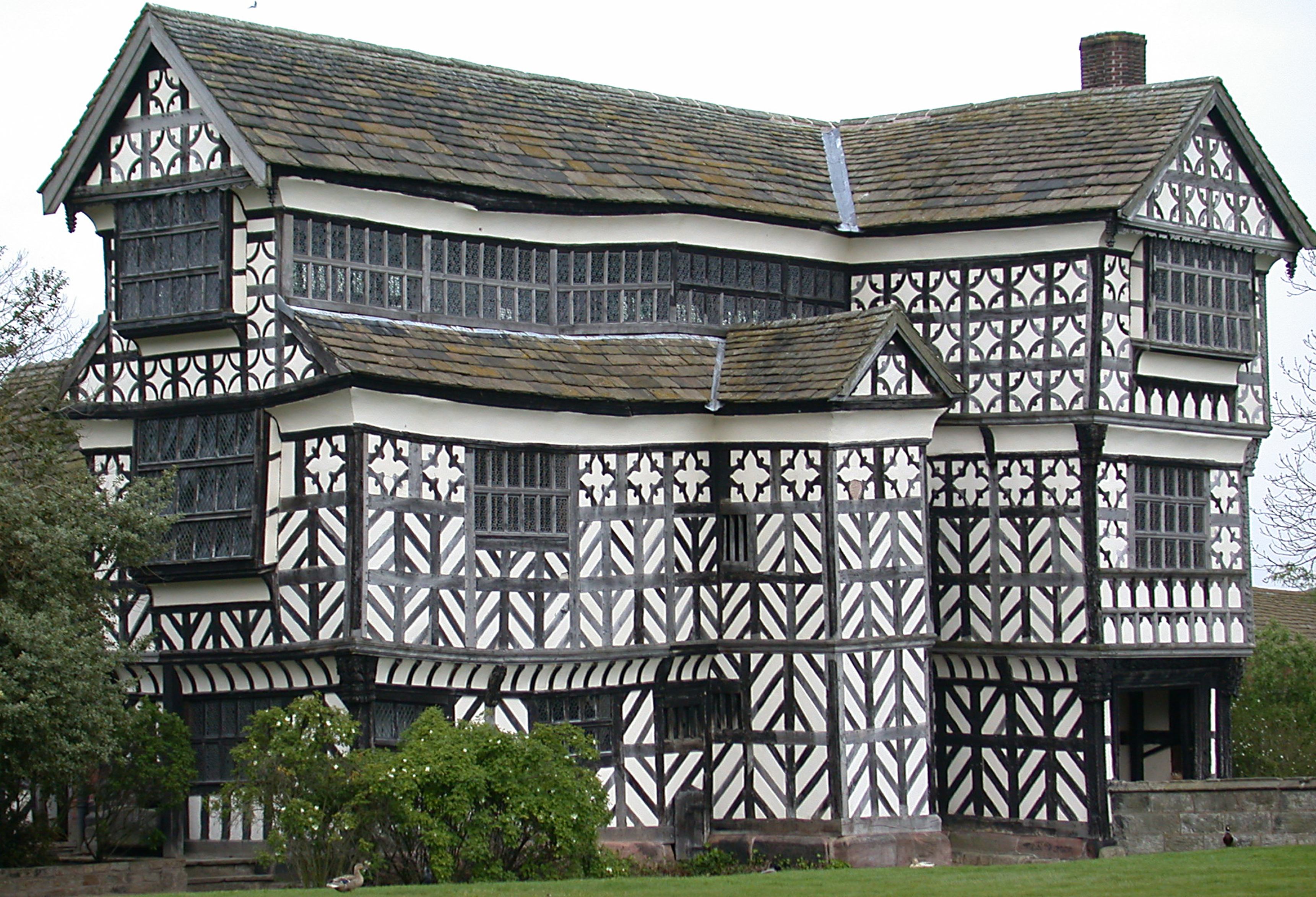 Structure of particular architectural and/or historic interest deserving of special protection. in the county, structures considered to be of particular architectural interest.[2]
| Name | Location | Architect | Completed | Entry number | Image |
|---|---|---|---|---|---|
Bakewell Bridge 14th-century bridge over the River Wye in Bakewell, Derbyshire. 14th-century bridge over the River Wye in Bakewell, Derbyshire. | Bakewell | c. 1300 | 1148112 | 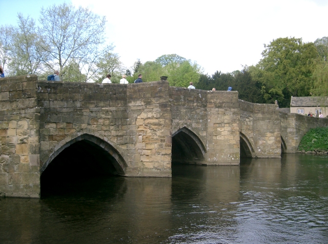 Wikimedia Commons | |
| Baslow Bridge | Baslow and Bubnell | Early 17th century | 1088195 |  Wikimedia Commons | |
| Bridge on main approach to Chatsworth House | Charsworth | James Paine | 1759–1774 | 1049093 | 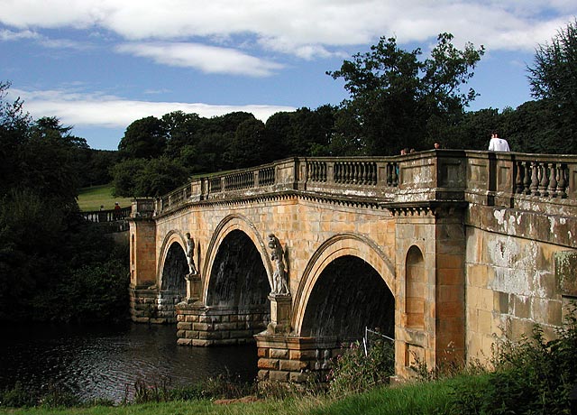 Wikimedia Commons |
| Chatsworth House | Chatsworth | 1687–1689 | 1373871 |  Wikimedia Commons | |
| Church of All Saints | Bakewell | 18th century | 1316489 |  Wikimedia Commons | |
| Church of All Saints | Bradbourne | 12th century | 1109479 |  Wikimedia Commons | |
| Church of All Saints | Brailsford | 12th century | 1109734 |  Wikimedia Commons | |
| Church of All Saints | Hassop | Joseph Ireland | 1816–1817 | 1253035 |  Wikimedia Commons |
| Church of All Saints | Youlgreave | Late 12th century | 1109853 | 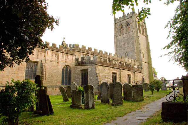 Wikimedia Commons | |
| Church of St Andrew | Cubley | Late 15th century | 1203949 |  Wikimedia Commons | |
| Church of St Chad | Longford | 15th century | 1109790 |  Wikimedia Commons | |
| Church of St Cuthbert | Doveridge | Late 12th century | 1274523 |  Wikimedia Commons | |
| Church of St Giles | Great Longstone | 13th century | 1109899 |  Wikimedia Commons | |
| Church of St John the Baptist | Tideswell | 14th century | 1215255 | 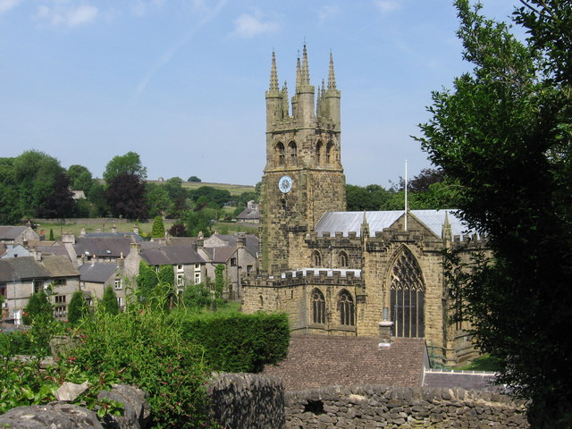 Wikimedia Commons | |
| Church of St Leonard | Thorpe | Early 12th century | 1203690 |  Wikimedia Commons | |
| Church of St Mary | Cromford | T. Gardner | 1792–1797 | 1248052 |  Wikimedia Commons |
| Church of St Mary | Wirksworth | 1335090 |  Wikimedia Commons | ||
| Church of St Mary and St Barlok | Norbury and Roston | Early 15th century | 1109764 |  Wikimedia Commons | |
| Church of St Michael | Kniveton | 12th century | 1146435 |  Wikimedia Commons | |
| Church of St Michael | Taddington | 14th century | 1109887 |  Wikimedia Commons | |
| Church of St Michael and All Angels | Hathersage | 14th century | 1109793 |  Wikimedia Commons | |
| Church of St Peter | Edensor | 12th century | 1088158 |  Wikimedia Commons | |
| Churchyard cross 6 metres east of church porch | Eyam | Early 9th century | 1100263 |  Wikimedia Commons | |
| Conduit House, Cascade and adjoining statues | Chatsworth | Grillet | c. 1696 | 1088181 | 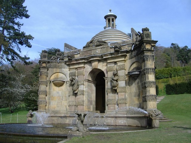 Wikimedia Commons |
| Cromford Mill | Cromford | 1771 | 1248010 |  Wikimedia Commons | |
| Cross situated 12 metres to south of porch of Church of All Saints | Bakewell | Early 10th century | 1316491 |  Wikimedia Commons | |
| Ednaston Manor and attached walls and terracing | Brailsford | Edwin Lutyens | 1912–1919 | 1109745 | |
| Egyptian statue behind the Dukes greenhouse 3 metres from the corner | Chatsworth | c. 1570–1304 BCE | 1067714 |  Wikimedia Commons | |
| Egyptian statue behind the Dukes greenhouse 9 metres from the corner | Chatsworth | c. 1570–1304 BCE | 1334742 | ||
| Former stables at Chatsworth House | Chatsworth | James Paine | 1758–1763 | 1088184 |  Wikimedia Commons |
| Haddon Hall | Nether Haddon | Mainly 14th and 15th century | 1334982 |  Wikimedia Commons | |
| Holme Bridge | Bakewell | 1664 | 1247518 |  Wikimedia Commons | |
| Holme Hall | Bakewell | 1626–1628 | 1246166 |  Wikimedia Commons | |
| Holy Trinity Church | Kirk Ireton | 12th century | 1335168 |  Wikimedia Commons | |
| Old Grammar School | Ashbourne | 1586 | 1207596 | 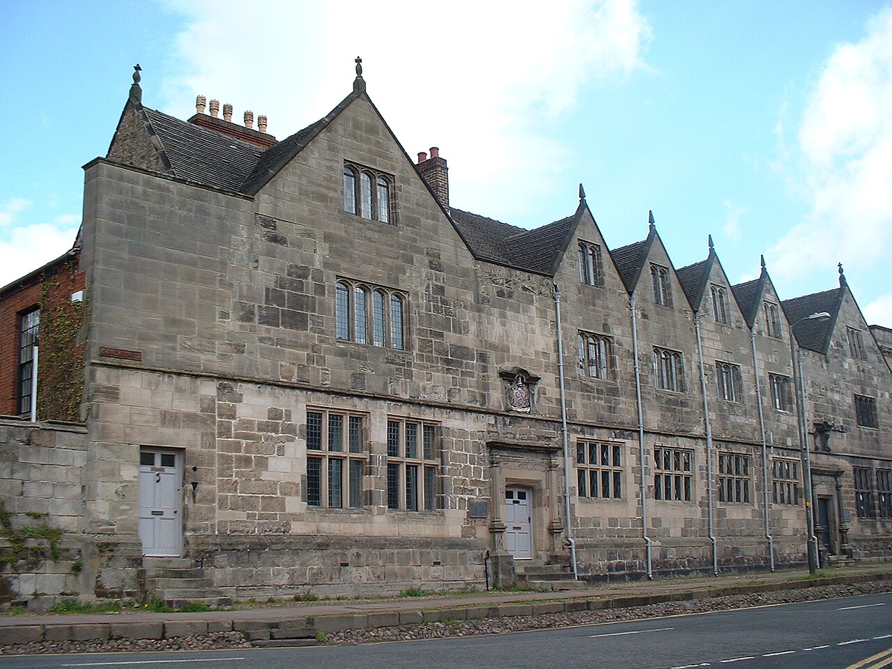 Wikimedia Commons | |
| Padley Chapel | Upper Padley, Grindleford | c. 14th and 15th century, with later alterations | 1335033 |  Wikimedia Commons | |
| Parish Church of St Oswald | Ashbourne | Mainly c. 1220 | 1207715 |  Wikimedia Commons | |
| Remains of Chapel of St Mary and St John the Baptist to south of Stydd Hall | Yeaveley | Early 13th century | 1109732 |  Wikimedia Commons | |
| Series of herms and altars laid out in a Y to the east of the Ring Pond | Chatsworth | Probably William Kent | c. 1730 | 1334743 |  Wikimedia Commons |
| Snitterton Hall | Snitterton, South Darley | Late 16th century | 1248141 |  Wikimedia Commons | |
| Somersal Herbert Hall | Somersal Herbert | Early 16th century | 1274325 | 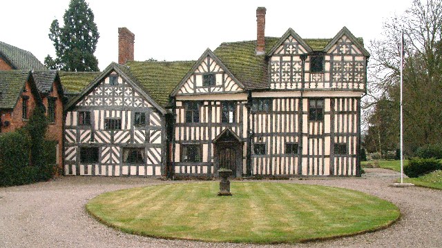 Wikimedia Commons | |
| Sudbury Hall and attached stable block | Sudbury | 1660–1670 | 1273995 |  Wikimedia Commons | |
| Temple of Flora | Chatsworth | Probably William Talman | 1693–1695 | 1088176 |  Wikimedia Commons |
| The Great Cross and railed enclosure | Bakewell | Early 9th century | 1316492 |  Wikimedia Commons | |
| The Mansion including coach house wall | Ashbourne | c. 1685 | 1335139 |  Wikimedia Commons | |
| The Old Manor and attached garden wall | Norbury Hollow | Late 17th century | 1281200 |  Wikimedia Commons |
See also
- Grade I listed buildings in Derbyshire
 Grade I listed buildings in the ceremonial county of Derbyshire, split into the eight district councils and one unitary authority.

