

Wikimedia Commons
Sale is one of the four major urban areas in the Metropolitan Borough of Trafford in Greater Manchester, the other three being Altrincham, Stretford One of the four major urban areas in the Metropolitan Borough of Trafford, Greater Manchester. and Urmston.[1] It sits on the south bank of the River Mersey, two miles (3.2 km) south of Stretford, three miles (4.8 km) northeast of Altrincham, and five miles (8 km) southwest of Manchester. As at the 2021 Census, the built-up areaCategorisation of UK census data that corresponds more closely to the traditional towns, villages and cities that people associate with where they live than do the administrative boundaries.Categorisation of UK census data that corresponds more closely to the traditional towns, villages and cities that people associate with where they live than do the administrative boundaries. of Sale has a population of 57,471.
The Bridgewater Canal reached the town in 1765, stimulating Sale’s urbanisation. The arrival of the railway in 1849 triggered Sale’s growth as an important town and place for people who wanted to travel to and from Manchester, leading to an influx of middle-class residents; by the end of the 19th century, the town’s population had more than tripled. Agriculture gradually declined as service industries boomed.
Geography
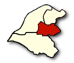
Sale lies in the Mersey Valley, about 100 feet (30 m) above sea level on generally flat ground. The River Mersey, which runs just north of the town,[2] is prone to flooding during heavy rains, so the Sale Water Park Parkland including a large artificial lake created by gravel extraction, a wildlife reserve, and part of the surrounding area's flood defences.Parkland including a large artificial lake created by gravel extraction, a wildlife reserve, and part of the surrounding area's flood defences., close to the town’s northern boundary, acts as an emergency flood basin.[3]
Sale’s local drift geology consists of sand and gravel deposited about 10,000 years ago, during the last ice age. The bedrock is Bunter sandstone in the west and Triassic waterstone in the east.[4]
History
Founding
A flint arrowhead discovered in Sale suggests a prehistoric human presence,[2] but there is no further evidence of activity in the area until the Roman period. A 4th-century hoard of forty-six Roman coins was discovered in Ashton upon Mersey, one of four known hoards dating from that period discovered within the Mersey basin.[5][6] Sale lies along the line of the Roman road which runs between the fortresses at Chester (Deva Victrix) and York (Eboracum), via the fort at Manchester (Mamucium);[5] the present-day A56 follows the route of the road through the town.[2]
Some local field and road names,[7] and the name of Sale itself, are Anglo-Saxon in origin, which suggests that the town was founded in the 7th or 8th century. The Old English salh, from which “Sale” is derived, means “at the sallow tree”,[8] and Ashton upon Mersey means “village or farm near the ash trees”.[9] Although the townships of Sale and Ashton upon Mersey were not mentioned in the Domesday Book of 1086, that may be because only a partial survey was taken.[10] The first recorded occurrences of Sale and Ashton upon Mersey are in 1199–1216 and 1260 respectively.[11] The settlements were referred to as townships rather than manors, which is further evidence of their Anglo-Saxon origins, as townships were developed by the Saxons.[12]
Early history
The manor of Sale was one of thirty held by William FitzNigel, a powerful 12th-century baron in north Cheshire. He divided it between Thomas de Sale and Adam de Carrington, who acted as Lords of the Manor on his behalf. On de Sale’s death his land passed to his son-in-law, John Holt; de Carrington’s land passed into the ownership of Richard de Massey, a member of the Masseys who were Barons of Dunham.

Wikimedia Commons
Sale descended through the Holt and Massey families until the 17th century, when their respective lands were sold.[13] Sale Old Hall was built in about 1603 for James Massey, probably to replace a medieval manor house, and was one of the first buildings in northwest England to be made of brick.[14][15] It was rebuilt in 1840 and demolished in 1920, but two buildings in its grounds have survived: its dovecote, now in Walkden GardensPublic green space in Sale, Greater Manchester., and its lodge, the latter now occupied by Sale Golf Club.[14]
The extension of the Bridgewater Canal to Runcorn was completed as far as Sale by 1765, and transformed the town’s economy by providing a quick and cheap route into Manchester for fresh produce.[16] Farmers who took their wares to market in Manchester brought back night soil to fertilise the fields.[17] Not everyone benefited from the canal however; several yeomen claimed that their crops were damaged by flooding from the Barfoot Aqueduct Grade II designated aqueduct carrying the Bridgewater Canal over the River Mersey at Stretford, Greater Manchester. crossing the River Mersey.[18]
The village of Cross Street was first referred to in 1586, and is believed to have originated around that time.[19] A 1777 map shows Cross Street, on the site of the road now of the same name, divided between the townships of Sale and Ashton upon Mersey. The map also shows that Sale was spread out, mainly consisting of farmhouses around Dane Road, Fairy Lane, and Old Hall Road.[20]
About 300 acres (121 ha) of “wasteland” known as Sale Moor was enclosed in 1807, to be divided between the landowners in Sale. This was part of a nationwide initiative to begin cultivation of common land to lessen the food shortage caused by the Napoleonic Wars.[21] Records of poor relief in the town start in 1808, a time when the region was in the grip of an economic depression.[22] In 1829 Samuel Brooks acquired 515 acres (208 ha) of land in Sale – about a quarter of the township – from George Grey, 6th Earl of Stamford, the area now known as Brooklands.[23][24]
Development
The Manchester, South Junction and Altrincham Railway opened in 1849,[25] and led to the middle classes using Sale as a commuter town, a residence away from their place of work.[26] This resulted in the town’s population more than tripling by the end of the 19th century.[27] The land in Sale Moor was the cheapest in the town because the soil was poor and difficult to cultivate, which was partly why the area had been common land until the early 19th century. But when the railway opened, Sale Moor was close to the station and became the most expensive area in the town.[28]
Sale’s shopping centre was redeveloped during the 1960s, as part of the town’s post-war regeneration. In 1973, the shopping precinct in the town centre, which had grown up in the mid-19th century, was also redeveloped and pedestrianised in an attempt to increase trade.[29] The construction of the M63 motorway (subsequently renamed the M60) in 1972 led to the creation of Sale Water ParkParkland including a large artificial lake created by gravel extraction, a wildlife reserve, and part of the surrounding area's flood defences.Parkland including a large artificial lake created by gravel extraction, a wildlife reserve, and part of the surrounding area's flood defences.. To minimise the risk of flooding, the motorway was built on an embankment, for which the necessary gravel was extracted from what is today an artificial lake and water-sports centre.[30]
Governance
Civic history
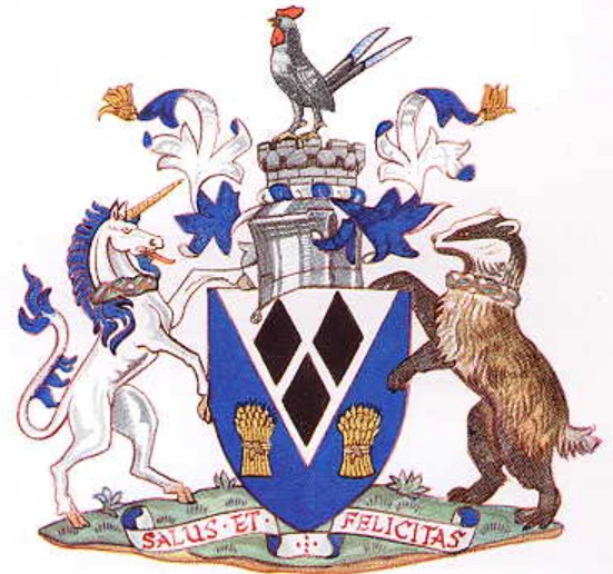
Civic Heraldry
Sale was a township in the ancient parish of Ashton upon Mersey, which formed part of the Bucklow Hundred of Cheshire. In 1836 the township also became part of the Altrincham Poor Law Union.[31][32]
The Sale township was made a local government district in 1867;[33] such districts were reconstituted as urban districts under the Local Government Act 1894.[34][35] The council was granted a coat of arms in 1920, with the motto Salus et felicitas (health and happiness).[36]
Sale Urban District was enlarged in 1930 to take in neighbouring Ashton upon Mersey,[37] and in 1935 Sale Urban District was incorporated to become a municipal borough.[38] The borough of Sale was abolished in 1974 under the Local Government Act 1972, and became part of the Metropolitan Borough of Trafford in Greater Manchester.[29]
Political representation
Sale was historically part of the parliamentary constituency of Altrincham, created in 1885 as a result of the Redistribution of Seats Act that year,[39] which introduced the concept of equally populated constituencies.[40] Altrincham was split into two seats in 1945, and Sale became part of the Altrincham and Sale constituency.[41] That constituency was abolished for the 1997 general election, when Sale was split between the new constituencies of Altrincham and Sale West, and Wythenshawe and Sale East.[42]
Since 2023 Sale has been divided between the Trafford local government wards of Ashton upon Mersey, Brooklands, Manor, Sale Central, and Sale Moor.[43] Each ward is represented by three local councillors, elected in thirds on a four-yearly cycle.[44]
Demographics
As at the 2021 Census, the built-up areaCategorisation of UK census data that corresponds more closely to the traditional towns, villages and cities that people associate with where they live than do the administrative boundaries.Categorisation of UK census data that corresponds more closely to the traditional towns, villages and cities that people associate with where they live than do the administrative boundaries. of Sale has a population of 57,471, occupying an area of 1,249 hectares (3,086 acres), giving a population density of 46 persons per hectare.[45]
Economy
During the medieval period most of the land was used for growing crops and raising livestock such as cattle.[46] The produce from arable farming would have been sufficient to support the local population, but the cattle would have been sold to the ruling classes.[47] Agriculture provided the main source of employment for Sale’s residents until the mid-19th century. Industry was slow to develop in the area, as in most of what would become Trafford, partly because of the reluctance of the two main land owners in the area, the Stamfords and the de Traffords, to invest.[48] Although weaving was common in Sale during the late 17th and early 18th century, by 1851 only 4% of the population was employed in that industry.[49]
Along with the rest of the region, Sale’s economy during the early 19th century was weak, a state of affairs which persisted until the arrival of the railway in the middle of the century.[50] Despite the previous dominance of agriculture, by 1901 fewer than 20% of Sale residents were employed in agriculture.[51]
Education
Along with the rest of Trafford, Sale maintains a selective education system assessed by an 11-plus examination.[52] Of the twenty-seven secondary schools in Trafford,[53] four are in Sale, one of which – Sale Grammar School – operates the selective system.[54]
Religion
At the 2021 UK census, 49.3% of Sale residents reported themselves as Christian, 4.8% Muslim, 2.7% Hindu, 0.4% Jewish, 0.4% Buddhist and 0.3% Sikh. A further 36.4% had no religion, and 0.5% had an alternative religion.[45]
Sale is part of the Roman Catholic Diocese of Shrewsbury,[55] and the Church of England Diocese of Chester.[56] The church buildings were mostly constructed in the late 19th or early 20th century in the wake of the population boom created by the arrival of the railway in 1849.[57] Two of the three Grade II* listed buildings in the town are churches. The Church of St Martin Grade II* listed church in Sale, Greater Manchester. in Ashton upon Mersey, which was probably originally an early 14th-century timber-framed structure, was rebuilt in 1714 after it had been destroyed in a storm.[58] The Church of St John the Divine was built in 1868, to the design of Alfred Waterhouse.[59]
Transport

The main A56 road through the town follows the line of a Roman road connecting the forts at Chester, Northwich and Manchester.[2] The M60 motorway, which encircles Manchester, can be accessed via junction 7, just to the north of Sale.
The present-day Sale Metrolink stop was built in the 1870s as a rail station for the Manchester South Junction and Altrincham Railway; Brookland station was built in 1859.[60] Both are now stops on the Altrincham to Manchester Metrolink line operated by Bee Network. Local bus services are also operated by Bee Network.[61]
Manchester Airport, the busiest in the UK outside the wider London area, is 4 miles (6 km) to the south of Sale.[62]
Sport
The semi-professional rugby union side Sale F. C. has been based in the area since 1861, and at its present Heywood Road ground since 1905. One of the oldest rugby clubs in the world, its 1865 Minute Book is the oldest existing book containing the rules of the game.[63]
The professional Sale Sharks team was originally part of Sale F. C., but split from it in 2003. Sale Sharks now play their matches at Salford Community Stadium, although they retain the use of the Heywood Road ground for training and for the staging of home games involving their reserve team, Sale Jets.[64]
Sale Harriers Manchester athletics club was formed in 1910, and still has its historical home at Crossford Bridge, a site shared with Sale United Football Club and Old Altrinchamians.[65][66] The club has produced successful athletes, including Olympic gold medallist Darren Campbell and Commonwealth Games gold medallist Diane Modahl.[67]
References
- p. 9
- pp. 1–3
- p. 4
- pp. 59, 75
- p. 12
- p. 4
- pp. 12–13
- p. 18
- pp. 32, 38–39
- p. 11
- p. 20
- p. 22
- p. 61
- p. 44
- p. 47
- pp. 44–45
- p. 56
- p. 40
- pp. 51–52
- pp. 61–62
- p. 59
- p. 111
- p. 97
- p. 85
- p. 87
- p. 91
- p. 134
- pp. 135–136
- p. 24
- pp. 541–542
- p. 119
- p. 15
- p. 199
- p. 187
- p. 15
- pp. 14, 16
- pp. 85–86, 88–91
- pp. 89–90
- p. 68
- p. 86
- p. 76
- pp. 22–24
- p. 89
