

Wakefield within West Yorkshire
Wikimedia Commons
Wikimedia Commons
The Metropolitan Borough of Wakefield is one of the five metropolitan boroughs that make up the Metropolitan County of West Yorkshire.[1]
The borough contains twenty-five of the Grade I listed buildings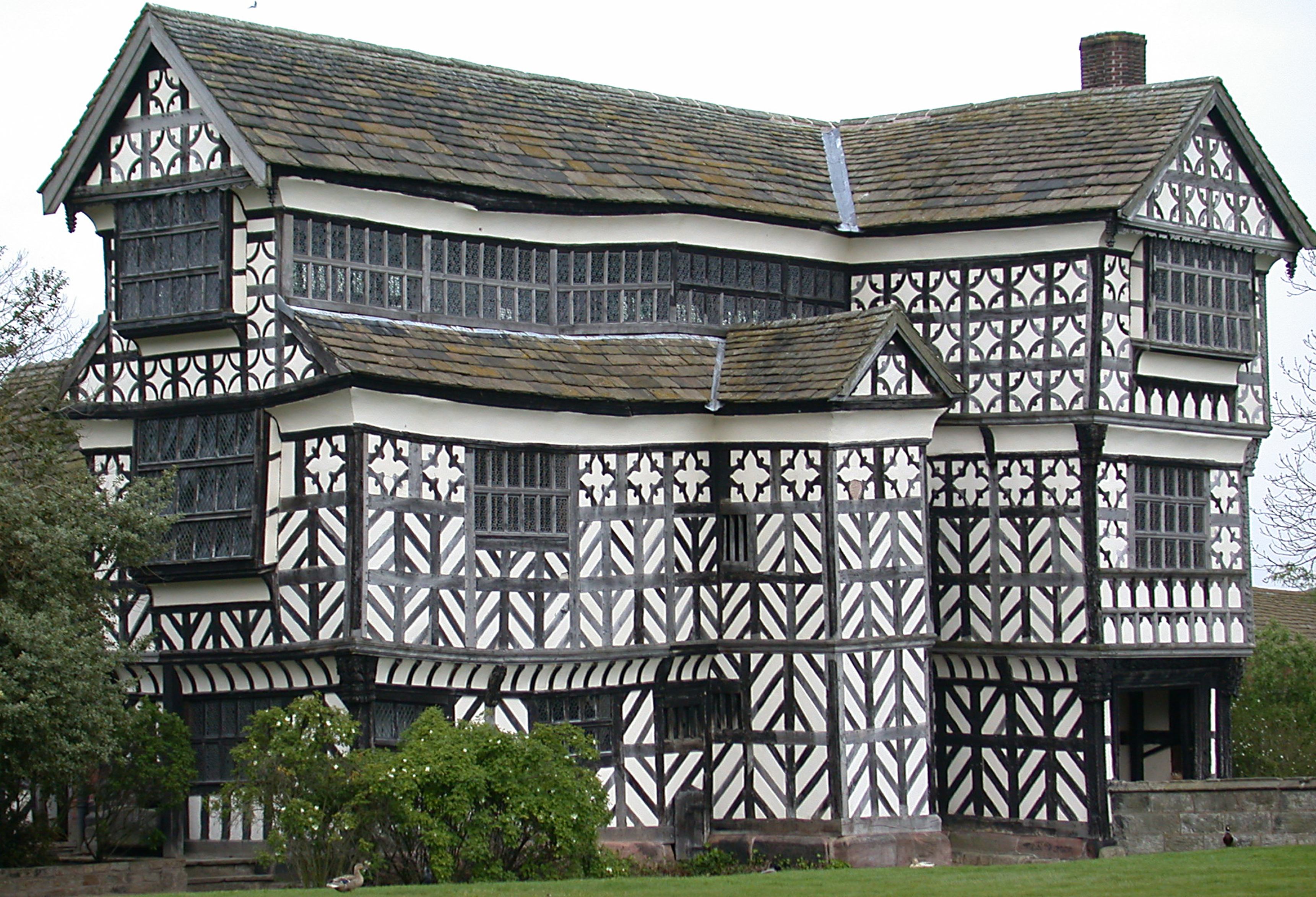 Structure of particular architectural and/or historic interest deserving of special protection. in West Yorkshire. Grade I structures are those considered to be “buildings of exceptional interest”.[2]
| Name | Location | Architect | Completed | Entry number | Image |
|---|---|---|---|---|---|
| Ackworth School (that Part Comprising Centre Block & East and West Wings, Shed Court, Main Entrance) | Ackworth | John Watson II and/or Timothy Lee | 1758–1763 | 1025067 |  Wikimedia Commons |
| Cathedral Church of All Saints | Kirkgate | Early 15th century | 1258237 |  Wikimedia Commons | |
Chapel of St Mary on East Side of Wakefield Bridge Usually known as Wakefield Chantry Chapel, part of the medieval bridge over the River Calder in Wakefield, West Yorkshire, England. Usually known as Wakefield Chantry Chapel, part of the medieval bridge over the River Calder in Wakefield, West Yorkshire, England. | Kirkgate | c. 1350 | 1258242 |  Wikimedia Commons | |
| Church of All Saints | South Kirkby | 13th century | 1227519 |  Wikimedia Commons | |
| Church of St Luke and All Saints | Darrington | Norman | 1313210 |  Wikimedia Commons | |
| Church of St Mary | Badsworth | 15th century | 1052219 |  Wikimedia Commons | |
| Church of St Michael and Our Lady (Wragby Parish Church) | Nostell Park | 1533 | 1253565 |  Wikimedia Commons | |
| Church of St Peter | Woolley | 15th century | 1200723 |  Wikimedia Commons | |
| Church of St Peter | South Hiendley | Norman | 1265442 |  Wikimedia Commons | |
| Church of St Peter and St Leonard | Horbury | John Carr | 1791–1793 | 1135508 |  Wikimedia Commons |
| County Hall (offices of West Yorkshire County Council) | Bond Street | Gibson and Russell | 1894–1898 | 1242349 |  Wikimedia Commons |
| Flanking Screen Walls and Gate Piers Attached to West Front of Heath Hall Linking East and West Pavilions | Heath Common | c. 1767 | 1200345 | ||
| Frieston’s Hospital | Warmfield-cum-Heath | c. 1595 | 1313217 |  Wikimedia Commons | |
| Heath Hall | Heath Common | c. 1709 | 1200238 |  Wikimedia Commons | |
| Horbury Hall | Horbury | Between 1478 and 1492 | 1135510 |  Wikimedia Commons | |
| Kettlethorpe Hall | Standbridge Lane | 1727 | 1259736 |  Wikimedia Commons | |
| Nostell Priory | Nostell Park | James Paine | 1736–1750 | 1262071 |  Wikimedia Commons |
| Stables at Nostell Priory | Nostell Park | South and west ranges, 1770–1776 by Robert Adam; the north and east ranges 1827–1829 by James Pritchett and Charles Watson | 1253558 |  Wikimedia Commons | |
| Stanley Ferry Aqueduct | Normanton | George Leather jun. | 1837–1839 | 1261690 |  Wikimedia Commons |
| The Brewhouse and East Pavilion at Heath Hall | Heath Common | John Carr | c. 1753 | 1313191 |  Wikimedia Commons |
| The Hermitage | Southgate | Adam de Laythorpe and his son Robert | 1386 | 1135427 | |
| The Stable House, Heath Hall | Heath Common | c. 1754 | 1135583 |  Wikimedia Commons | |
| The West Pavilion, Heath Hall | Heath Common | John Carr | c. 1753 | 1200273 |  Wikimedia Commons |
| Town Hall | Wood Street | T. E. Collcutt | 1877–1880 | 1258995 |  Wikimedia Commons |
Wakefield Bridge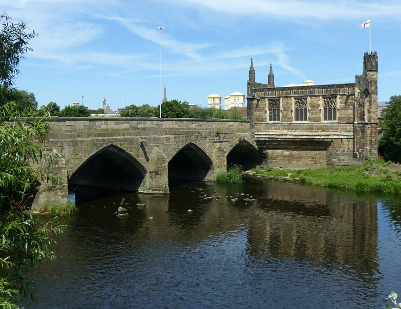 The longest surviving medieval bridge in England The longest surviving medieval bridge in England | Kirkgate | Early to mid-14th century | 1273508 |  Wikimedia Commons |
See also
- Grade I listed buildings in West Yorkshire
 Grade I listed buildings in the Metropolitan County of West Yorkshire, split into the five metropolitan boroughs.
